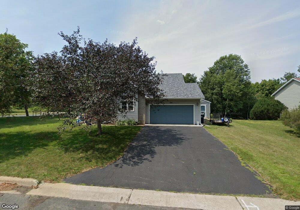
2001 Johnson Ct Northfield, MN 55057
Estimated Value: $349,899 - $384,000
3
Beds
2
Baths
1,108
Sq Ft
$330/Sq Ft
Est. Value
About This Home
This home is located at 2001 Johnson Ct, Northfield, MN 55057 and is currently estimated at $365,475, approximately $329 per square foot. 2001 Johnson Ct is a home located in Rice County with nearby schools including Bridgewater Elementary School, Northfield Middle School, and Northfield Senior High School.
Ownership History
Date
Name
Owned For
Owner Type
Purchase Details
Closed on
Nov 15, 2017
Sold by
Kaul William J and Kaul Jean
Bought by
Boecker Timothy M and Devries Amy
Current Estimated Value
Home Financials for this Owner
Home Financials are based on the most recent Mortgage that was taken out on this home.
Original Mortgage
$188,000
Outstanding Balance
$157,743
Interest Rate
3.9%
Mortgage Type
New Conventional
Estimated Equity
$207,732
Purchase Details
Closed on
Sep 18, 2015
Sold by
Hoernke Timothy Timothy
Bought by
Kaul William William
Home Financials for this Owner
Home Financials are based on the most recent Mortgage that was taken out on this home.
Original Mortgage
$85,000
Interest Rate
3.91%
Purchase Details
Closed on
May 5, 2002
Sold by
Will Dennis P and Will Tania R
Bought by
Hoernke Timothy J and Hoernke Jennifer M
Create a Home Valuation Report for This Property
The Home Valuation Report is an in-depth analysis detailing your home's value as well as a comparison with similar homes in the area
Home Values in the Area
Average Home Value in this Area
Purchase History
| Date | Buyer | Sale Price | Title Company |
|---|---|---|---|
| Boecker Timothy M | $235,000 | Rice County Abstract And Tit | |
| Kaul William William | $210,000 | -- | |
| Hoernke Timothy J | $191,000 | -- |
Source: Public Records
Mortgage History
| Date | Status | Borrower | Loan Amount |
|---|---|---|---|
| Open | Boecker Timothy M | $188,000 | |
| Previous Owner | Kaul William William | $85,000 |
Source: Public Records
Tax History
| Year | Tax Paid | Tax Assessment Tax Assessment Total Assessment is a certain percentage of the fair market value that is determined by local assessors to be the total taxable value of land and additions on the property. | Land | Improvement |
|---|---|---|---|---|
| 2025 | $5,304 | $322,900 | $76,900 | $246,000 |
| 2024 | $5,304 | $314,600 | $70,300 | $244,300 |
| 2023 | $4,532 | $314,600 | $70,300 | $244,300 |
| 2022 | $4,084 | $288,500 | $65,900 | $222,600 |
| 2021 | $3,900 | $255,000 | $59,300 | $195,700 |
| 2020 | $3,994 | $241,100 | $57,100 | $184,000 |
| 2019 | $3,716 | $241,500 | $54,900 | $186,600 |
| 2018 | $3,592 | $223,500 | $51,100 | $172,400 |
| 2017 | $3,236 | $213,100 | $48,900 | $164,200 |
| 2016 | $2,988 | $209,300 | $48,900 | $160,400 |
| 2015 | $2,816 | $186,600 | $48,900 | $137,700 |
| 2014 | -- | $178,100 | $48,900 | $129,200 |
Source: Public Records
Map
Nearby Homes
- 1741 Roosevelt Dr
- 1802 Van Buren Ct
- 2100 Taylor Ct
- 2004 Lincoln St S
- 1513 Senate Ln
- 2300 Pepper Ridge Ln
- XXXX Division St S
- 2106 Sunnyview Ln
- 1301 Presidential Dr
- 1908 Sibley View Ln
- 205 Linden Place S
- 2620 Oak Lawn Dr
- Outlot Honeylocust Dr
- 2432 Aspen St
- 2505 Aspen St
- 301 Aster Dr
- 318 Ford St E
- 421 Ford St E
- 402 Ford St E
- 425 Ford St E
- 2005 Johnson Ct
- 2000 Johnson Ct
- 2009 Johnson Ct
- 2004 Johnson Ct
- 1925 Roosevelt Dr
- 2000 Park Pointe Ct
- 2004 Park Pointe Ct
- 2015 Grant Dr
- 2011 Grant Dr
- 2001 Park Pointe Ct
- 2008 Johnson Ct
- 2013 Johnson Ct
- 2019 Grant Dr
- 1917 Adams Ct
- 2008 Park Pointe Ct
- 1921 Adams Ct
- 2007 Grant Dr
- 2005 Park Pointe Ct
- 2012 Johnson Ct
- 2017 Johnson Ct
Your Personal Tour Guide
Ask me questions while you tour the home.