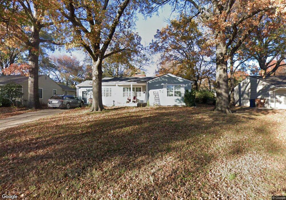
2002 Stratford Rd Lawrence, KS 66044
Hillcrest NeighborhoodEstimated Value: $285,000 - $355,000
3
Beds
1
Bath
1,546
Sq Ft
$202/Sq Ft
Est. Value
About This Home
This home is located at 2002 Stratford Rd, Lawrence, KS 66044 and is currently estimated at $312,217, approximately $201 per square foot. 2002 Stratford Rd is a home located in Douglas County with nearby schools including Hillcrest Elementary School, West Middle School, and Lawrence Free State High School.
Ownership History
Date
Name
Owned For
Owner Type
Purchase Details
Closed on
Mar 14, 2022
Sold by
Santaularia Tena K
Bought by
Stringer Christopher Martin
Current Estimated Value
Home Financials for this Owner
Home Financials are based on the most recent Mortgage that was taken out on this home.
Original Mortgage
$260,000
Outstanding Balance
$242,731
Interest Rate
3.85%
Mortgage Type
New Conventional
Estimated Equity
$69,486
Purchase Details
Closed on
Feb 13, 2009
Sold by
Emerson Jan D
Bought by
Santaularia Tena
Home Financials for this Owner
Home Financials are based on the most recent Mortgage that was taken out on this home.
Original Mortgage
$103,098
Interest Rate
4.91%
Mortgage Type
FHA
Create a Home Valuation Report for This Property
The Home Valuation Report is an in-depth analysis detailing your home's value as well as a comparison with similar homes in the area
Home Values in the Area
Average Home Value in this Area
Purchase History
| Date | Buyer | Sale Price | Title Company |
|---|---|---|---|
| Stringer Christopher Martin | -- | None Listed On Document | |
| Santaularia Tena | -- | Continental Title Company |
Source: Public Records
Mortgage History
| Date | Status | Borrower | Loan Amount |
|---|---|---|---|
| Open | Stringer Christopher Martin | $260,000 | |
| Previous Owner | Santaularia Tena | $103,098 |
Source: Public Records
Tax History Compared to Growth
Tax History
| Year | Tax Paid | Tax Assessment Tax Assessment Total Assessment is a certain percentage of the fair market value that is determined by local assessors to be the total taxable value of land and additions on the property. | Land | Improvement |
|---|---|---|---|---|
| 2025 | $4,418 | $35,800 | $10,350 | $25,450 |
| 2024 | $4,220 | $34,236 | $10,120 | $24,116 |
| 2023 | $4,050 | $31,625 | $8,625 | $23,000 |
| 2022 | $3,540 | $27,513 | $6,325 | $21,188 |
| 2021 | $3,130 | $23,515 | $5,175 | $18,340 |
| 2020 | $2,907 | $21,977 | $5,175 | $16,802 |
| 2019 | $2,743 | $20,780 | $4,947 | $15,833 |
| 2018 | $2,688 | $20,217 | $4,720 | $15,497 |
| 2017 | $2,639 | $19,631 | $4,720 | $14,911 |
| 2016 | $2,477 | $19,263 | $5,175 | $14,088 |
| 2015 | $2,385 | $18,561 | $5,175 | $13,386 |
| 2014 | $1,968 | $15,525 | $5,175 | $10,350 |
Source: Public Records
Map
Nearby Homes
- 1321 Raintree Place
- 1336 Spencer Dr
- 917 Sunset Dr
- 2609 Westdale Rd
- 923 Crestline Dr
- 2901 University Dr
- 2901 University Dr Unit A, B, C, D, E, F
- 800 Madeline Ln
- 817 Maine St
- 735 Missouri St
- 1014 Lawrence Ave
- 1008 Lawrence Ave
- 1304 Lawrence Ave
- 1439 Applegate Ct
- 1801 Missouri St
- 1704 W 20th St
- 1633 W 20th St
- 1807 Alabama St
- 1620 W 20th Terrace
- Lot 9 W 5th St
- 2008 Stratford Rd
- 1920 Stratford Rd
- 2003 Oxford Rd
- 2009 Oxford Rd
- 2014 Stratford Rd
- 1916 Stratford Rd
- 2003 Stratford Rd
- 1919 Stratford Rd
- 2015 Oxford Rd
- 2009 Stratford Rd
- 1917 Oxford Rd
- 1910 Stratford Rd
- 2020 Stratford Rd
- 1915 Stratford Rd
- 2015 Stratford Rd
- 2021 Oxford Rd
- 1911 Oxford Rd
- 2002 Oxford Rd
- 1909 Stratford Rd
- 2021 Stratford Rd