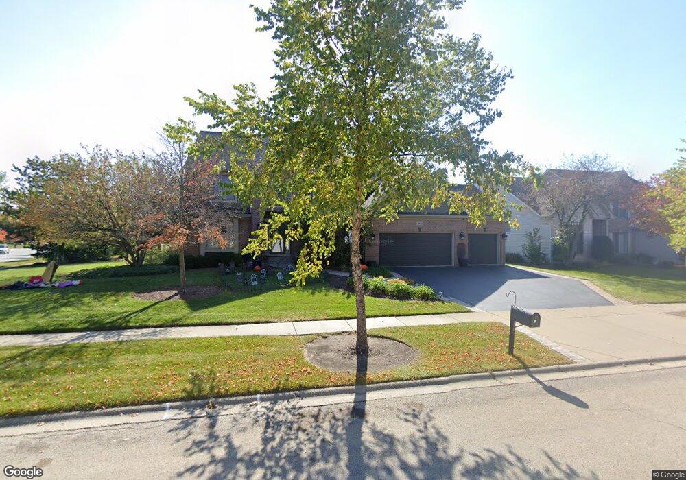
2003 Tunbridge Trail Algonquin, IL 60102
Estimated Value: $534,000 - $587,000
4
Beds
3
Baths
3,398
Sq Ft
$167/Sq Ft
Est. Value
About This Home
This home is located at 2003 Tunbridge Trail, Algonquin, IL 60102 and is currently estimated at $566,566, approximately $166 per square foot. 2003 Tunbridge Trail is a home located in McHenry County with nearby schools including Westfield Community School, Kenneth E Neubert Elementary School, and Harry D Jacobs High School.
Ownership History
Date
Name
Owned For
Owner Type
Purchase Details
Closed on
Jun 3, 1998
Sold by
Legacy Fine Custom Homes Inc
Bought by
Sylvester Frank P and Sylvester Laura L
Current Estimated Value
Home Financials for this Owner
Home Financials are based on the most recent Mortgage that was taken out on this home.
Original Mortgage
$195,000
Interest Rate
7.27%
Mortgage Type
Balloon
Purchase Details
Closed on
May 20, 1998
Sold by
Sentry Construction Inc
Bought by
Legacy Fine Custom Homes Inc
Home Financials for this Owner
Home Financials are based on the most recent Mortgage that was taken out on this home.
Original Mortgage
$195,000
Interest Rate
7.27%
Mortgage Type
Balloon
Create a Home Valuation Report for This Property
The Home Valuation Report is an in-depth analysis detailing your home's value as well as a comparison with similar homes in the area
Purchase History
| Date | Buyer | Sale Price | Title Company |
|---|---|---|---|
| Sylvester Frank P | $292,500 | First American Title | |
| Legacy Fine Custom Homes Inc | $65,000 | First American Title |
Source: Public Records
Mortgage History
| Date | Status | Borrower | Loan Amount |
|---|---|---|---|
| Closed | Sylvester Frank P | $195,000 |
Source: Public Records
Tax History
| Year | Tax Paid | Tax Assessment Tax Assessment Total Assessment is a certain percentage of the fair market value that is determined by local assessors to be the total taxable value of land and additions on the property. | Land | Improvement |
|---|---|---|---|---|
| 2024 | $13,762 | $183,921 | $35,568 | $148,353 |
| 2023 | $13,100 | $164,494 | $31,811 | $132,683 |
| 2022 | $12,134 | $147,491 | $38,471 | $109,020 |
| 2021 | $11,660 | $137,405 | $35,840 | $101,565 |
| 2020 | $11,362 | $132,541 | $34,571 | $97,970 |
| 2019 | $11,098 | $126,858 | $33,089 | $93,769 |
| 2018 | $10,598 | $117,190 | $30,567 | $86,623 |
| 2017 | $10,396 | $110,400 | $28,796 | $81,604 |
| 2016 | $10,258 | $103,545 | $27,008 | $76,537 |
| 2013 | -- | $85,871 | $25,195 | $60,676 |
Source: Public Records
Map
Nearby Homes
- 1157 Sawmill Ln
- 760 Regal Ln
- 741 Regal Ln
- 2233 Dawson Ln Unit 312
- 2051 Carlisle St
- 681 Majestic Dr
- 1820 Crofton Dr
- 2380 Dawson Ln Unit 165
- 20 Peach Tree Ct Unit 4153
- 18 Peach Tree Ct Unit 4154
- 1033 Interloch Ct Unit 32
- 2069 Peach Tree Ln Unit 4116
- 1920 Jester Ln
- 700 Fairfield Ln
- 1831 Haverford Dr
- 1900 Waverly Ln
- 1 N Hubbard St
- SWC Talaga and Algonquin Rd
- 2601 Harnish Dr
- 145 S Oakleaf Rd
- 2013 Tunbridge Trail
- 2000 Brindlewood Ln
- 2010 Brindlewood Ln
- 4 Brindlewood Ct
- 2023 Tunbridge Trail
- 2020 Brindlewood Ln
- 2 Brindlewood Ct
- 2002 Tunbridge Trail
- 2012 Tunbridge Trail
- 2030 Brindlewood Ln
- 6 Brindlewood Ct
- 2022 Tunbridge Trail
- 2033 Tunbridge Trail
- 2001 Brindlewood Ln
- 2011 Brindlewood Ln
- 2032 Tunbridge Trail
- 1133 Sawmill Ln
- 2040 Brindlewood Ln
- 2043 Tunbridge Trail
- 1135 Sawmill Ln
Your Personal Tour Guide
Ask me questions while you tour the home.