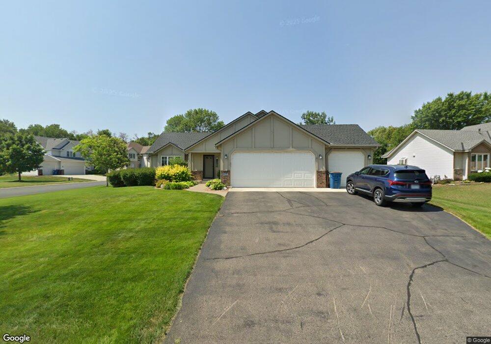
2004 Saint Francis Ave Shakopee, MN 55379
Estimated Value: $435,000 - $464,000
4
Beds
2
Baths
1,306
Sq Ft
$344/Sq Ft
Est. Value
About This Home
This home is located at 2004 Saint Francis Ave, Shakopee, MN 55379 and is currently estimated at $449,263, approximately $343 per square foot. 2004 Saint Francis Ave is a home located in Scott County with nearby schools including Sun Path Elementary School, Shakopee West Middle School, and Shakopee Senior High School.
Ownership History
Date
Name
Owned For
Owner Type
Purchase Details
Closed on
Apr 24, 2012
Sold by
Lagro Patrick and Lagro April
Bought by
Lagro Patrick and Lagro April
Current Estimated Value
Home Financials for this Owner
Home Financials are based on the most recent Mortgage that was taken out on this home.
Original Mortgage
$210,000
Outstanding Balance
$88,646
Interest Rate
4.08%
Mortgage Type
New Conventional
Estimated Equity
$360,617
Purchase Details
Closed on
May 28, 1999
Sold by
U S Home Corp
Bought by
Lagro Patrick and Herschman April
Create a Home Valuation Report for This Property
The Home Valuation Report is an in-depth analysis detailing your home's value as well as a comparison with similar homes in the area
Home Values in the Area
Average Home Value in this Area
Purchase History
| Date | Buyer | Sale Price | Title Company |
|---|---|---|---|
| Lagro Patrick | -- | Nations Title Agency Of Minn | |
| Lagro Patrick | $177,011 | -- |
Source: Public Records
Mortgage History
| Date | Status | Borrower | Loan Amount |
|---|---|---|---|
| Open | Lagro Patrick | $210,000 |
Source: Public Records
Tax History Compared to Growth
Tax History
| Year | Tax Paid | Tax Assessment Tax Assessment Total Assessment is a certain percentage of the fair market value that is determined by local assessors to be the total taxable value of land and additions on the property. | Land | Improvement |
|---|---|---|---|---|
| 2025 | $4,328 | $413,900 | $145,600 | $268,300 |
| 2024 | $4,184 | $417,500 | $145,600 | $271,900 |
| 2023 | $4,436 | $391,800 | $135,400 | $256,400 |
| 2022 | $3,914 | $406,900 | $153,800 | $253,100 |
| 2021 | $3,532 | $314,000 | $121,700 | $192,300 |
| 2020 | $3,840 | $310,100 | $116,700 | $193,400 |
| 2019 | $3,896 | $297,100 | $103,700 | $193,400 |
| 2018 | $3,800 | $0 | $0 | $0 |
| 2016 | $3,960 | $0 | $0 | $0 |
| 2014 | -- | $0 | $0 | $0 |
Source: Public Records
Map
Nearby Homes
- 2052 Wilhelm Ct
- 1844 Mockingbird Ave Unit 1102
- 1820 Mockingbird Ave
- 1552 Dublin Ct
- 2471 Tyrone Dr
- 2447 Tyrone Dr
- 2399 Tyrone Dr
- 1511 England Way
- 2263 Tyrone Dr
- 1895 Omega Dr
- 1624 Philipp Way
- 2518 Green Ash Ave
- 2529 Green Ash Ave
- 2006 Tyrone Dr
- Berkley Plan at Arbor Bluff - Venture Collection
- 2551 Aspen Ct
- Clark Plan at Arbor Bluff - Venture Collection
- 2548 Aspen Ct
- Itasca Plan at Arbor Bluff - Landmark Collection
- Sequoia Plan at Arbor Bluff - Venture Collection
- 1974 Saint Francis Ave
- 1974 1974 St Francis Ave
- 2061 Groveland Way
- 2014 Saint Francis Ave
- 1964 Saint Francis Ave
- 2042 Groveland Way
- 2031 Groveland Way
- 2031 Saint Francis Ave
- 2021 Saint Francis Ave
- 2022 Groveland Way
- 1954 Saint Francis Ave
- 2044 Saint Francis Ave
- 2112 Groveland Way
- 2011 Saint Francis Ave
- 1981 Groveland Way
- 2012 Groveland Way
- 1944 Saint Francis Ave
- 2043 Mathias Rd
- 2098 Anton Way
- 1971 Saint Francis Ave