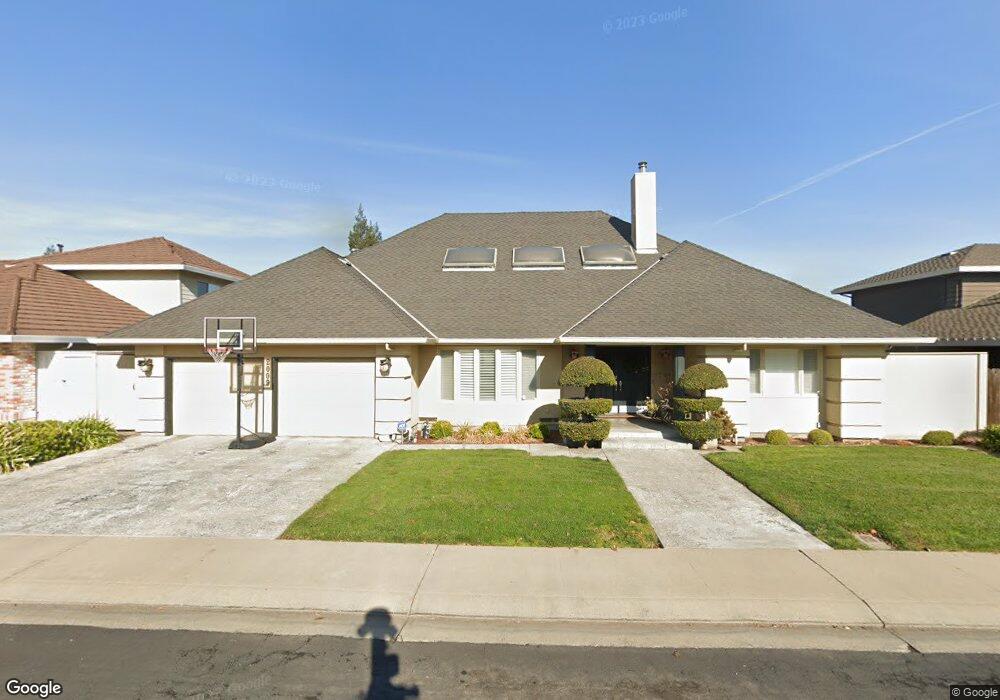
2009 San Marco Dr Modesto, CA 95355
Northeast Modesto NeighborhoodEstimated Value: $568,000 - $673,000
2
Beds
3
Baths
2,296
Sq Ft
$274/Sq Ft
Est. Value
About This Home
This home is located at 2009 San Marco Dr, Modesto, CA 95355 and is currently estimated at $629,032, approximately $273 per square foot. 2009 San Marco Dr is a home located in Stanislaus County with nearby schools including Rose Avenue Elementary School, La Loma Jr High, and Thomas Downey High School.
Ownership History
Date
Name
Owned For
Owner Type
Purchase Details
Closed on
Nov 20, 2025
Sold by
Vallerand Kathleen
Bought by
K L Vallerand 2025 Living Trust and Vallerand
Current Estimated Value
Purchase Details
Closed on
Aug 28, 2001
Sold by
Vallerand Kathleen
Bought by
Vallerand Kathleen
Home Financials for this Owner
Home Financials are based on the most recent Mortgage that was taken out on this home.
Original Mortgage
$242,000
Interest Rate
7.05%
Purchase Details
Closed on
Mar 21, 2001
Sold by
Vallerand Barry and Vallerand Kathleen
Bought by
Vallerand Kathleen
Create a Home Valuation Report for This Property
The Home Valuation Report is an in-depth analysis detailing your home's value as well as a comparison with similar homes in the area
Home Values in the Area
Average Home Value in this Area
Purchase History
| Date | Buyer | Sale Price | Title Company |
|---|---|---|---|
| K L Vallerand 2025 Living Trust | -- | None Listed On Document | |
| Vallerand Kathleen | -- | Stewart Title | |
| Vallerand Kathleen | -- | -- |
Source: Public Records
Mortgage History
| Date | Status | Borrower | Loan Amount |
|---|---|---|---|
| Previous Owner | Vallerand Kathleen | $242,000 |
Source: Public Records
Tax History
| Year | Tax Paid | Tax Assessment Tax Assessment Total Assessment is a certain percentage of the fair market value that is determined by local assessors to be the total taxable value of land and additions on the property. | Land | Improvement |
|---|---|---|---|---|
| 2025 | $5,700 | $494,443 | $101,970 | $392,473 |
| 2024 | $5,443 | $484,749 | $99,971 | $384,778 |
| 2023 | $5,362 | $475,245 | $98,011 | $377,234 |
| 2022 | $5,230 | $465,928 | $96,090 | $369,838 |
| 2021 | $4,918 | $456,793 | $94,206 | $362,587 |
| 2020 | $5,013 | $452,111 | $93,241 | $358,870 |
| 2019 | $4,896 | $443,247 | $91,413 | $351,834 |
| 2018 | $4,660 | $434,557 | $89,621 | $344,936 |
| 2017 | $4,547 | $426,037 | $87,864 | $338,173 |
| 2016 | $4,093 | $384,000 | $100,000 | $284,000 |
| 2015 | $3,903 | $366,000 | $55,000 | $311,000 |
| 2014 | $3,554 | $332,500 | $50,000 | $282,500 |
Source: Public Records
Map
Nearby Homes
- 1912 Kendall Ave
- 1316 Sharonwood Dr
- 1312 Wylmawood Ln
- 1313 Sharonwood Dr
- 1802 Rockford Ave
- 1805 E Orangeburg Ave
- 1900 Ellison Dr
- 2045 Celeste Dr
- 2005 Althoff Way
- 1837 Celeste Dr
- 2408 Beatrice Ln
- 2209 Perth Dr
- 1608 Kruger Dr
- 2113 Milford Ln
- 2307 Oakdale Rd Unit 13
- 2513 Stoneridge Dr
- 2317 Jeanine Dr
- 2425 Meadow Rue Dr
- 2209 Lantern Dr
- 2520 Casita Dr
- 2005 San Marco Dr
- 2013 San Marco Dr
- 2008 Kendall Ave
- 2012 Kendall Ave
- 2008 San Marco Dr
- 2017 San Marco Dr
- 2004 San Marco Dr
- 2004 Kendall Ave
- 2001 San Marco Dr
- 2012 San Marco Dr
- 2016 Kendall Ave
- 1509 El Pueblo Dr
- 2016 San Marco Dr
- 2000 Kendall Ave
- 2021 San Marco Dr
- 1505 El Pueblo Dr
- 2005 Casa Grande Ct
- 2020 Kendall Ave
- 2001 Casa Grande Ct
- 2009 Casa Grande Ct
Your Personal Tour Guide
Ask me questions while you tour the home.