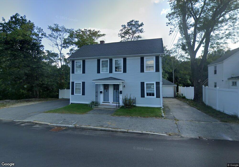
201 Andover St Unit 203 Andover, MA 01810
Ballardvale NeighborhoodEstimated Value: $776,032 - $923,000
2
Beds
1
Bath
1,100
Sq Ft
$773/Sq Ft
Est. Value
About This Home
This home is located at 201 Andover St Unit 203, Andover, MA 01810 and is currently estimated at $850,008, approximately $772 per square foot. 201 Andover St Unit 203 is a home located in Essex County with nearby schools including South Elementary School, Andover West Middle School, and Andover High School.
Ownership History
Date
Name
Owned For
Owner Type
Purchase Details
Closed on
Jul 12, 2004
Sold by
Mitton Steven L and Mitton Madelyn
Bought by
Delellis Michael S and Delellis Kornhauser-Delellis M
Current Estimated Value
Home Financials for this Owner
Home Financials are based on the most recent Mortgage that was taken out on this home.
Original Mortgage
$336,000
Interest Rate
6.32%
Mortgage Type
Purchase Money Mortgage
Purchase Details
Closed on
Jun 23, 1995
Sold by
Jedrey Joan M
Bought by
Mition Steven L
Home Financials for this Owner
Home Financials are based on the most recent Mortgage that was taken out on this home.
Original Mortgage
$87,500
Interest Rate
7.82%
Mortgage Type
Purchase Money Mortgage
Create a Home Valuation Report for This Property
The Home Valuation Report is an in-depth analysis detailing your home's value as well as a comparison with similar homes in the area
Home Values in the Area
Average Home Value in this Area
Purchase History
| Date | Buyer | Sale Price | Title Company |
|---|---|---|---|
| Delellis Michael S | $420,000 | -- | |
| Mition Steven L | $125,000 | -- |
Source: Public Records
Mortgage History
| Date | Status | Borrower | Loan Amount |
|---|---|---|---|
| Open | Mition Steven L | $355,000 | |
| Closed | Delellis Michael S | $336,000 | |
| Previous Owner | Mition Steven L | $87,500 |
Source: Public Records
Tax History Compared to Growth
Tax History
| Year | Tax Paid | Tax Assessment Tax Assessment Total Assessment is a certain percentage of the fair market value that is determined by local assessors to be the total taxable value of land and additions on the property. | Land | Improvement |
|---|---|---|---|---|
| 2024 | $8,050 | $625,000 | $333,900 | $291,100 |
| 2023 | $8,084 | $591,800 | $300,700 | $291,100 |
| 2022 | $7,471 | $511,700 | $266,200 | $245,500 |
| 2021 | $7,150 | $467,600 | $242,000 | $225,600 |
| 2020 | $6,607 | $440,200 | $236,200 | $204,000 |
| 2019 | $6,230 | $408,000 | $222,700 | $185,300 |
| 2018 | $5,948 | $380,300 | $210,100 | $170,200 |
| 2017 | $5,375 | $354,100 | $205,900 | $148,200 |
| 2016 | $4,744 | $320,100 | $192,700 | $127,400 |
| 2015 | $4,681 | $312,700 | $185,300 | $127,400 |
Source: Public Records
Map
Nearby Homes
- 197 Andover St
- 203 Andover St
- 000 Andover St
- 199 Andover St Unit 1
- 199 Andover St Unit 2
- Unit 8-H, 18 Dale St Unit H,Bldg 8
- 205-209 Andover St
- 2 Tewksbury St
- 00000 Andover St
- 207 Andover St
- 1 River St
- 207 Andover St Unit 207
- 209 Andover St Unit 1
- 209 Andover St
- 3 River St Unit 1
- 1 River St
- 205 Andover St Unit 209
- 68 Dale St
- 8 Dale St
- 195 Andover St Unit 1