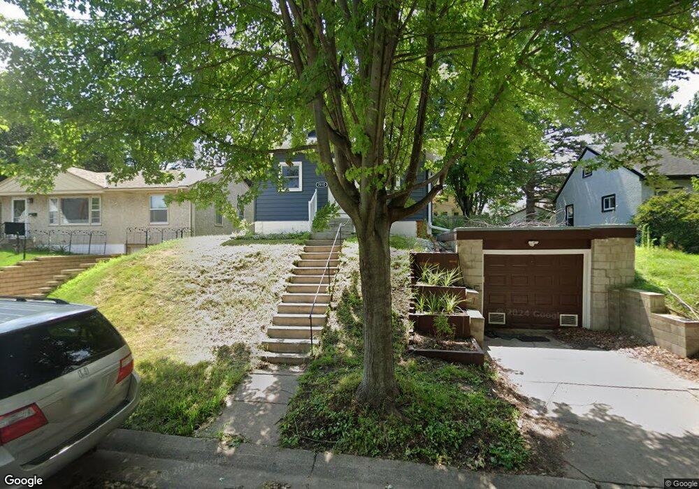
2010 Nortonia Ave Saint Paul, MN 55119
Beaver Lake Heights NeighborhoodEstimated Value: $207,000 - $232,726
2
Beds
1
Bath
848
Sq Ft
$261/Sq Ft
Est. Value
About This Home
This home is located at 2010 Nortonia Ave, Saint Paul, MN 55119 and is currently estimated at $221,182, approximately $260 per square foot. 2010 Nortonia Ave is a home located in Ramsey County with nearby schools including Hazel Park Preparatory Academy, Txuj Ci HMong Language and Culture Upper Campus, and Johnson Senior High School.
Ownership History
Date
Name
Owned For
Owner Type
Purchase Details
Closed on
Mar 17, 2020
Sold by
Norris Omar
Bought by
Andreson Christopher Charles
Current Estimated Value
Home Financials for this Owner
Home Financials are based on the most recent Mortgage that was taken out on this home.
Original Mortgage
$103,500
Outstanding Balance
$91,489
Interest Rate
3.4%
Mortgage Type
New Conventional
Estimated Equity
$129,693
Purchase Details
Closed on
Jan 26, 2017
Sold by
Atzmiller John L
Bought by
Norris Omar
Home Financials for this Owner
Home Financials are based on the most recent Mortgage that was taken out on this home.
Original Mortgage
$87,300
Interest Rate
4.16%
Mortgage Type
New Conventional
Create a Home Valuation Report for This Property
The Home Valuation Report is an in-depth analysis detailing your home's value as well as a comparison with similar homes in the area
Home Values in the Area
Average Home Value in this Area
Purchase History
| Date | Buyer | Sale Price | Title Company |
|---|---|---|---|
| Andreson Christopher Charles | $153,500 | Absolute Title Support | |
| Norris Omar | $92,727 | North American Title Co |
Source: Public Records
Mortgage History
| Date | Status | Borrower | Loan Amount |
|---|---|---|---|
| Open | Andreson Christopher Charles | $103,500 | |
| Previous Owner | Norris Omar | $87,300 |
Source: Public Records
Tax History Compared to Growth
Tax History
| Year | Tax Paid | Tax Assessment Tax Assessment Total Assessment is a certain percentage of the fair market value that is determined by local assessors to be the total taxable value of land and additions on the property. | Land | Improvement |
|---|---|---|---|---|
| 2025 | $3,730 | $230,200 | $30,000 | $200,200 |
| 2023 | $3,730 | $207,700 | $25,000 | $182,700 |
| 2022 | $3,848 | $195,200 | $25,000 | $170,200 |
| 2021 | $2,570 | $160,300 | $25,000 | $135,300 |
| 2020 | $2,062 | $153,500 | $14,800 | $138,700 |
| 2019 | $2,090 | $129,300 | $14,800 | $114,500 |
| 2018 | $1,812 | $132,200 | $14,800 | $117,400 |
| 2017 | $1,674 | $122,000 | $14,800 | $107,200 |
| 2016 | $1,264 | $0 | $0 | $0 |
| 2015 | $1,092 | $98,600 | $14,800 | $83,800 |
| 2014 | $874 | $0 | $0 | $0 |
Source: Public Records
Map
Nearby Homes
- 2002 Nortonia Ave
- 2015 Bush Ave E
- 834 Iroquois Ave
- 2054 Nortonia Ave
- 2037 Manitou Ave
- 1979 Stillwater Ave E
- 2112 Minnehaha Ave E
- 2121 Minnehaha Ave E
- 2161 Ross Ave E
- 2160 Nokomis Ave
- 2106 Stillwater Ave E
- 2175 Bush Ave E
- 1950 Case Ave E
- 2172 Reaney Ave E
- 1803 Bush Ave E
- 2220 Reaney Ave E
- 1964 4th St E
- 1764 Bush Ave
- 1935 Fremont Ave E
- 1784 Sims Ave
- 2016 Nortonia Ave
- 2006 Nortonia Ave
- 2009 Bush Ave E
- 2005 Bush Ave E
- 2005 2005 Bush-Avenue-
- 2011 Nortonia Ave
- 2015 Nortonia Ave
- 2015 2015 Nortonia-Avenue-
- 2020 Nortonia Ave
- 2005 Nortonia Ave
- 1998 1998 Nortonia-Avenue-
- 1998 Nortonia Ave
- 1993 1993 Bush Ave E
- 1993 Bush Ave E
- 2026 Nortonia Ave
- 2021 Bush Ave E
- 2021 Nortonia Ave
- 2001 Nortonia Ave
- 2010 Bush Ave E
- 2008 Nokomis Ave