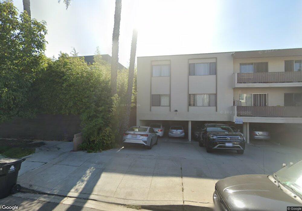
2010 Preuss Rd Unit 4 Los Angeles, CA 90034
Mid-City NeighborhoodEstimated Value: $1,387,391 - $1,648,000
3
Beds
3
Baths
1,400
Sq Ft
$1,056/Sq Ft
Est. Value
About This Home
This home is located at 2010 Preuss Rd Unit 4, Los Angeles, CA 90034 and is currently estimated at $1,478,598, approximately $1,056 per square foot. 2010 Preuss Rd Unit 4 is a home located in Los Angeles County with nearby schools including Mark Twain Middle School, Alexander Hamilton Senior High School, and Cheder Menachem School.
Ownership History
Date
Name
Owned For
Owner Type
Purchase Details
Closed on
May 14, 2024
Sold by
Zolfaghari Sara
Bought by
Sara Zolfaghari Trust and Zolfaghari
Current Estimated Value
Purchase Details
Closed on
Sep 10, 2014
Sold by
4 Corners Group Llc
Bought by
Zolfaghari Sara
Home Financials for this Owner
Home Financials are based on the most recent Mortgage that was taken out on this home.
Original Mortgage
$499,000
Interest Rate
4.07%
Mortgage Type
New Conventional
Create a Home Valuation Report for This Property
The Home Valuation Report is an in-depth analysis detailing your home's value as well as a comparison with similar homes in the area
Home Values in the Area
Average Home Value in this Area
Purchase History
| Date | Buyer | Sale Price | Title Company |
|---|---|---|---|
| Sara Zolfaghari Trust | -- | None Listed On Document | |
| Zolfaghari Sara | $699,000 | Chicago Title Company |
Source: Public Records
Mortgage History
| Date | Status | Borrower | Loan Amount |
|---|---|---|---|
| Previous Owner | Zolfaghari Sara | $499,000 |
Source: Public Records
Tax History Compared to Growth
Tax History
| Year | Tax Paid | Tax Assessment Tax Assessment Total Assessment is a certain percentage of the fair market value that is determined by local assessors to be the total taxable value of land and additions on the property. | Land | Improvement |
|---|---|---|---|---|
| 2025 | $10,081 | $840,082 | $406,700 | $433,382 |
| 2024 | $10,081 | $823,611 | $398,726 | $424,885 |
| 2023 | $9,889 | $807,462 | $390,908 | $416,554 |
| 2022 | $9,430 | $791,631 | $383,244 | $408,387 |
| 2021 | $9,312 | $776,110 | $375,730 | $400,380 |
| 2019 | $9,032 | $753,092 | $364,587 | $388,505 |
| 2018 | $8,978 | $738,327 | $357,439 | $380,888 |
| 2016 | $8,567 | $709,659 | $343,560 | $366,099 |
| 2015 | $8,441 | $699,000 | $338,400 | $360,600 |
| 2014 | $4,370 | $348,723 | $187,447 | $161,276 |
Source: Public Records
Map
Nearby Homes
- 2011 S Shenandoah St
- 8953 W 24th St
- 1904 Preuss Rd
- 2502 S Robertson Blvd
- 1942 S Sherbourne Dr
- 8809 David Ave
- 1952 S Holt Ave
- 2055 S Corning St
- 2628 Reynier Ave
- 2411 S Canfield Ave
- 2261 Bagley Ave
- 2702 Reynier Ave
- 1810 S Sherbourne Dr
- 9142 Monte Mar Dr
- 9313 Bolton Rd
- 2847 S Robertson Blvd
- 1960 Chariton St
- 1944 Chariton St
- 1726 S Sherbourne Dr
- 8767 Airdrome St
- 2010 Preuss Rd
- 8874 Guthrie Ave
- 8870 Guthrie Ave
- 2020 Preuss Rd
- 2020 Preuss Rd Unit 208
- 2020 Preuss Rd Unit 202
- 2020 Preuss Rd Unit 101
- 2008 Preuss Rd Unit 2
- 2008 Preuss Rd Unit 1/2
- 2008 Preuss Rd
- 8880 Guthrie Ave
- 8864 Guthrie Ave
- 8856 Guthrie Ave
- 2006 Preuss Rd
- 2006 1/2 Preuss Rd
- 2006 1/2 Preuss Rd Unit 3
- 1974 Preuss Rd
- 2013 S Shenandoah St
- 1976 Preuss Rd
- 8865 Guthrie Ave