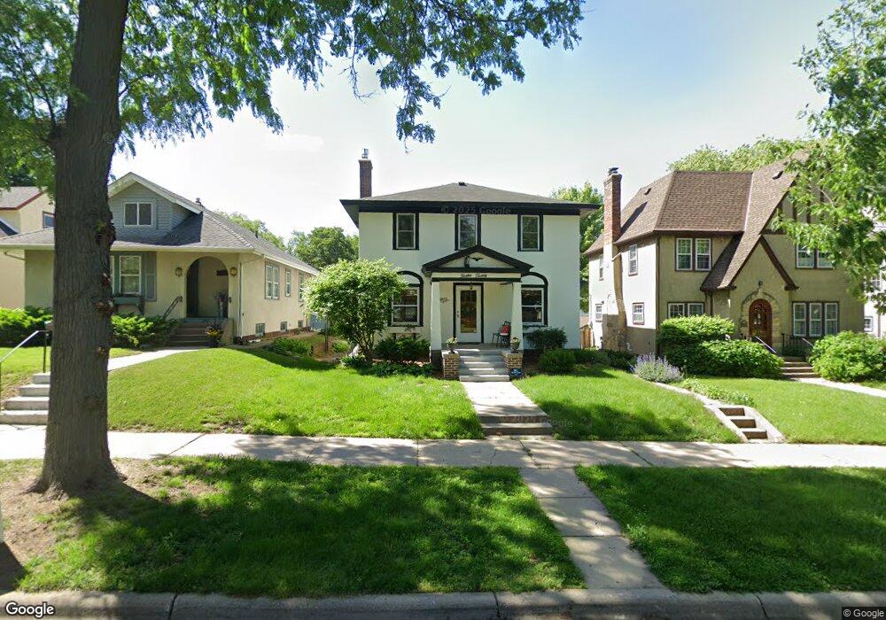
2012 Stanford Ave Saint Paul, MN 55105
Macalester-Groveland NeighborhoodEstimated Value: $681,000 - $693,000
3
Beds
2
Baths
2,660
Sq Ft
$258/Sq Ft
Est. Value
About This Home
This home is located at 2012 Stanford Ave, Saint Paul, MN 55105 and is currently estimated at $685,759, approximately $257 per square foot. 2012 Stanford Ave is a home located in Ramsey County with nearby schools including Groveland Park Elementary School, Hidden River Middle School, and Central Senior High School.
Ownership History
Date
Name
Owned For
Owner Type
Purchase Details
Closed on
Apr 15, 2021
Sold by
Motl Daniel W and Degnan Jennifer
Bought by
Sherwood Grant and Sherwood Kelsey
Current Estimated Value
Home Financials for this Owner
Home Financials are based on the most recent Mortgage that was taken out on this home.
Original Mortgage
$548,250
Outstanding Balance
$495,400
Interest Rate
3.05%
Mortgage Type
New Conventional
Estimated Equity
$190,359
Purchase Details
Closed on
May 7, 2018
Sold by
Girk David J
Bought by
Motl Daniel W
Home Financials for this Owner
Home Financials are based on the most recent Mortgage that was taken out on this home.
Original Mortgage
$363,850
Interest Rate
4.4%
Mortgage Type
New Conventional
Create a Home Valuation Report for This Property
The Home Valuation Report is an in-depth analysis detailing your home's value as well as a comparison with similar homes in the area
Home Values in the Area
Average Home Value in this Area
Purchase History
| Date | Buyer | Sale Price | Title Company |
|---|---|---|---|
| Sherwood Grant | $625,700 | Dca Title | |
| Motl Daniel W | $383,000 | Liberty Title Inc | |
| Sherwood Grant Grant | $625,700 | -- |
Source: Public Records
Mortgage History
| Date | Status | Borrower | Loan Amount |
|---|---|---|---|
| Open | Sherwood Grant | $548,250 | |
| Previous Owner | Motl Daniel W | $363,850 | |
| Closed | Sherwood Grant Grant | $548,250 |
Source: Public Records
Tax History Compared to Growth
Tax History
| Year | Tax Paid | Tax Assessment Tax Assessment Total Assessment is a certain percentage of the fair market value that is determined by local assessors to be the total taxable value of land and additions on the property. | Land | Improvement |
|---|---|---|---|---|
| 2025 | $10,182 | $669,400 | $140,800 | $528,600 |
| 2023 | $10,182 | $635,100 | $140,800 | $494,300 |
| 2022 | $7,940 | $603,600 | $140,800 | $462,800 |
| 2021 | $7,350 | $491,500 | $140,800 | $350,700 |
| 2020 | $7,084 | $471,800 | $140,800 | $331,000 |
| 2019 | $7,262 | $421,800 | $140,800 | $281,000 |
| 2018 | $6,512 | $427,100 | $140,800 | $286,300 |
| 2017 | $5,904 | $393,700 | $140,800 | $252,900 |
| 2016 | $5,894 | $0 | $0 | $0 |
| 2015 | $5,940 | $359,400 | $126,700 | $232,700 |
| 2014 | $5,320 | $0 | $0 | $0 |
Source: Public Records
Map
Nearby Homes
- 281 Cleveland Ave S
- 2129 Stanford Ave
- 2133 Berkeley Ave
- 188 Cleveland Ave S
- 2114 Randolph Ave
- 1818 Juliet Ave
- 1926 Lincoln Ave
- 313 Stonebridge Blvd
- 317 Stonebridge Blvd
- 1797 James Ave
- 475 Mount Curve Blvd
- 2250 Princeton Ave
- 2009 Grand Ave
- 2047 Grand Ave
- 2248 Goodrich Ave
- 2056 Summit Ave
- 196 Mississippi River Blvd S
- 1917 Summit Ave Unit 2
- 590 Fairview Ave S
- 191 Vernon St
- 2018 Stanford Ave
- 2010 Stanford Ave
- 2004 Stanford Ave
- 2000 Stanford Ave
- 2024 Stanford Ave
- 2015 Wellesley Ave
- 2019 Wellesley Ave
- 2009 Wellesley Ave
- 2030 Stanford Ave
- 2023 Wellesley Ave
- 2007 Wellesley Ave
- 2015 Stanford Ave
- 2025 Wellesley Ave
- 2003 Wellesley Ave
- 2011 Stanford Ave
- 2019 Stanford Ave
- 2005 Stanford Ave
- 2023 Stanford Ave
- 2029 Wellesley Ave
- 1996 Stanford Ave