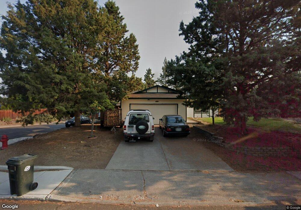
2014 NE Wells Acres Rd Bend, OR 97701
Mountain View NeighborhoodEstimated Value: $476,002 - $517,000
3
Beds
2
Baths
1,112
Sq Ft
$444/Sq Ft
Est. Value
About This Home
This home is located at 2014 NE Wells Acres Rd, Bend, OR 97701 and is currently estimated at $493,251, approximately $443 per square foot. 2014 NE Wells Acres Rd is a home located in Deschutes County with nearby schools including Ensworth Elementary School, Pilot Butte Middle School, and Mountain View Senior High School.
Ownership History
Date
Name
Owned For
Owner Type
Purchase Details
Closed on
Jul 3, 2023
Sold by
Larson Richard S
Bought by
Larson Richard S and Larson Rebecca A
Current Estimated Value
Home Financials for this Owner
Home Financials are based on the most recent Mortgage that was taken out on this home.
Original Mortgage
$652,500
Outstanding Balance
$475,984
Interest Rate
7.5%
Mortgage Type
FHA
Estimated Equity
$17,267
Create a Home Valuation Report for This Property
The Home Valuation Report is an in-depth analysis detailing your home's value as well as a comparison with similar homes in the area
Home Values in the Area
Average Home Value in this Area
Purchase History
| Date | Buyer | Sale Price | Title Company |
|---|---|---|---|
| Larson Richard S | -- | None Listed On Document |
Source: Public Records
Mortgage History
| Date | Status | Borrower | Loan Amount |
|---|---|---|---|
| Open | Larson Richard S | $652,500 | |
| Closed | Larson Richard S | $652,500 |
Source: Public Records
Tax History Compared to Growth
Tax History
| Year | Tax Paid | Tax Assessment Tax Assessment Total Assessment is a certain percentage of the fair market value that is determined by local assessors to be the total taxable value of land and additions on the property. | Land | Improvement |
|---|---|---|---|---|
| 2025 | $2,609 | $154,400 | -- | -- |
| 2024 | $2,510 | $149,910 | -- | -- |
| 2023 | $2,327 | $145,550 | $0 | $0 |
| 2022 | $2,171 | $137,210 | $0 | $0 |
| 2021 | $2,174 | $133,220 | $0 | $0 |
| 2020 | $2,063 | $133,220 | $0 | $0 |
| 2019 | $2,006 | $129,340 | $0 | $0 |
| 2018 | $1,949 | $125,580 | $0 | $0 |
| 2017 | $1,892 | $121,930 | $0 | $0 |
| 2016 | $1,804 | $118,380 | $0 | $0 |
| 2015 | $1,754 | $114,940 | $0 | $0 |
| 2014 | $1,703 | $111,600 | $0 | $0 |
Source: Public Records
Map
Nearby Homes
- 2739 NE Cordata
- 2976 NE Bluebell Ln
- 2843 NE Purcell Blvd
- 2987 NE Oakley Ct
- 2241 NE Hyatt Ct
- 2574 NE Robinson St
- 2254 NE Indigo Ln
- 2293 NE Lynda Ln
- 2026 NE Neil Way
- 2382 NE Jackson Ave
- 2025 NE Neil Way
- 2011 NE Neil Way
- 2101 NE Holliday Ave
- 21620 NE Butler Market Rd
- 2939 NE Quiet Canyon Dr
- 2485 NE Jennie Jo Ct
- 3280 NE Jonahs Ct
- 2508 NE Buckwheat Ct
- 1473 NE Mable Ct
- 1407 NE Talon Ct
- 2032 NE Wells Acres Rd
- 2002 NE Wells Acres Rd
- 1985 NE Red Rock Ln
- 2003 NE Wells Acres Rd
- 2901 NE Sheridan Ave
- 2817 NE Cordata
- 1954 NE Wells Acres Rd
- 1955 NE Wells Acres Rd
- 2811 NE Cordata
- 1999 NE Red Rock Ln
- 2044 NE Wells Acres Rd
- 1979 NE Red Rock Ln
- 2803 NE Cordata
- 1948 NE Wells Acres Rd
- 2923 NE Deborah Ct
- 2816 NE Lapoint Ct
- 2816 NE Lapointe Ct
- 2003 NE Red Rock Ln
- 2816 NE Cordata