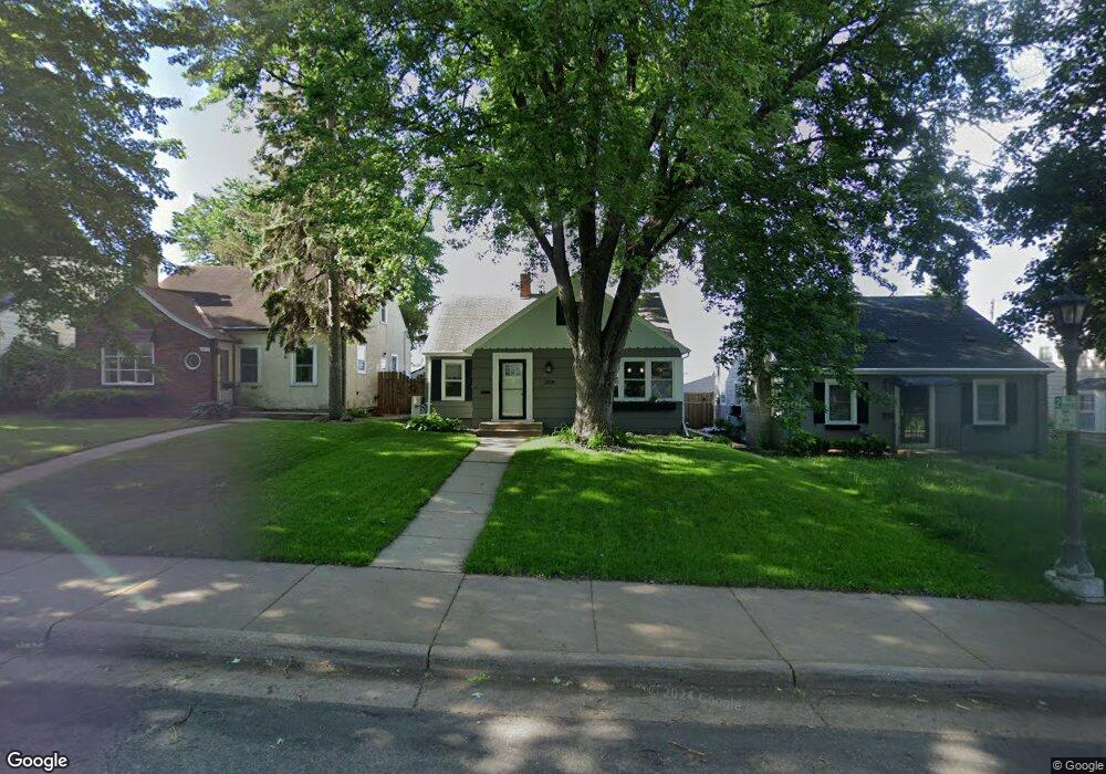
2014 Pinehurst Ave Saint Paul, MN 55116
Highland Park NeighborhoodEstimated Value: $407,000 - $433,886
2
Beds
3
Baths
701
Sq Ft
$605/Sq Ft
Est. Value
About This Home
This home is located at 2014 Pinehurst Ave, Saint Paul, MN 55116 and is currently estimated at $424,222, approximately $605 per square foot. 2014 Pinehurst Ave is a home located in Ramsey County with nearby schools including Horace Mann School, Highland Park Middle School, and Highland Park Senior High.
Ownership History
Date
Name
Owned For
Owner Type
Purchase Details
Closed on
Jul 12, 2022
Sold by
Pursley Richard J and Pursley Mary Jo
Bought by
Richard J Pursley And Mary Jo Pursley Trust and Pursley
Current Estimated Value
Purchase Details
Closed on
Oct 26, 2018
Sold by
Prokop Britt E
Bought by
Pursley Richard and Pursley Mary Jo
Home Financials for this Owner
Home Financials are based on the most recent Mortgage that was taken out on this home.
Original Mortgage
$150,000
Interest Rate
4.7%
Mortgage Type
New Conventional
Create a Home Valuation Report for This Property
The Home Valuation Report is an in-depth analysis detailing your home's value as well as a comparison with similar homes in the area
Home Values in the Area
Average Home Value in this Area
Purchase History
| Date | Buyer | Sale Price | Title Company |
|---|---|---|---|
| Richard J Pursley And Mary Jo Pursley Trust | $500 | Graham Kate Z | |
| Pursley Richard | $290,752 | Results Title |
Source: Public Records
Mortgage History
| Date | Status | Borrower | Loan Amount |
|---|---|---|---|
| Previous Owner | Pursley Richard | $150,000 |
Source: Public Records
Tax History Compared to Growth
Tax History
| Year | Tax Paid | Tax Assessment Tax Assessment Total Assessment is a certain percentage of the fair market value that is determined by local assessors to be the total taxable value of land and additions on the property. | Land | Improvement |
|---|---|---|---|---|
| 2025 | $5,416 | $388,000 | $136,600 | $251,400 |
| 2023 | $5,416 | $353,400 | $136,600 | $216,800 |
| 2022 | $5,006 | $382,800 | $136,600 | $246,200 |
| 2021 | $4,568 | $315,600 | $136,600 | $179,000 |
| 2020 | $4,780 | $300,100 | $136,600 | $163,500 |
| 2019 | $4,090 | $292,800 | $136,600 | $156,200 |
| 2018 | $3,750 | $251,200 | $136,600 | $114,600 |
| 2017 | $3,308 | $239,000 | $136,600 | $102,400 |
| 2016 | $3,334 | $0 | $0 | $0 |
| 2015 | $3,456 | $215,600 | $117,100 | $98,500 |
| 2014 | $3,170 | $0 | $0 | $0 |
Source: Public Records
Map
Nearby Homes
- 1941 Ford Pkwy Unit 102
- 677 Wilder St S
- 898 Wilder St S
- 1885 W Eleanor Ave
- 1857 Ford Pkwy
- 1856 Highland Pkwy
- 1886 Rome Ave
- 1846 Saunders Ave
- 1778 Ford Pkwy
- 1776 Ford Pkwy
- 875 Falls Passage W Unit C
- 590 Fairview Ave S
- 870 Mount Curve Blvd Unit F
- 870 Mount Curve Blvd Unit L
- 909 Mount Curve Blvd Unit F
- 909 Mount Curve Blvd Unit I
- 909 Mount Curve Blvd Unit G
- 909 Mount Curve Blvd Unit H
- 909 Mount Curve Blvd Unit E
- 909 Mount Curve Blvd Unit D
- 2010 Pinehurst Ave
- 2018 Pinehurst Ave
- 2006 Pinehurst Ave
- 2022 Pinehurst Ave
- 2026 Pinehurst Ave
- 2002 Pinehurst Ave
- 2030 Pinehurst Ave
- 2015 Pinehurst Ave
- 2019 Pinehurst Ave
- 2011 Pinehurst Ave
- 2023 Pinehurst Ave
- 2007 Pinehurst Ave
- 2027 Pinehurst Ave
- 2005 Pinehurst Ave
- 1998 Pinehurst Ave
- 2031 Pinehurst Ave
- 2035 Pinehurst Ave
- 1994 Pinehurst Ave
- 2042 Pinehurst Ave
- 1999 Pinehurst Ave