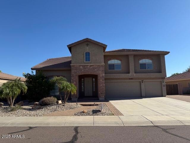
2015 W Quail Track Dr Phoenix, AZ 85085
Norterra NeighborhoodHighlights
- RV Gated
- 0.29 Acre Lot
- Santa Barbara Architecture
- Norterra Canyon School Rated A-
- Fireplace in Primary Bedroom
- Hydromassage or Jetted Bathtub
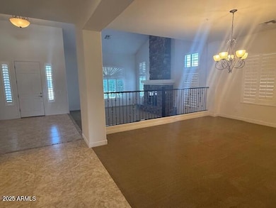
About This Home
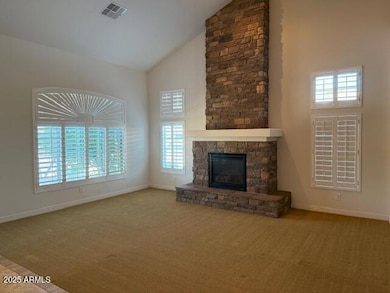
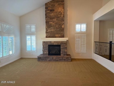
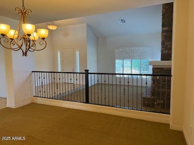
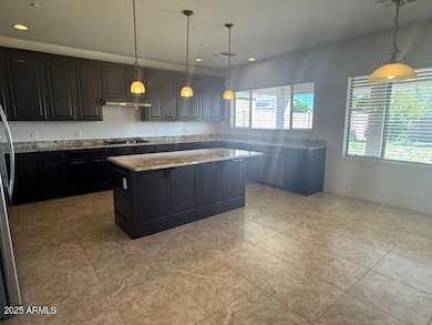
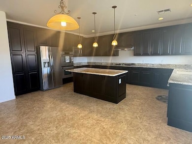
Nice sized home in great area. Living room with fireplace. Formal dining room plus an eat in kitchen. Large family room with bar and built in refrigerator. Entertainers kitchen with gas stove top and large island. Primary suite has fireplace and huge walk in closet. Upstairs loft. Huge backyard.

Home Details
Home Type
- Single Family
Est. Annual Taxes
- $3,999
Year Built
- Built in 2008
Lot Details
- 0.29 Acre Lot
- Desert faces the front of the property
- Cul-De-Sac
- Block Wall Fence
Parking
- 3 Car Garage
- RV Gated
Home Design
- Santa Barbara Architecture
- Wood Frame Construction
- Tile Roof
- Stucco
Interior Spaces
- 4,463 Sq Ft Home
- 2-Story Property
- Ceiling Fan
- Living Room with Fireplace
- 2 Fireplaces
- Carpet
- Laundry in unit
Kitchen
- Eat-In Kitchen
- Breakfast Bar
- Built-In Microwave
- Kitchen Island
- Granite Countertops
Bedrooms and Bathrooms
- 5 Bedrooms
- Fireplace in Primary Bedroom
- Primary Bathroom is a Full Bathroom
- 3.5 Bathrooms
- Double Vanity
- Hydromassage or Jetted Bathtub
- Bathtub With Separate Shower Stall
Outdoor Features
- Covered Patio or Porch
Schools
- Norterra Canyon Elementary And Middle School
- Barry Goldwater High School
Utilities
- Central Air
- Heating System Uses Natural Gas
- Water Softener
- High Speed Internet
- Cable TV Available
Listing and Financial Details
- Property Available on 12/8/25
- $34 Move-In Fee
- 6-Month Minimum Lease Term
- $65 Application Fee
- Tax Lot 511
- Assessor Parcel Number 210-20-125
Community Details
Overview
- Property has a Home Owners Association
- Valley Vista HOA, Phone Number (602) 437-4777
- Built by Meritage
- Valley Vista Parcel B Subdivision, The Vista Floorplan
Recreation
- Bike Trail
Pet Policy
- Call for details about the types of pets allowed
Map
Source: Arizona Regional Multiple Listing Service (ARMLS)
MLS Number: 6955368
APN: 210-20-125
Disclaimer: Certain information contained herein is derived from information provided by parties other than Homes.com. All information provided is deemed reliable, but is not guaranteed to be accurate and should be independently verified.
![]() All information should be verified by the recipient and none is guaranteed as accurate by ARMLS
All information should be verified by the recipient and none is guaranteed as accurate by ARMLS
Listing Information presented by local MLS brokerage: Ten-X, local REALTOR®- Arlene Richardson - (888)-952-6393
- 1864 W Buckhorn Trail
- 1860 W Buckhorn Trail
- 1918 W Bonanza Ln
- 1828 W Desperado Way
- 27414 N 22nd Ln
- 1927 W Mine Trail
- Echo Plan at Union Park at Norterra - Encore Collection
- 1759 W Desperado Way
- 1749 W Fetlock Trail
- 1846 W Bonanza Dr
- 1747 W Straight Arrow Ln
- 2302 W Hedgehog Place
- 2022 W Rowel Rd
- 2409 W Quail Track Dr
- 1827 W Black Hill Rd
- Grace Plan at Union Park at Norterra - Retreat Collection
- Serene Plan at Union Park at Norterra - Retreat Collection
- Harmony Plan at Union Park at Norterra - Retreat Collection
- Virtue Plan at Union Park at Norterra - Retreat Collection
- 2332 W Andrea Dr
- 2216 W Blaylock Dr
- 1843 W Fetlock Trail
- 1918 W Bonanza Ln
- 1928 W Spur Dr
- 2237 W Bonanza Ln
- 2219 W Spur Dr
- 2205 W Gambit Trail
- 1819 W Bonanza Dr
- 28000 N North Valley Pkwy
- 1953 W Yellowbird Ln
- 2315 W Running Deer Trail
- 26209 N 19th Ln
- 26205 N 19th Ln
- 2442 W Rowel Rd
- 2460 W Rowel Rd
- 2528 W Straight Arrow Ln
- 2432 W Blue Sky Dr
- 2503 W Gambit Trail
- 26425 N 24th Glen
- 2344 W White Feather Ln