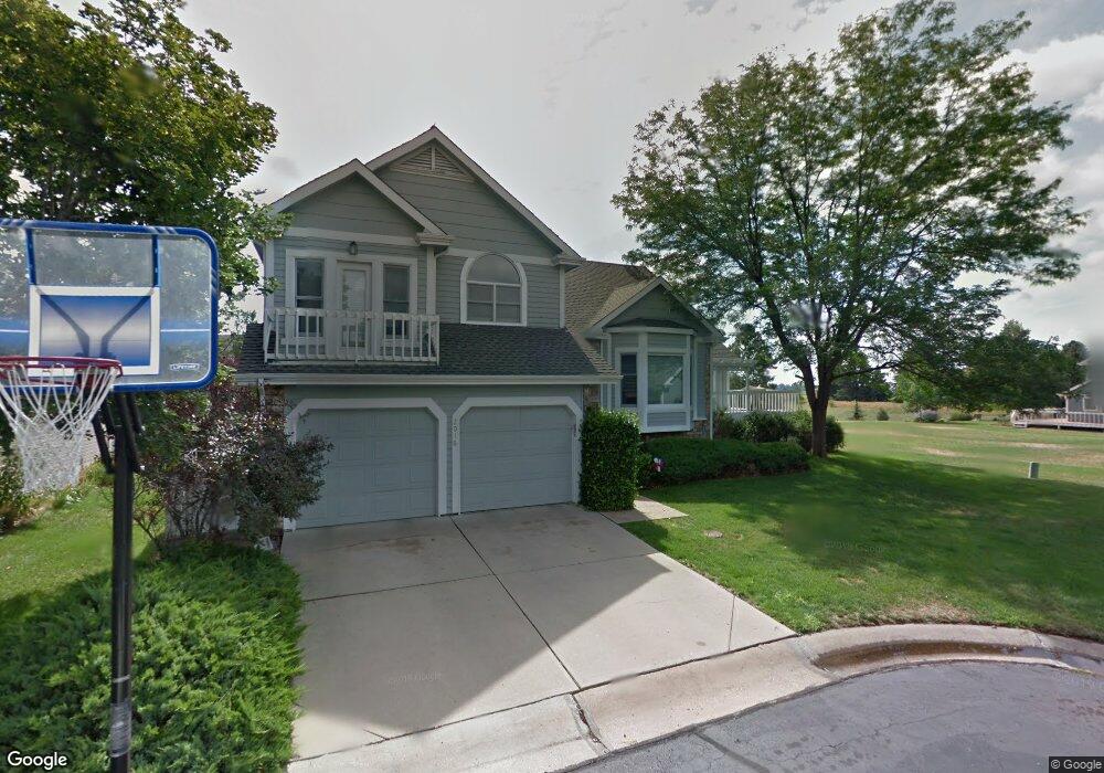
2016 Simsbury Ct Fort Collins, CO 80524
Estimated Value: $603,000 - $704,794
4
Beds
3
Baths
3,270
Sq Ft
$205/Sq Ft
Est. Value
About This Home
This home is located at 2016 Simsbury Ct, Fort Collins, CO 80524 and is currently estimated at $669,449, approximately $204 per square foot. 2016 Simsbury Ct is a home located in Larimer County with nearby schools including Tavelli Elementary School, Lincoln Middle School, and Poudre High School.
Ownership History
Date
Name
Owned For
Owner Type
Purchase Details
Closed on
Aug 2, 2021
Sold by
Matuska Floyd Dale
Bought by
Brown Terrol L and Brown Charlene K
Current Estimated Value
Home Financials for this Owner
Home Financials are based on the most recent Mortgage that was taken out on this home.
Original Mortgage
$476,367
Outstanding Balance
$96,458
Interest Rate
5%
Mortgage Type
Purchase Money Mortgage
Estimated Equity
$572,991
Purchase Details
Closed on
Apr 30, 2021
Sold by
Bee David S and Piepho Julie
Bought by
Matuska Floyd Dale
Purchase Details
Closed on
Sep 21, 2005
Sold by
Bee David S
Bought by
Bee David S and Piepho Julie
Purchase Details
Closed on
Dec 1, 1991
Bought by
Bee David S and Bee Kathleen J
Create a Home Valuation Report for This Property
The Home Valuation Report is an in-depth analysis detailing your home's value as well as a comparison with similar homes in the area
Home Values in the Area
Average Home Value in this Area
Purchase History
| Date | Buyer | Sale Price | Title Company |
|---|---|---|---|
| Brown Terrol L | $473,330 | Land Title Guarantee | |
| Matuska Floyd Dale | $475,000 | Heritage Title Co | |
| Bee David S | -- | -- | |
| Bee David S | $164,500 | -- |
Source: Public Records
Mortgage History
| Date | Status | Borrower | Loan Amount |
|---|---|---|---|
| Open | Brown Terrol L | $476,367 |
Source: Public Records
Tax History Compared to Growth
Tax History
| Year | Tax Paid | Tax Assessment Tax Assessment Total Assessment is a certain percentage of the fair market value that is determined by local assessors to be the total taxable value of land and additions on the property. | Land | Improvement |
|---|---|---|---|---|
| 2025 | $4,166 | $46,545 | $2,680 | $43,865 |
| 2024 | $3,966 | $46,545 | $2,680 | $43,865 |
| 2022 | $3,124 | $32,728 | $2,780 | $29,948 |
| 2021 | $3,151 | $33,669 | $2,860 | $30,809 |
| 2020 | $3,322 | $35,192 | $2,860 | $32,332 |
| 2019 | $3,338 | $35,192 | $2,860 | $32,332 |
| 2018 | $3,163 | $34,402 | $2,880 | $31,522 |
| 2017 | $3,152 | $34,402 | $2,880 | $31,522 |
| 2016 | $2,970 | $32,254 | $3,184 | $29,070 |
| 2015 | $2,949 | $32,250 | $3,180 | $29,070 |
| 2014 | $2,400 | $26,080 | $3,180 | $22,900 |
Source: Public Records
Map
Nearby Homes
- 1604 Heber Dr
- 2126 Friar Tuck Ct
- 2150 Sherwood Forest Ct
- 2221 Chesapeake Dr
- 1545 Adriel Ct Unit 1545
- 1508 Linden Lake Rd
- 1643 Adriel Dr Unit 1643
- 1311 S View Cir
- 1614 Hillside Dr
- 2327 Sunbury Ln
- 1412 Wimbledon Ct
- 2305 Turnberry Rd
- 2332 Marshfield Ln
- 1328 Hillside Dr
- 1300 Steeplechase Dr
- 2427 Maple Hill Dr
- 2513 Banbury Ln
- 1208 Miramont Dr
- 1310 Country Club Rd
- 2463 Clarion Ln
- 2012 Simsbury Ct
- 2005 Simsbury Ct
- 2004 Simsbury Ct
- 1709 Barrington Ct
- 2008 Shelburne Ct
- 1717 Barrington Ct
- 2012 Shelburne Ct
- 1712 Barrington Ct
- 2013 Shelburne Ct
- 1923 Simsbury Ct
- 1920 Simsbury Ct
- 1720 Barrington Ct
- 1919 Simsbury Ct
- 1924 Shelburne Ct
- 1808 Westover Ct
- 1807 Westover Ct
- 2009 Shelburne Ct
- 2005 Shelburne Ct
- 1813 Barrington Ct
- 1915 Simsbury Ct