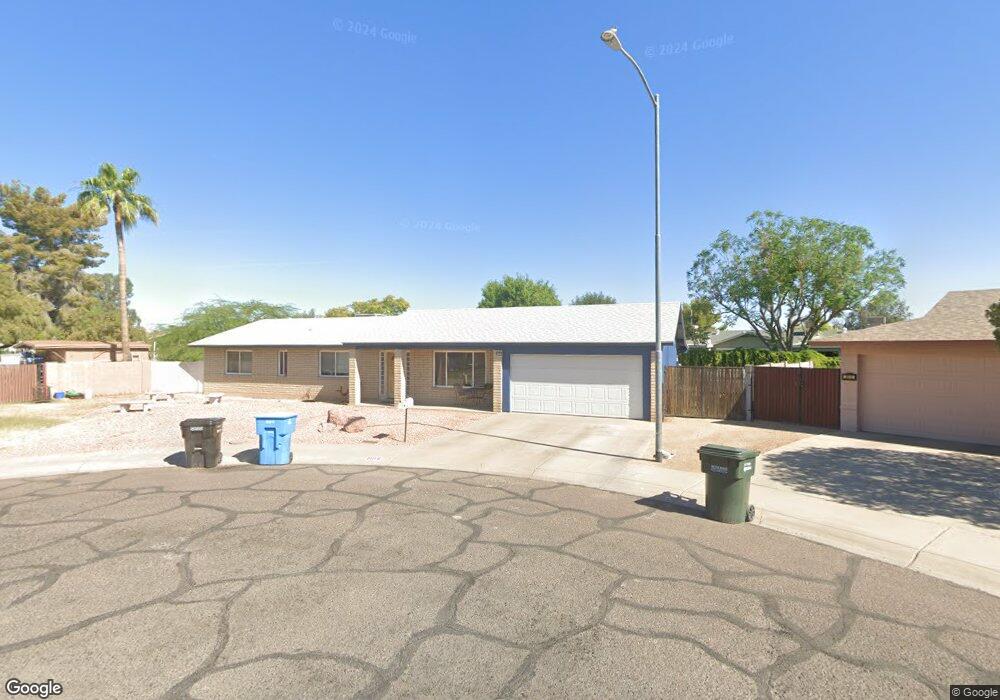
2016 W Kimberly Way Phoenix, AZ 85027
North Central Phoenix NeighborhoodEstimated Value: $348,391 - $416,000
--
Bed
2
Baths
1,720
Sq Ft
$230/Sq Ft
Est. Value
About This Home
This home is located at 2016 W Kimberly Way, Phoenix, AZ 85027 and is currently estimated at $395,598, approximately $229 per square foot. 2016 W Kimberly Way is a home located in Maricopa County with nearby schools including Village Meadows Elementary School, Deer Valley Middle School, and Barry Goldwater High School.
Ownership History
Date
Name
Owned For
Owner Type
Purchase Details
Closed on
May 15, 2020
Sold by
Stulce Leroy J and Stulce Patricia A
Bought by
Luadtke Hazen F and Luadtke Kelly M
Current Estimated Value
Home Financials for this Owner
Home Financials are based on the most recent Mortgage that was taken out on this home.
Original Mortgage
$147,000
Outstanding Balance
$102,586
Interest Rate
3.2%
Mortgage Type
New Conventional
Estimated Equity
$293,012
Create a Home Valuation Report for This Property
The Home Valuation Report is an in-depth analysis detailing your home's value as well as a comparison with similar homes in the area
Home Values in the Area
Average Home Value in this Area
Purchase History
| Date | Buyer | Sale Price | Title Company |
|---|---|---|---|
| Luadtke Hazen F | $186,000 | Pioneer Title Agency Inc |
Source: Public Records
Mortgage History
| Date | Status | Borrower | Loan Amount |
|---|---|---|---|
| Open | Luadtke Hazen F | $147,000 |
Source: Public Records
Tax History Compared to Growth
Tax History
| Year | Tax Paid | Tax Assessment Tax Assessment Total Assessment is a certain percentage of the fair market value that is determined by local assessors to be the total taxable value of land and additions on the property. | Land | Improvement |
|---|---|---|---|---|
| 2025 | $1,584 | $18,209 | -- | -- |
| 2024 | $1,541 | $17,342 | -- | -- |
| 2023 | $1,541 | $30,820 | $6,160 | $24,660 |
| 2022 | $1,484 | $24,150 | $4,830 | $19,320 |
| 2021 | $1,550 | $22,370 | $4,470 | $17,900 |
| 2020 | $1,521 | $20,570 | $4,110 | $16,460 |
| 2019 | $1,474 | $18,930 | $3,780 | $15,150 |
| 2018 | $1,423 | $17,330 | $3,460 | $13,870 |
| 2017 | $1,374 | $15,510 | $3,100 | $12,410 |
| 2016 | $1,297 | $15,650 | $3,130 | $12,520 |
| 2015 | $923 | $13,130 | $2,620 | $10,510 |
Source: Public Records
Map
Nearby Homes
- 2020 W Union Hills Dr Unit 260
- 2020 W Union Hills Dr Unit 201
- 2020 W Union Hills Dr Unit 240
- 2020 W Union Hills Dr Unit 246
- 2020 W Union Hills Dr Unit 127
- 2020 W Union Hills Dr Unit 146
- 2020 W Union Hills Dr Unit 263
- 2110 W Morrow Dr
- 2201 W Topeka Dr
- 18811 N 19th Ave Unit 2017
- 1942 W Kristal Way
- 2226 W Mcrae Way
- 2142 W Kerry Ln
- 2201 W Union Hills Dr Unit 118
- 19013 N 18th Ave
- 1750 W Union Hills Dr Unit 21
- 1750 W Union Hills Dr Unit 37
- 2315 W Union Hills Dr Unit 108
- 19249 N 23rd Ave
- 18045 N 20th Ln
- 2018 W Kimberly Way
- 2011 W Wescott Dr
- 18821 N 20th Dr
- 2012 W Kimberly Way
- 18815 N 20th Dr
- 2019 W Wescott Dr
- 2001 W Wescott Dr
- 2008 W Kimberly Way
- 2020 W Kimberly Way
- 18807 N 20th Dr
- 2002 W Kimberly Way
- 1950 W Kimberly Way
- 1953 W Wescott Dr
- 2016 W Wescott Dr
- 2012 W Wescott Dr
- 1948 W Kimberly Way
- 18822 N 20th Dr
- 18816 N 20th Dr
- 2020 W Wescott Dr
- 2002 W Wescott Dr