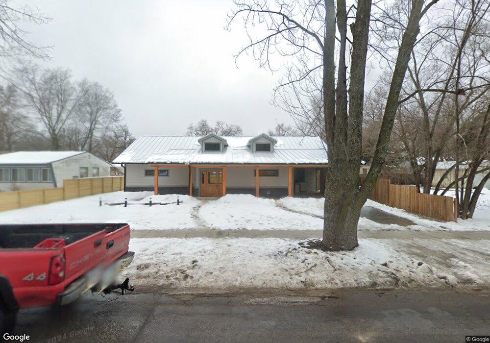
2017 Barker Ave Lawrence, KS 66046
Barker NeighborhoodEstimated Value: $459,000 - $596,000
3
Beds
3
Baths
1,839
Sq Ft
$294/Sq Ft
Est. Value
About This Home
This home is located at 2017 Barker Ave, Lawrence, KS 66046 and is currently estimated at $539,781, approximately $293 per square foot. 2017 Barker Ave is a home located in Douglas County with nearby schools including Cordley Elementary School, Liberty Memorial Central Middle School, and Lawrence High School.
Ownership History
Date
Name
Owned For
Owner Type
Purchase Details
Closed on
Apr 8, 2024
Sold by
Bea Construction Llc
Bought by
Spencer Sharon Kay
Current Estimated Value
Home Financials for this Owner
Home Financials are based on the most recent Mortgage that was taken out on this home.
Original Mortgage
$429,600
Outstanding Balance
$423,205
Interest Rate
6.9%
Mortgage Type
New Conventional
Estimated Equity
$116,576
Purchase Details
Closed on
Oct 25, 2021
Sold by
Salvini Ii Ira G and Salvini Lynn
Bought by
Richardson Paula
Purchase Details
Closed on
Oct 21, 2021
Sold by
Paula Richardson
Bought by
Bea Construction Llc
Create a Home Valuation Report for This Property
The Home Valuation Report is an in-depth analysis detailing your home's value as well as a comparison with similar homes in the area
Home Values in the Area
Average Home Value in this Area
Purchase History
| Date | Buyer | Sale Price | Title Company |
|---|---|---|---|
| Spencer Sharon Kay | -- | Lawyers Title | |
| Richardson Paula | -- | Security 1St Title | |
| Bea Construction Llc | -- | None Listed On Document |
Source: Public Records
Mortgage History
| Date | Status | Borrower | Loan Amount |
|---|---|---|---|
| Open | Spencer Sharon Kay | $429,600 |
Source: Public Records
Tax History
| Year | Tax Paid | Tax Assessment Tax Assessment Total Assessment is a certain percentage of the fair market value that is determined by local assessors to be the total taxable value of land and additions on the property. | Land | Improvement |
|---|---|---|---|---|
| 2025 | $7,817 | $62,310 | $10,350 | $51,960 |
| 2024 | $5,984 | $47,983 | $8,625 | $39,358 |
| 2023 | $1,185 | $9,775 | $6,900 | $2,875 |
| 2022 | $872 | $7,305 | $4,600 | $2,705 |
| 2021 | $1,829 | $13,881 | $4,368 | $9,513 |
| 2020 | $1,731 | $13,223 | $4,368 | $8,855 |
| 2019 | $1,644 | $12,592 | $3,798 | $8,794 |
| 2017 | $1,523 | $11,477 | $3,571 | $7,906 |
| 2016 | $1,459 | $11,488 | $4,884 | $6,604 |
| 2015 | -- | $11,569 | $4,884 | $6,685 |
| 2014 | -- | $11,649 | $4,884 | $6,765 |
Source: Public Records
Map
Nearby Homes
- 1950 Barker Ave
- 2146 Rhode Island St
- 2115 Massachusetts St
- 2208 Massachusetts St
- 5701 Johnson Ave
- 5804 Johnson Ave
- 1630 Barker Ave
- 2210 Louisiana St
- 1616 Louisiana St
- 2409 Ohio St
- 1831 Illinois St
- 314 Oklahoma St
- 1341 Rhode Island St
- 1807 Alabama St
- 2014 Maple Ln
- 1327 New Jersey St
- 1701 Alabama St
- 1103 W 19th Terrace
- 1300 New York St Unit A & B
- 1300 New York St
- 2023 Barker Ave
- 2016 Rhode Island St
- 2007 Barker Ave
- 2010 Rhode Island St
- 2025 Barker Ave
- 2022 Rhode Island St
- 2022 Barker Ave
- 2006 Rhode Island St
- 2027 Barker Ave
- 2028 Rhode Island St
- 2000 Rhode Island St
- 2026 Barker Ave
- 2019 Barker Ct
- 2035 Barker Ave
- 2032 Rhode Island St
- 2000 Barker Ave
- 2030 Barker Ave
- 2013 Rhode Island St
- 2021 Rhode Island St
- 2039 Barker Ave
Your Personal Tour Guide
Ask me questions while you tour the home.