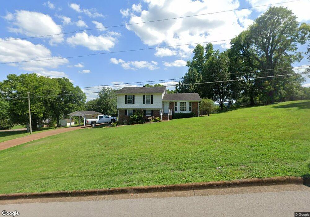
2017 Lynne Rd Pulaski, TN 38478
Estimated Value: $198,382 - $293,000
Studio
3
Baths
1,286
Sq Ft
$201/Sq Ft
Est. Value
About This Home
This home is located at 2017 Lynne Rd, Pulaski, TN 38478 and is currently estimated at $257,846, approximately $200 per square foot. 2017 Lynne Rd is a home located in Giles County with nearby schools including Pulaski Elementary School, Southside Elementary School, and Bridgeforth Middle School.
Ownership History
Date
Name
Owned For
Owner Type
Purchase Details
Closed on
Aug 27, 2021
Sold by
Gordon Ken and Gordon Shelia
Bought by
Gordon Shelia and The Gordon Income Only Trust
Current Estimated Value
Home Financials for this Owner
Home Financials are based on the most recent Mortgage that was taken out on this home.
Original Mortgage
$82,500
Outstanding Balance
$61,270
Interest Rate
2.1%
Mortgage Type
New Conventional
Estimated Equity
$196,576
Purchase Details
Closed on
Jul 14, 2020
Sold by
Gordon Ken and Gordon Shellia
Bought by
Gordoh Shelia and Gordon Income Only Trust
Purchase Details
Closed on
May 3, 2004
Sold by
Bomar Jeannette C
Bought by
Gordon Ken
Purchase Details
Closed on
Sep 17, 1998
Bought by
Bomar Jeannette C %Star Bank Mortgage
Purchase Details
Closed on
Oct 30, 1995
Sold by
Barr Birdie Williamson
Bought by
Young William M
Purchase Details
Closed on
Mar 30, 1994
Sold by
Armstrong Dewey T
Bought by
Kelly Joseph Kim
Purchase Details
Closed on
Feb 9, 1990
Bought by
Armstrong Dewey T
Purchase Details
Closed on
Apr 6, 1987
Bought by
Gates Douglas S and Gates Darlene
Create a Home Valuation Report for This Property
The Home Valuation Report is an in-depth analysis detailing your home's value as well as a comparison with similar homes in the area
Home Values in the Area
Average Home Value in this Area
Purchase History
| Date | Buyer | Sale Price | Title Company |
|---|---|---|---|
| Gordon Shelia | -- | None Available | |
| Gordon Ken | -- | Amrock Inc | |
| Gordoh Shelia | -- | None Available | |
| Gordon Ken | $98,500 | -- | |
| Bomar Jeannette C %Star Bank Mortgage | $85,000 | -- | |
| Young William M | $85,000 | -- | |
| Kelly Joseph Kim | $73,000 | -- | |
| Armstrong Dewey T | $70,000 | -- | |
| Gates Douglas S | -- | -- |
Source: Public Records
Mortgage History
| Date | Status | Borrower | Loan Amount |
|---|---|---|---|
| Open | Gordon Ken | $82,500 |
Source: Public Records
Tax History
| Year | Tax Paid | Tax Assessment Tax Assessment Total Assessment is a certain percentage of the fair market value that is determined by local assessors to be the total taxable value of land and additions on the property. | Land | Improvement |
|---|---|---|---|---|
| 2025 | $1,254 | $45,975 | $7,100 | $38,875 |
| 2024 | $1,107 | $45,975 | $7,100 | $38,875 |
| 2023 | $1,107 | $45,975 | $7,100 | $38,875 |
| 2022 | $999 | $41,500 | $7,100 | $34,400 |
| 2021 | $906 | $26,775 | $4,850 | $21,925 |
| 2020 | $906 | $26,775 | $4,850 | $21,925 |
| 2019 | $756 | $26,775 | $4,850 | $21,925 |
| 2018 | $906 | $26,775 | $4,850 | $21,925 |
| 2017 | $906 | $26,775 | $4,850 | $21,925 |
| 2016 | $967 | $27,300 | $4,875 | $22,425 |
| 2015 | $912 | $27,300 | $4,875 | $22,425 |
| 2014 | $912 | $27,300 | $0 | $0 |
Source: Public Records
Map
Nearby Homes
- 0 Campbellsville Rd Unit RTC3168340
- 120 Sunset Dr
- 102 Sunset Dr
- 1 Chicken Creek Rd
- 187 Garland Dr
- 1336 Charlotte Ct
- 846 Red Bud Ln
- 1011 Vales Mill Rd
- 411 Mountain View Dr
- 226 Rose St
- 402 Fort Hill Dr
- 420 Fort Hill Dr
- 1307 Carroll Dr
- 0 Jackson Dr Unit RTC3067618
- 2605 Columbia Hwy
- 300 Morris St
- 2787 Columbia Hwy
- 0 N 3rd St
- 2220 Cherry Dr
- 1811 Columbia Hwy
- 204 Robin Hood Rd
- 2011 Lynne Rd
- 212 Robin Hood Rd
- 116 Linda St
- 115 Linda St
- 220 Robin Hood Rd
- 119 Scott St
- 2007 Lynne Rd
- 203 Robin Hood Rd
- 409 Westgate Dr
- 110 Linda St
- 228 Robin Hood Rd
- 209 Robin Hood Rd
- 111 Linda St
- 120 Scott St
- 407 Westgate Dr
- 115 Scott St
- 215 Robin Hood Rd
- 221 Robin Hood Rd
- 405 Westgate Dr
Your Personal Tour Guide
Ask me questions while you tour the home.