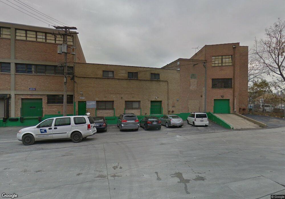
2017 N Mendell St Chicago, IL 60614
Bucktown Neighborhood
--
Bed
--
Bath
--
Sq Ft
1.12
Acres
About This Home
This home is located at 2017 N Mendell St, Chicago, IL 60614. 2017 N Mendell St is a home located in Cook County with nearby schools including Pulaski Intl School of Chicago, Wells Community Academy High School, and CICS - Bucktown Campus.
Ownership History
Date
Name
Owned For
Owner Type
Purchase Details
Closed on
Mar 20, 2015
Sold by
2017 Mendell Llc
Bought by
2017 Mendell Tmg Llc
Home Financials for this Owner
Home Financials are based on the most recent Mortgage that was taken out on this home.
Original Mortgage
$2,100,000
Interest Rate
3.73%
Mortgage Type
Commercial
Purchase Details
Closed on
Mar 9, 2013
Sold by
Stawski Stanley O and Stawski Barbara
Bought by
2017 Mendel Llc
Create a Home Valuation Report for This Property
The Home Valuation Report is an in-depth analysis detailing your home's value as well as a comparison with similar homes in the area
Home Values in the Area
Average Home Value in this Area
Purchase History
| Date | Buyer | Sale Price | Title Company |
|---|---|---|---|
| 2017 Mendell Tmg Llc | $2,500,000 | Saturn Title Llc | |
| 2017 Mendel Llc | -- | None Available |
Source: Public Records
Mortgage History
| Date | Status | Borrower | Loan Amount |
|---|---|---|---|
| Closed | 2017 Mendell Tmg Llc | $2,100,000 |
Source: Public Records
Tax History Compared to Growth
Tax History
| Year | Tax Paid | Tax Assessment Tax Assessment Total Assessment is a certain percentage of the fair market value that is determined by local assessors to be the total taxable value of land and additions on the property. | Land | Improvement |
|---|---|---|---|---|
| 2024 | $233,716 | $1,105,550 | $231,594 | $873,956 |
| 2023 | $239,043 | $1,104,396 | $169,678 | $934,718 |
| 2022 | $239,043 | $1,162,198 | $284,888 | $877,310 |
| 2021 | $233,707 | $1,162,195 | $284,887 | $877,308 |
| 2020 | $142,842 | $641,212 | $284,887 | $356,325 |
| 2019 | $151,401 | $753,568 | $284,887 | $468,681 |
| 2018 | $34,009 | $172,166 | $94,962 | $77,204 |
| 2017 | $29,668 | $137,820 | $80,718 | $57,102 |
| 2016 | $73,353 | $366,235 | $80,718 | $285,517 |
| 2015 | $67,111 | $366,235 | $80,718 | $285,517 |
| 2014 | $52,425 | $282,558 | $80,718 | $201,840 |
| 2013 | $51,390 | $282,558 | $80,718 | $201,840 |
Source: Public Records
Map
Nearby Homes
- 1728 N Clybourn Ave
- 1845 N Marshfield Ave
- 2243 N Greenview Ave Unit D
- 2124 N Lakewood Ave
- 1916 N Hermitage Ave
- 2304 N Greenview Ave
- 1242 W Dickens Ave
- 1312 W Webster Ave Unit 3W
- 2307 N Greenview Ave Unit 3
- 1408 W Belden Ave Unit 1
- 2300 N Southport Ave Unit 3C
- 1809 W Armitage Ave
- 2327 N Bosworth Ave Unit 2327
- 1938 N Wood St
- 2047 N Honore St
- 2051 N Magnolia Ave
- 1323 W Belden Ave Unit E1
- 1740 N Marshfield Ave Unit D29
- 1740 N Marshfield Ave Unit E30
- 1809 W Cortland St
- 2001 N Elston Ave
- 1529 W Armitage Ave
- 1538 W Homer St
- 1952 N Elston Ave Unit 1
- 1952 N Elston Ave Unit 2
- 1952 N Elston Ave
- 1948 N Elston Ave Unit 1SW
- 2332-34 N Elston Ave
- 1525 W Homer St
- 2040 N Elston Ave
- 2036 N Elston Ave
- 1918 N Mendell St
- 1918 N Mendell St Unit 2
- 1427 W Dickens Ave
- 2015 Dominick St
- 9999 N Ashland Ave
- 1941 N Elston Ave
- 1500 W Cortland St
- 1907 N Mendell St
- 2222 N Elston Ave