2019 Brookside Dr Albert Lea, MN 56007
Estimated Value: $420,000 - $436,479
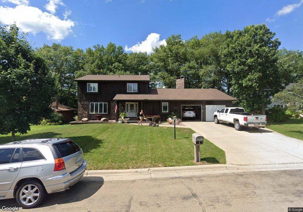
About This Home
This home is located at 2019 Brookside Dr, Albert Lea, MN 56007 and is currently estimated at $427,870, approximately $104 per square foot. 2019 Brookside Dr is a home located in Freeborn County with nearby schools including Lakeview Elementary School, Southwest Middle School, and Albert Lea Senior High School.
Ownership History
We collect this data history from publicly available records. To have your information removed, we recommend requesting removal directly through your county’s website.
Purchase Details
Purchase Details
Home Values in the Area
Average Home Value in this Area
Purchase History
We collect this data history from publicly available records. To have your information removed, we recommend requesting removal directly through your county’s website.
| Date | Buyer | Sale Price | Title Company |
|---|---|---|---|
| $100,000 | -- | ||
| -- | -- |
Mortgage History
We collect this data history from publicly available records. To have your information removed, we recommend requesting removal directly through your county’s website.
| Date | Status | Borrower | Loan Amount |
|---|---|---|---|
| Closed | $207,000 | ||
| Closed | $208,000 |
Tax History
We collect this data history from publicly available records. To have your information removed, we recommend requesting removal directly through your county’s website.
| Year | Tax Paid | Tax Assessment Tax Assessment Total Assessment is a certain percentage of the fair market value that is determined by local assessors to be the total taxable value of land and additions on the property. | Land | Improvement |
|---|---|---|---|---|
| 2026 | $6,824 | $440,200 | $79,500 | $360,700 |
| 2025 | $6,606 | $440,200 | $79,500 | $360,700 |
| 2024 | $6,542 | $419,300 | $79,500 | $339,800 |
| 2023 | $5,512 | $419,300 | $79,500 | $339,800 |
| 2022 | $5,792 | $347,900 | $63,600 | $284,300 |
| 2021 | $5,732 | $320,500 | $63,600 | $256,900 |
| 2020 | $5,454 | $300,000 | $63,600 | $236,400 |
| 2019 | $5,050 | $279,500 | $63,600 | $215,900 |
| 2018 | $4,692 | $0 | $0 | $0 |
| 2016 | $2,494 | $0 | $0 | $0 |
| 2015 | $4,000 | $0 | $0 | $0 |
| 2014 | $4,052 | $0 | $0 | $0 |
| 2012 | $4,194 | $0 | $0 | $0 |
Map
- 1918 Bayview Dr
- 1902 Brookside Dr
- 1821 Brookside Cir
- 1845 Greenwood Dr
- 1825 Bayview Dr
- 1005 W Richway Dr
- 417 Meredith Rd
- 419 Ridge Rd
- 1933 Wilby Rd
- 406 Ridge Cir
- 437 Crescent Dr
- 311 Meredith Rd
- 406 Robin Rd
- 314 Garden Rd
- 314 Meredith Rd
- 1309 Oriole Dr
- 307 Channel Rd
- 1401 Martin Rd
- 1709 Keystone Dr
- 702 Glenview Dr
- 2023 Brookside Dr
- 2015 Brookside Dr
- 2011 Brookside Dr
- 2020 Brookside Dr
- 2025 Brookside Dr
- 2016 Brookside Dr
- 2010 Brookside Dr
- 2018 Bayview Dr
- 2007 Brookside Dr
- 2009 Bayview Dr
- 2014 Bayview Dr
- 2002 Brookside Dr
- 2031 Greenwood Dr
- 2037 Greenwood Dr
- 2025 Greenwood Dr
- 2005 Bayview Dr
- 2010 Bayview Dr
- 2003 Brookside Dr
- 1922 Brookside Dr
- 2017 Greenwood Dr
Ask me questions while you tour the home.