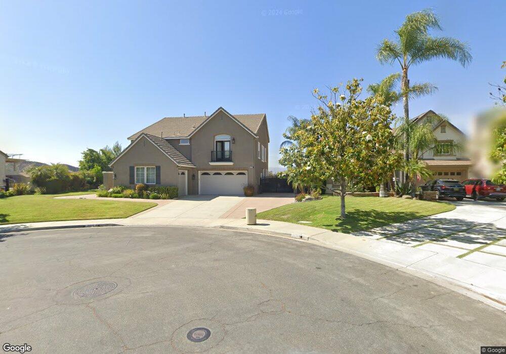
2019 Erin Ct Simi Valley, CA 93065
West Simi Valley NeighborhoodEstimated Value: $1,250,953 - $1,415,000
3
Beds
3
Baths
3,483
Sq Ft
$378/Sq Ft
Est. Value
About This Home
This home is located at 2019 Erin Ct, Simi Valley, CA 93065 and is currently estimated at $1,315,738, approximately $377 per square foot. 2019 Erin Ct is a home located in Ventura County with nearby schools including Crestview Elementary School, Hillside Middle School, and Royal High School.
Ownership History
Date
Name
Owned For
Owner Type
Purchase Details
Closed on
Jan 15, 2002
Sold by
South Hills 107 Llc
Bought by
Jessing Ronald Sean and Jessing Dawn Christine
Current Estimated Value
Home Financials for this Owner
Home Financials are based on the most recent Mortgage that was taken out on this home.
Original Mortgage
$79,250
Interest Rate
6.59%
Mortgage Type
Stand Alone Second
Create a Home Valuation Report for This Property
The Home Valuation Report is an in-depth analysis detailing your home's value as well as a comparison with similar homes in the area
Home Values in the Area
Average Home Value in this Area
Purchase History
| Date | Buyer | Sale Price | Title Company |
|---|---|---|---|
| Jessing Ronald Sean | $532,500 | First American Title Ins Co |
Source: Public Records
Mortgage History
| Date | Status | Borrower | Loan Amount |
|---|---|---|---|
| Closed | Jessing Ronald Sean | $79,250 | |
| Open | Jessing Ronald Sean | $400,000 |
Source: Public Records
Tax History
| Year | Tax Paid | Tax Assessment Tax Assessment Total Assessment is a certain percentage of the fair market value that is determined by local assessors to be the total taxable value of land and additions on the property. | Land | Improvement |
|---|---|---|---|---|
| 2025 | $9,282 | $792,551 | $314,654 | $477,897 |
| 2024 | $9,282 | $777,011 | $308,484 | $468,527 |
| 2023 | $8,731 | $761,776 | $302,435 | $459,341 |
| 2022 | $8,721 | $746,840 | $296,505 | $450,335 |
| 2021 | $8,681 | $732,197 | $290,692 | $441,505 |
| 2020 | $8,517 | $724,691 | $287,712 | $436,979 |
| 2019 | $8,133 | $710,482 | $282,071 | $428,411 |
| 2018 | $8,080 | $696,552 | $276,541 | $420,011 |
| 2017 | $7,912 | $682,895 | $271,119 | $411,776 |
| 2016 | $7,563 | $669,505 | $265,803 | $403,702 |
| 2015 | $7,416 | $659,450 | $261,811 | $397,639 |
| 2014 | $7,326 | $646,534 | $256,684 | $389,850 |
Source: Public Records
Map
Nearby Homes
- 2098 Covington Ave
- 2044 Covington Ave
- 2339 Rudolph Dr
- 1995 Covington Ave
- 951 Vallejo Ave
- 969 Roldan Ave
- 1724 Sunnydale Ave
- 221 Hazelridge Ct
- 1917 Fitzgerald Rd
- 766 Wishard Ave
- 604 Hudspeth St
- 1091 Vallejo Ave
- 977 Gibson Ave
- 1625 Rambling Rd
- 1135 Donner Ave
- 896 Moffatt Cir
- 2056 Casual Ct
- 2490 Invar Ct
- 2025 Royal Ave
- 1290 Lawrence Cir
- 2031 Erin Ct
- 2007 Erin Ct
- 590 Peter Place
- 2024 Arielle Ln
- 2043 Erin Ct
- 2042 Arielle Ln
- 2024 Erin Ct
- 557 Peter Place
- 659 Asia Ct
- 2009 Arielle Ln
- 2056 Arielle Ln
- 1997 Arielle Ln
- 1975 Rheinland Ct
- 548 Peter Place
- 658 Asia Ct
- 675 Asia Ct
- 1990 Rheinland Ct
- 1959 Rheinland Ct
- 534 Peter Place
- 607 Covington Ave
Your Personal Tour Guide
Ask me questions while you tour the home.