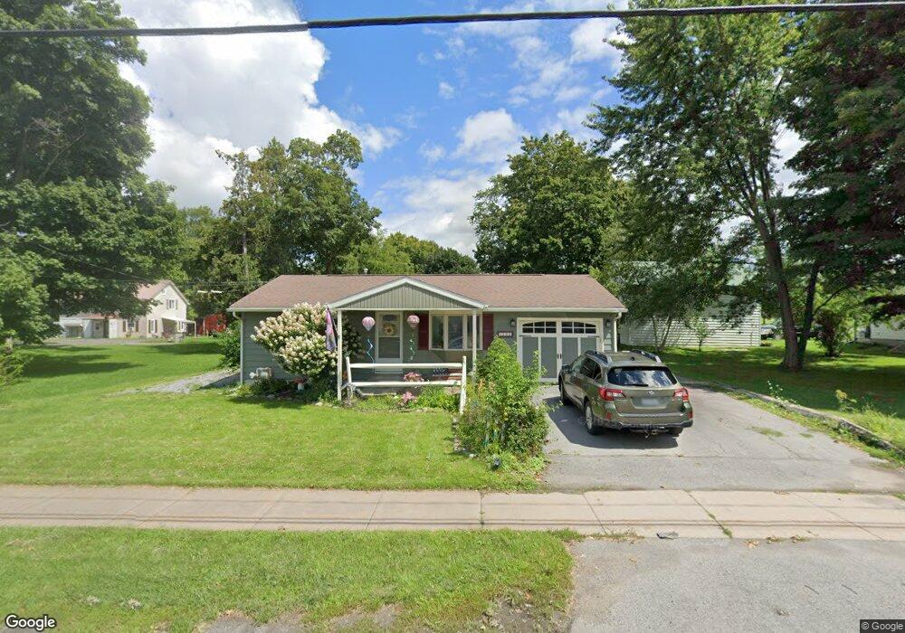
202 N Court St Canastota, NY 13032
Estimated Value: $175,000 - $216,000
2
Beds
1
Bath
775
Sq Ft
$253/Sq Ft
Est. Value
About This Home
This home is located at 202 N Court St, Canastota, NY 13032 and is currently estimated at $196,040, approximately $252 per square foot. 202 N Court St is a home with nearby schools including Peterboro Street Elementary School, South Side Elementary School, and Roberts Street Middle School.
Ownership History
Date
Name
Owned For
Owner Type
Purchase Details
Closed on
Apr 20, 2022
Sold by
Seymour Lori B
Bought by
Fountain Brooke
Current Estimated Value
Purchase Details
Closed on
Feb 13, 2009
Sold by
Pangborn Robert F
Bought by
Brockway Lori B
Home Financials for this Owner
Home Financials are based on the most recent Mortgage that was taken out on this home.
Original Mortgage
$25,000
Interest Rate
5.26%
Mortgage Type
Purchase Money Mortgage
Purchase Details
Closed on
Jul 29, 1996
Sold by
Dale Barbara C
Bought by
Fangborn Robert F
Create a Home Valuation Report for This Property
The Home Valuation Report is an in-depth analysis detailing your home's value as well as a comparison with similar homes in the area
Home Values in the Area
Average Home Value in this Area
Purchase History
| Date | Buyer | Sale Price | Title Company |
|---|---|---|---|
| Fountain Brooke | $162,500 | Vindigni & Betro & Getman Pllc | |
| Brockway Lori B | $70,000 | Richard G Vindigni | |
| Fangborn Robert F | $63,000 | -- |
Source: Public Records
Mortgage History
| Date | Status | Borrower | Loan Amount |
|---|---|---|---|
| Previous Owner | Brockway Lori B | $25,000 |
Source: Public Records
Tax History
| Year | Tax Paid | Tax Assessment Tax Assessment Total Assessment is a certain percentage of the fair market value that is determined by local assessors to be the total taxable value of land and additions on the property. | Land | Improvement |
|---|---|---|---|---|
| 2024 | $3,727 | $92,400 | $14,800 | $77,600 |
| 2023 | $4,171 | $92,400 | $14,800 | $77,600 |
| 2022 | $3,378 | $77,400 | $14,800 | $62,600 |
| 2021 | $3,383 | $77,400 | $14,800 | $62,600 |
| 2020 | $2,374 | $77,400 | $14,800 | $62,600 |
| 2019 | $2,193 | $76,200 | $14,800 | $61,400 |
| 2018 | $2,193 | $76,200 | $14,800 | $61,400 |
| 2017 | $2,193 | $76,200 | $14,800 | $61,400 |
| 2016 | $2,186 | $76,200 | $14,800 | $61,400 |
| 2015 | -- | $76,200 | $14,800 | $61,400 |
| 2014 | -- | $76,200 | $14,800 | $61,400 |
Source: Public Records
Map
Nearby Homes
- 113 Genesee St
- 4190 Churchill Ln
- 322 Canal Rd
- 4036 Mary Lynn Dr
- 3995 Douglas Heights Dr
- 1266 Genesee St
- 341 Roberts St
- 315 1st St
- 214 Driftwood Dr
- 1012 Fitch St
- 4399 Furnace Hill Rd
- 315 Roberts St
- 313 Roberts St
- 462 Foxwood Terrace
- 650 Patio Circle Dr
- 3517 Seneca Turnpike
- 154 Hunt Valley Rd
- 102 Mechanic St
- 1710 Schoolheimer Rd
- 607 Birchwood Dr
