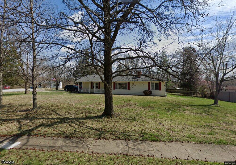
202 Robin Hill Ln Ballwin, MO 63021
Estimated Value: $279,395 - $323,000
3
Beds
2
Baths
988
Sq Ft
$301/Sq Ft
Est. Value
About This Home
This home is located at 202 Robin Hill Ln, Ballwin, MO 63021 and is currently estimated at $297,349, approximately $300 per square foot. 202 Robin Hill Ln is a home located in St. Louis County with nearby schools including Ballwin Elementary School, Selvidge Middle School, and Marquette Sr. High School.
Ownership History
Date
Name
Owned For
Owner Type
Purchase Details
Closed on
Oct 26, 1999
Sold by
Steuber Daniel B and Steuber Laura A
Bought by
Stennes Mark R and Stennes Jacqueline M
Current Estimated Value
Home Financials for this Owner
Home Financials are based on the most recent Mortgage that was taken out on this home.
Original Mortgage
$92,400
Outstanding Balance
$30,401
Interest Rate
9.25%
Estimated Equity
$266,948
Create a Home Valuation Report for This Property
The Home Valuation Report is an in-depth analysis detailing your home's value as well as a comparison with similar homes in the area
Home Values in the Area
Average Home Value in this Area
Purchase History
| Date | Buyer | Sale Price | Title Company |
|---|---|---|---|
| Stennes Mark R | $115,500 | -- |
Source: Public Records
Mortgage History
| Date | Status | Borrower | Loan Amount |
|---|---|---|---|
| Open | Stennes Mark R | $92,400 |
Source: Public Records
Tax History
| Year | Tax Paid | Tax Assessment Tax Assessment Total Assessment is a certain percentage of the fair market value that is determined by local assessors to be the total taxable value of land and additions on the property. | Land | Improvement |
|---|---|---|---|---|
| 2025 | $3,156 | $50,460 | $26,200 | $24,260 |
| 2024 | $3,156 | $44,990 | $21,830 | $23,160 |
| 2023 | $3,154 | $44,990 | $21,830 | $23,160 |
| 2022 | $2,822 | $37,350 | $21,830 | $15,520 |
| 2021 | $2,801 | $37,350 | $21,830 | $15,520 |
| 2020 | $2,896 | $36,830 | $17,960 | $18,870 |
| 2019 | $2,908 | $36,830 | $17,960 | $18,870 |
| 2018 | $2,549 | $30,400 | $14,140 | $16,260 |
| 2017 | $2,489 | $30,400 | $14,140 | $16,260 |
| 2016 | $2,241 | $26,290 | $10,010 | $16,280 |
| 2015 | $2,196 | $26,290 | $10,010 | $16,280 |
| 2014 | $2,268 | $26,500 | $6,780 | $19,720 |
Source: Public Records
Map
Nearby Homes
- 429 Fairview Ct
- 275 Essen Ct Unit TBB
- 212 Lakeside Dr
- 313 Saint Lawrence Dr
- 312 Ballwin Ave
- 401 Hillcrest Blvd
- 408 Saint Lawrence Dr
- 3 Chappel Ct
- 756 Alexander Mark Way
- 332 Remington Way Dr
- 247 Ramsey Ln
- 729 Tuscan Valley Ct
- 798 Canary Dr
- 521 Kehrs Mill Rd
- 112 Shirley Ln
- 548 Windsor Mill Dr
- 604 Nandale Ln
- 114 Lea Meadows Dr
- 899 Oklahoma Ave
- 203 Morewood Dr
- 204 Robin Hill Ln
- 132 Warbler Ct
- 200 Robin Hill Ln
- 201 Robin Hill Ln
- 133 Sharon Place
- 130 Warbler Ct
- 131 Sharon Place
- 206 Robin Hill Ln
- 144 Mockingbird Ln
- 131 Warbler Ct
- 118 Robin Hill Ln
- 203 Robin Hill Ln
- 329 Fairview Ct
- 333 Fairview Ct
- 325 Fairview Ct
- 132 Sharon Place
- 337 Fairview Ct
- 137 Sharon Place
- 146 Mockingbird Ln
- 401 Fairview Ct
Your Personal Tour Guide
Ask me questions while you tour the home.