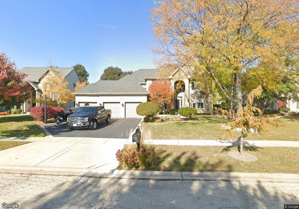
2020 Brindlewood Ln Algonquin, IL 60102
Estimated Value: $531,018 - $583,000
4
Beds
3
Baths
2,944
Sq Ft
$188/Sq Ft
Est. Value
About This Home
This home is located at 2020 Brindlewood Ln, Algonquin, IL 60102 and is currently estimated at $554,755, approximately $188 per square foot. 2020 Brindlewood Ln is a home located in McHenry County with nearby schools including Westfield Community School, Kenneth E Neubert Elementary School, and United Junior High School.
Ownership History
Date
Name
Owned For
Owner Type
Purchase Details
Closed on
Jun 25, 2021
Sold by
Sloma Robert A and Sloma Kimberly A
Bought by
Sloma Devin R and Virlee Alexis H
Current Estimated Value
Home Financials for this Owner
Home Financials are based on the most recent Mortgage that was taken out on this home.
Original Mortgage
$355,500
Outstanding Balance
$322,561
Interest Rate
2.9%
Mortgage Type
New Conventional
Estimated Equity
$232,194
Purchase Details
Closed on
Dec 13, 1995
Sold by
Legacy Fine Custom Homes
Bought by
Sloma Robert A and Sloma Kimberly A
Create a Home Valuation Report for This Property
The Home Valuation Report is an in-depth analysis detailing your home's value as well as a comparison with similar homes in the area
Home Values in the Area
Average Home Value in this Area
Purchase History
| Date | Buyer | Sale Price | Title Company |
|---|---|---|---|
| Sloma Devin R | $395,000 | Clark Courtney | |
| Sloma Robert A | $277,000 | First American Title |
Source: Public Records
Mortgage History
| Date | Status | Borrower | Loan Amount |
|---|---|---|---|
| Open | Sloma Devin R | $355,500 | |
| Closed | Sloma Robert A | $24,000 |
Source: Public Records
Tax History Compared to Growth
Tax History
| Year | Tax Paid | Tax Assessment Tax Assessment Total Assessment is a certain percentage of the fair market value that is determined by local assessors to be the total taxable value of land and additions on the property. | Land | Improvement |
|---|---|---|---|---|
| 2024 | $12,820 | $171,886 | $33,569 | $138,317 |
| 2023 | $12,199 | $153,730 | $30,023 | $123,707 |
| 2022 | $11,192 | $136,500 | $36,777 | $99,723 |
| 2021 | $10,751 | $127,166 | $34,262 | $92,904 |
| 2020 | $10,476 | $122,664 | $33,049 | $89,615 |
| 2019 | $10,230 | $117,404 | $31,632 | $85,772 |
| 2018 | $9,766 | $108,456 | $29,221 | $79,235 |
| 2017 | $9,577 | $102,172 | $27,528 | $74,644 |
| 2016 | $9,446 | $95,828 | $25,819 | $70,009 |
| 2013 | -- | $91,142 | $24,085 | $67,057 |
Source: Public Records
Map
Nearby Homes
- 741 Regal Ln
- 2235 Dawson Ln
- 2161 Burnham Ct
- 1820 Crofton Dr
- 2248 Dawson Ln Unit 272
- 661 Majestic Dr
- 000 County Line Rd
- 2043 Peach Tree Ln Unit 4122
- 2101 Peach Tree Ln Unit 4094
- 1971 Peach Tree Ln
- 700 Fairfield Ln
- 1900 Waverly Ln
- 30 Arbordale Ct Unit 4284
- 305 Buckingham Dr
- 1 N Hubbard St
- SWC Talaga and Algonquin Rd
- 2601 Harnish Dr
- 2611 Harnish Dr
- 2060 Dorchester Ave
- DOVER Plan at Grand Reserve - Algonquin
- 2010 Brindlewood Ln
- 2030 Brindlewood Ln
- 2013 Tunbridge Trail
- 2023 Tunbridge Trail
- 2000 Brindlewood Ln
- 2040 Brindlewood Ln
- 2033 Tunbridge Trail
- 2003 Tunbridge Trail
- 2031 Brindlewood Ln
- 2011 Brindlewood Ln
- 2043 Tunbridge Trail
- 2041 Brindlewood Ln
- 2050 Brindlewood Ln
- 2001 Brindlewood Ln
- 2051 Brindlewood Ln
- 2053 Tunbridge Trail
- 2022 Tunbridge Trail
- 2012 Tunbridge Trail
- 2 Brindlewood Ct
- 2060 Brindlewood Ln