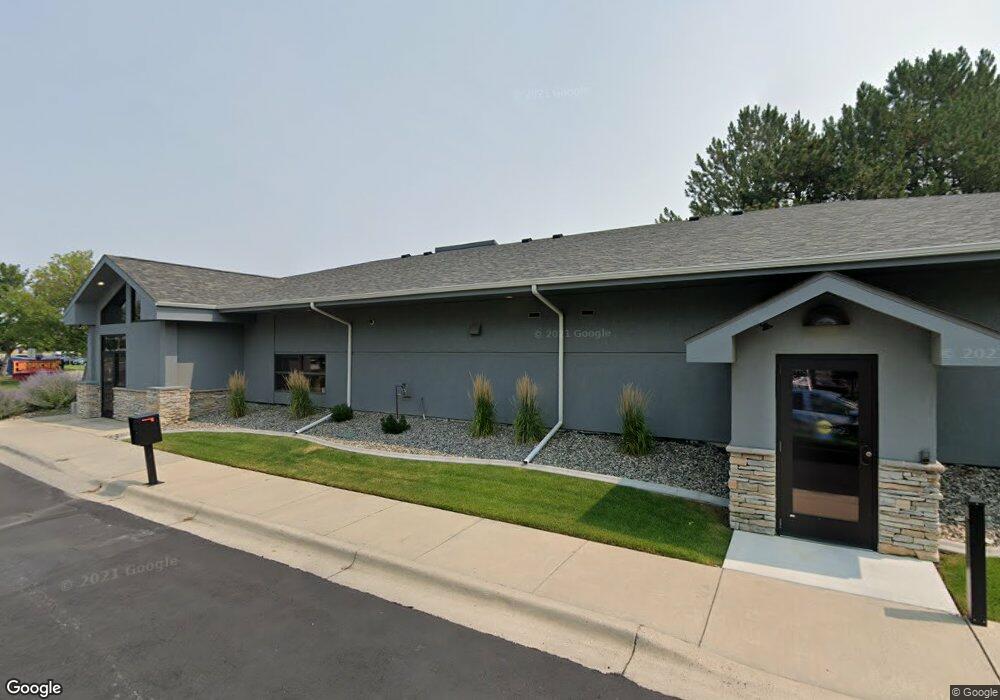
2021 Overland Ave Billings, MT 59102
West End Neighborhood
--
Bed
--
Bath
6,260
Sq Ft
1.31
Acres
About This Home
This home is located at 2021 Overland Ave, Billings, MT 59102. 2021 Overland Ave is a home located in Yellowstone County with nearby schools including Elysian Elementary School, Elysian School, and Billings West High School.
Ownership History
Date
Name
Owned For
Owner Type
Purchase Details
Closed on
Mar 31, 2016
Sold by
Ehli Holdings Llc
Bought by
Billings Association Of Realtors Inc
Home Financials for this Owner
Home Financials are based on the most recent Mortgage that was taken out on this home.
Original Mortgage
$800,000
Outstanding Balance
$634,716
Interest Rate
3.64%
Mortgage Type
Commercial
Purchase Details
Closed on
Mar 12, 2007
Sold by
Thompson Sharon and Ehli Mark A
Bought by
Ehli Holdings Llc
Purchase Details
Closed on
Mar 21, 2005
Sold by
Tam Edward K and Tam Lily
Bought by
Ehli Pius
Home Financials for this Owner
Home Financials are based on the most recent Mortgage that was taken out on this home.
Original Mortgage
$1,200,000
Interest Rate
5.61%
Mortgage Type
Commercial
Create a Home Valuation Report for This Property
The Home Valuation Report is an in-depth analysis detailing your home's value as well as a comparison with similar homes in the area
Home Values in the Area
Average Home Value in this Area
Purchase History
| Date | Buyer | Sale Price | Title Company |
|---|---|---|---|
| Billings Association Of Realtors Inc | -- | American Title & Escrow | |
| Ehli Holdings Llc | -- | None Available | |
| Ehli Pius | -- | None Available |
Source: Public Records
Mortgage History
| Date | Status | Borrower | Loan Amount |
|---|---|---|---|
| Open | Billings Association Of Realtors Inc | $800,000 | |
| Previous Owner | Ehli Pius | $1,200,000 |
Source: Public Records
Tax History Compared to Growth
Tax History
| Year | Tax Paid | Tax Assessment Tax Assessment Total Assessment is a certain percentage of the fair market value that is determined by local assessors to be the total taxable value of land and additions on the property. | Land | Improvement |
|---|---|---|---|---|
| 2025 | $12,787 | $978,400 | $539,049 | $439,351 |
| 2024 | $12,787 | $953,000 | $414,603 | $538,397 |
| 2023 | $12,727 | $953,000 | $414,603 | $538,397 |
| 2022 | $10,241 | $918,400 | $0 | $0 |
| 2021 | $12,414 | $918,400 | $0 | $0 |
| 2020 | $11,855 | $843,500 | $0 | $0 |
| 2019 | $11,229 | $843,500 | $0 | $0 |
| 2018 | $11,338 | $830,900 | $0 | $0 |
| 2017 | $8,815 | $830,900 | $0 | $0 |
| 2016 | $12,049 | $962,300 | $0 | $0 |
| 2015 | $11,802 | $962,300 | $0 | $0 |
| 2014 | $10,118 | $601,938 | $0 | $0 |
Source: Public Records
Map
Nearby Homes
- 669 S 22nd St W
- 2225 Rosebud Dr
- 2014 George St
- 2016 Monad Rd
- 240 Birchwood Dr
- 6114 Northstead Ave
- 6152 Northstead Ave
- 19 Patton Ave
- 6170 Elysian Rd Unit 103-203
- 14 Bonanza Dr
- 1884 St Peter Ln
- 126 Ardmore Dr
- 46 Vista Dr
- 1 Bonanza Dr
- 2 Mcbride St
- 43 Roundup Dr
- 2150 Eldorado Dr
- 12 Macarthur Ave
- 102 S Santa fe Dr
- 1686 Saint George Blvd
- 2220 Grant Rd
- 2060 Overland Ave
- 1911 King
- 2110 Overland Ave
- 2270 Grant Rd
- 712 Carbon St
- 712 Carbon Suite B St
- 0 King Park Dr
- 2280 Grant Rd
- 2290 Grant Rd
- 2170 Overland Ave
- 670 King Park Dr
- 691 S 22nd St W
- 689 S 22nd St W
- 679 S 22nd St W
- 1737 King Ave W
- 681 S 22nd St W
- 6012 S Frontage Rd
- 5950 S Frontage Rd
- 671 S 22nd St W