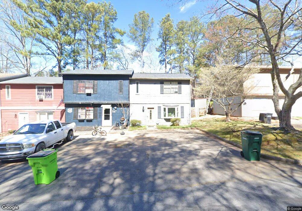
2022 Drennon Ave Austell, GA 30106
Estimated Value: $170,000 - $215,000
2
Beds
2
Baths
1,056
Sq Ft
$181/Sq Ft
Est. Value
About This Home
This home is located at 2022 Drennon Ave, Austell, GA 30106 and is currently estimated at $191,317, approximately $181 per square foot. 2022 Drennon Ave is a home located in Cobb County with nearby schools including Deerwood Elementary School, Clarkdale Elementary School, and Garrett Middle School.
Ownership History
Date
Name
Owned For
Owner Type
Purchase Details
Closed on
Feb 28, 2001
Sold by
Stone Barbara A
Bought by
Barnett Barbara
Current Estimated Value
Home Financials for this Owner
Home Financials are based on the most recent Mortgage that was taken out on this home.
Original Mortgage
$64,490
Outstanding Balance
$23,260
Interest Rate
7.06%
Mortgage Type
FHA
Estimated Equity
$168,057
Create a Home Valuation Report for This Property
The Home Valuation Report is an in-depth analysis detailing your home's value as well as a comparison with similar homes in the area
Home Values in the Area
Average Home Value in this Area
Purchase History
| Date | Buyer | Sale Price | Title Company |
|---|---|---|---|
| Barnett Barbara | $65,000 | -- |
Source: Public Records
Mortgage History
| Date | Status | Borrower | Loan Amount |
|---|---|---|---|
| Open | Barnett Barbara | $64,490 |
Source: Public Records
Tax History Compared to Growth
Tax History
| Year | Tax Paid | Tax Assessment Tax Assessment Total Assessment is a certain percentage of the fair market value that is determined by local assessors to be the total taxable value of land and additions on the property. | Land | Improvement |
|---|---|---|---|---|
| 2025 | $1,082 | $56,740 | $16,000 | $40,740 |
| 2024 | $1,083 | $56,740 | $16,000 | $40,740 |
| 2023 | $496 | $49,468 | $10,000 | $39,468 |
| 2022 | $310 | $21,008 | $4,000 | $17,008 |
| 2021 | $310 | $21,008 | $4,000 | $17,008 |
| 2020 | $281 | $19,688 | $4,000 | $15,688 |
| 2019 | $281 | $19,688 | $4,000 | $15,688 |
| 2018 | $281 | $19,688 | $4,000 | $15,688 |
| 2017 | $179 | $15,332 | $4,000 | $11,332 |
| 2016 | $180 | $15,332 | $4,000 | $11,332 |
| 2015 | $186 | $15,332 | $4,000 | $11,332 |
| 2014 | $188 | $15,332 | $0 | $0 |
Source: Public Records
Map
Nearby Homes
- 2024 Drennon Ave
- 2026 Drennon Ave
- 2028 Drennon Ave
- 2016 Drennon Ave
- 2018 Drennon Ave
- 2030 Drennon Ave
- 2014 Drennon Ave
- 2032 Drennon Ave
- 2012 Drennon Ave
- 2010 Drennon Ave
- 2010 Drennon Ave Unit 9999
- 2036 Drennon Ave
- 2038 Drennon Ave
- 4394 Stonecrest Dr
- 2040 Drennon Ave
- 2042 Drennon Ave
- 4386 Stonecrest Dr
- 1986 Drennon Ave
- 4390 Stonecrest Dr
- 4390 Stonecrest Dr Unit GAA0357