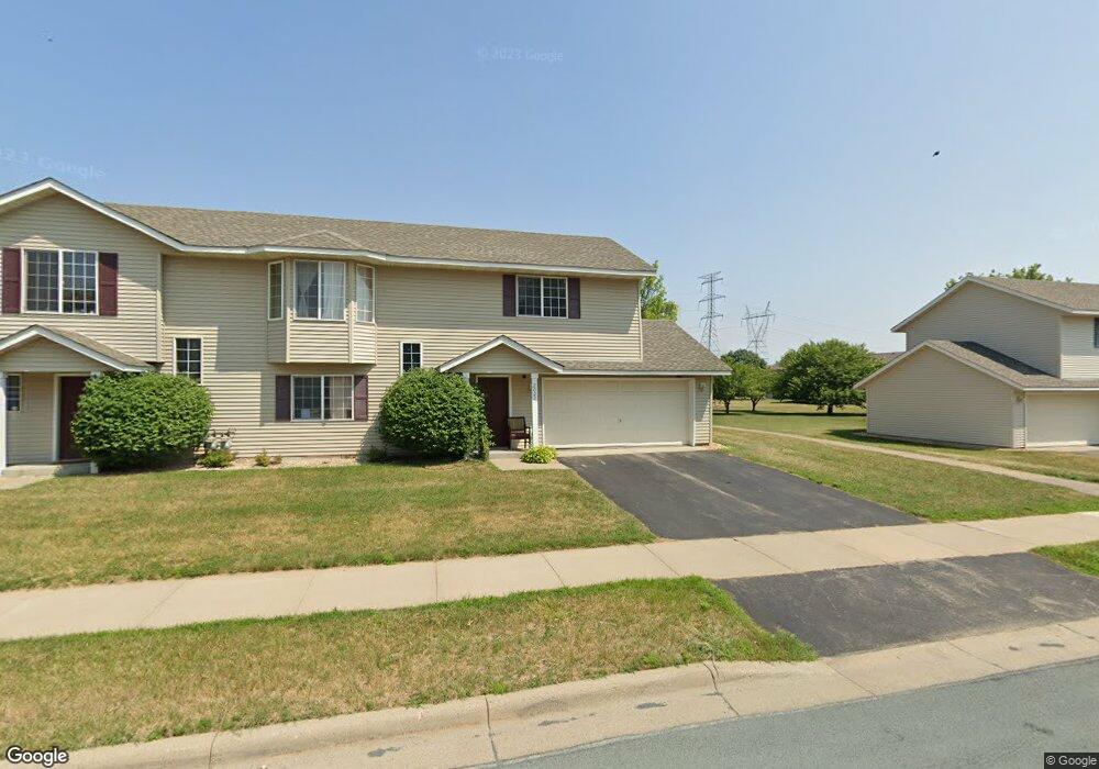
2023 Downing Ave Shakopee, MN 55379
Estimated Value: $265,000 - $273,000
3
Beds
2
Baths
1,550
Sq Ft
$174/Sq Ft
Est. Value
About This Home
This home is located at 2023 Downing Ave, Shakopee, MN 55379 and is currently estimated at $269,817, approximately $174 per square foot. 2023 Downing Ave is a home located in Scott County with nearby schools including Sun Path Elementary School, Shakopee West Middle School, and Shakopee Senior High School.
Ownership History
Date
Name
Owned For
Owner Type
Purchase Details
Closed on
Oct 15, 2020
Sold by
Hamilton Heather D and Hamilton Samuel L
Bought by
Cheam Neang and Cheam Tim Sovothan
Current Estimated Value
Home Financials for this Owner
Home Financials are based on the most recent Mortgage that was taken out on this home.
Original Mortgage
$227,659
Outstanding Balance
$202,121
Interest Rate
2.8%
Mortgage Type
New Conventional
Estimated Equity
$67,696
Purchase Details
Closed on
Aug 31, 2007
Sold by
Hansen William C and Hansen Kimberly S
Bought by
Hamilton Samuel L and Hamilton Heather D
Purchase Details
Closed on
Oct 18, 2001
Sold by
Steger David E
Bought by
Hansen William C and Hansen Kimberly S
Purchase Details
Closed on
Dec 21, 2000
Sold by
Mw Johnson Construction
Bought by
Steger Dave
Create a Home Valuation Report for This Property
The Home Valuation Report is an in-depth analysis detailing your home's value as well as a comparison with similar homes in the area
Home Values in the Area
Average Home Value in this Area
Purchase History
| Date | Buyer | Sale Price | Title Company |
|---|---|---|---|
| Cheam Neang | $234,700 | Gcs Title | |
| Hamilton Samuel L | $184,800 | -- | |
| Hansen William C | $154,900 | -- | |
| Steger Dave | $130,000 | -- |
Source: Public Records
Mortgage History
| Date | Status | Borrower | Loan Amount |
|---|---|---|---|
| Open | Cheam Neang | $227,659 |
Source: Public Records
Tax History
| Year | Tax Paid | Tax Assessment Tax Assessment Total Assessment is a certain percentage of the fair market value that is determined by local assessors to be the total taxable value of land and additions on the property. | Land | Improvement |
|---|---|---|---|---|
| 2025 | $2,330 | $252,100 | $83,800 | $168,300 |
| 2024 | $2,406 | $240,700 | $79,800 | $160,900 |
| 2023 | $2,464 | $237,000 | $78,300 | $158,700 |
| 2022 | $2,432 | $238,800 | $80,100 | $158,700 |
| 2021 | $2,116 | $205,900 | $62,700 | $143,200 |
| 2020 | $2,200 | $199,100 | $55,100 | $144,000 |
| 2019 | $2,032 | $184,800 | $47,200 | $137,600 |
| 2018 | $1,994 | $0 | $0 | $0 |
| 2016 | $1,856 | $0 | $0 | $0 |
| 2014 | -- | $0 | $0 | $0 |
Source: Public Records
Map
Nearby Homes
- 2066 Mockingbird Ave
- 1596 Chartreux Ave
- 2350 Downing Ave
- 1928 Vierling Dr E
- 2423 Tyrone Dr
- 2399 Tyrone Dr
- 2351 Tyrone Dr
- 2574 Vierling Dr E
- 2006 Tyrone Dr
- 2655 King Ave
- 2795 Downing Ave
- 2817 Downing Ave
- 1624 Philipp Way
- 1542 Philipp Way
- 1227 Elmwood Ave Unit 85
- 2542 Mathias Rd
- 2868 Trinity Dr
- 2871 Trinity Dr
- 1667 Countryside Dr
- 1705 Tyrone Dr
- 2035 Downing Ave
- 1999 Downing Ave
- 1994 Brittany Ct
- 2047 Downing Ave
- 2026 Downing Ave
- 2014 Downing Ave
- 2038 Downing Ave
- 1998 Brittany Ct
- 2002 Downing Ave
- 2059 Downing Ave
- 2050 Downing Ave
- 2002 Brittany Ct
- 2062 Downing Ave
- 2071 Downing Ave
- 2006 Brittany Ct
- 2084 Brittany Ct
- 1993 Downing Ave
- 1995 Brittany Ct
- 2028 Brittany Ct
- 2080 Brittany Ct
Your Personal Tour Guide
Ask me questions while you tour the home.