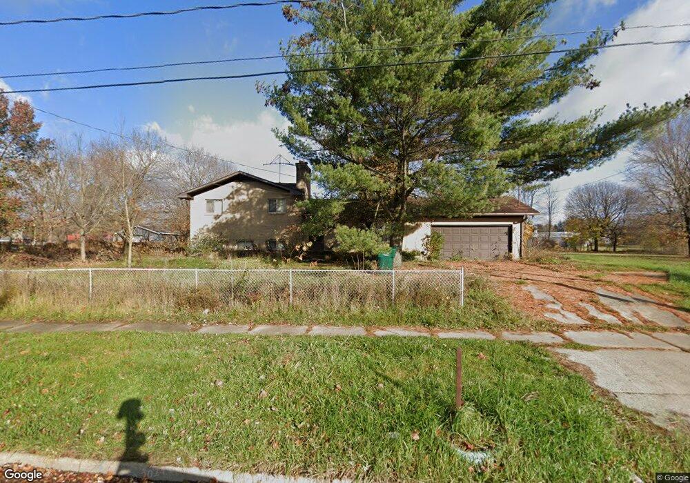
2024 W Miller Rd Lansing, MI 48911
Southern Lansing NeighborhoodEstimated Value: $159,000 - $209,582
--
Bed
1
Bath
2,318
Sq Ft
$80/Sq Ft
Est. Value
About This Home
This home is located at 2024 W Miller Rd, Lansing, MI 48911 and is currently estimated at $184,896, approximately $79 per square foot. 2024 W Miller Rd is a home located in Ingham County with nearby schools including Reo Elementary School, Attwood School, and Everett High School.
Ownership History
Date
Name
Owned For
Owner Type
Purchase Details
Closed on
Nov 30, 2021
Sold by
Phillips Donald A
Bought by
Phillips Donald A and Phillips Timothy
Current Estimated Value
Home Financials for this Owner
Home Financials are based on the most recent Mortgage that was taken out on this home.
Original Mortgage
$74,000
Outstanding Balance
$57,847
Interest Rate
2.33%
Mortgage Type
New Conventional
Estimated Equity
$127,049
Purchase Details
Closed on
Jun 6, 2011
Sold by
Phillips Donald A and Phillips Lourdes B
Bought by
Phillips Donald A and Phillips Lourdes B
Create a Home Valuation Report for This Property
The Home Valuation Report is an in-depth analysis detailing your home's value as well as a comparison with similar homes in the area
Home Values in the Area
Average Home Value in this Area
Purchase History
| Date | Buyer | Sale Price | Title Company |
|---|---|---|---|
| Phillips Donald A | -- | None Available | |
| Phillips Donald A | -- | None Available |
Source: Public Records
Mortgage History
| Date | Status | Borrower | Loan Amount |
|---|---|---|---|
| Open | Phillips Donald A | $74,000 |
Source: Public Records
Tax History Compared to Growth
Tax History
| Year | Tax Paid | Tax Assessment Tax Assessment Total Assessment is a certain percentage of the fair market value that is determined by local assessors to be the total taxable value of land and additions on the property. | Land | Improvement |
|---|---|---|---|---|
| 2025 | $4,745 | $90,500 | $21,500 | $69,000 |
| 2024 | $40 | $81,600 | $21,500 | $60,100 |
| 2023 | $4,463 | $75,300 | $21,500 | $53,800 |
| 2022 | $4,070 | $66,600 | $21,500 | $45,100 |
| 2021 | $3,091 | $58,000 | $12,500 | $45,500 |
| 2020 | $3,072 | $53,300 | $12,500 | $40,800 |
| 2019 | $2,946 | $51,000 | $12,500 | $38,500 |
| 2018 | $2,760 | $52,200 | $12,500 | $39,700 |
| 2017 | $2,717 | $52,200 | $12,500 | $39,700 |
| 2016 | $2,689 | $47,700 | $12,500 | $35,200 |
| 2015 | $2,689 | $45,900 | $24,975 | $20,925 |
| 2014 | $2,689 | $48,200 | $40,584 | $7,616 |
Source: Public Records
Map
Nearby Homes
- 6030 Piper Ave
- 6037 Hughes Rd
- 5838 S Martin Luther King Junior Blvd
- 2923 Newark Ave
- 5750 Ashley Dr
- 1119 W Miller Rd
- 2045 Moffitt St
- 1020 R G Curtiss Ave
- 1014 W Northrup St
- 2626 Little Hickory Dr
- 0 Midwood St
- 6270 S Washington Ave
- 2416 Midwood St
- 6421 S Washington Ave
- 2520 Renfrew Way
- 4916 Tressa Dr
- 5902 Hilliard Rd
- 2416 Houghton Hollow Dr
- 0 W Jolly Rd
- 4828 Ingham St
- 2032 W Ller
- 2004 W Miller Rd
- 2032 W Miller Rd
- 2004 W Ller
- 1924 W Miller Rd
- 2104 W Miller Rd
- 1918 W Miller Rd
- 2110 W Miller Rd
- 2029 W Miller Rd
- 2035 W Miller Rd
- 2041 W Miller Rd
- 2023 W Miller Rd
- 2031 Newark Ave
- 2047 W Miller Rd
- 1914 W Miller Rd
- 2101 W Miller Rd
- 2101 W Ller
- 2011 W Miller Rd
- 2025 Newark Ave
- 2107 W Miller Rd