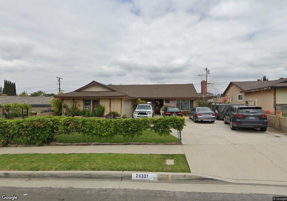
20331 Acfold Dr Walnut, CA 91789
Estimated Value: $921,853 - $1,032,000
4
Beds
2
Baths
1,689
Sq Ft
$592/Sq Ft
Est. Value
About This Home
This home is located at 20331 Acfold Dr, Walnut, CA 91789 and is currently estimated at $1,000,463, approximately $592 per square foot. 20331 Acfold Dr is a home located in Los Angeles County with nearby schools including Walnut Elementary School, South Pointe Middle School, and Walnut High School.
Ownership History
Date
Name
Owned For
Owner Type
Purchase Details
Closed on
Jun 23, 1999
Sold by
Corti Peter A And Lois Trs Corti Trust
Bought by
Marquisee Eric and Marquisee Helen
Current Estimated Value
Home Financials for this Owner
Home Financials are based on the most recent Mortgage that was taken out on this home.
Original Mortgage
$194,400
Outstanding Balance
$62,189
Interest Rate
9.62%
Estimated Equity
$938,274
Create a Home Valuation Report for This Property
The Home Valuation Report is an in-depth analysis detailing your home's value as well as a comparison with similar homes in the area
Home Values in the Area
Average Home Value in this Area
Purchase History
| Date | Buyer | Sale Price | Title Company |
|---|---|---|---|
| Marquisee Eric | $216,000 | Lawyers Title Company |
Source: Public Records
Mortgage History
| Date | Status | Borrower | Loan Amount |
|---|---|---|---|
| Open | Marquisee Eric | $194,400 | |
| Closed | Marquisee Eric | $10,800 |
Source: Public Records
Tax History
| Year | Tax Paid | Tax Assessment Tax Assessment Total Assessment is a certain percentage of the fair market value that is determined by local assessors to be the total taxable value of land and additions on the property. | Land | Improvement |
|---|---|---|---|---|
| 2025 | $4,443 | $331,963 | $161,371 | $170,592 |
| 2024 | $4,443 | $325,455 | $158,207 | $167,248 |
| 2023 | $4,343 | $319,074 | $155,105 | $163,969 |
| 2022 | $4,253 | $312,818 | $152,064 | $160,754 |
| 2021 | $4,170 | $306,685 | $149,083 | $157,602 |
| 2019 | $4,044 | $297,590 | $144,662 | $152,928 |
| 2018 | $3,825 | $291,756 | $141,826 | $149,930 |
| 2016 | $3,545 | $280,429 | $136,320 | $144,109 |
| 2015 | $3,563 | $276,218 | $134,273 | $141,945 |
| 2014 | $3,572 | $270,808 | $131,643 | $139,165 |
Source: Public Records
Map
Nearby Homes
- 20239 Damietta Dr
- 1129 Belbury Dr
- 20471 Flintgate Dr
- 1525 Walnut Leaf Dr Unit 211
- 1389 S Lemon Ave
- 20139 Lake Canyon Dr
- 20608 Shepherd Hills Dr
- 20629 Shepherd Hills Dr
- 1833 Walnut Leaf Dr
- 20111 Evening Breeze Dr
- 20739 Lycoming St Unit 35
- 1509 Sapphire Ln
- 1571 Sapphire Ln
- 20505 Missionary Ridge St
- 20232 Evening Breeze Dr
- 1337 Brea Canyon Cutoff Rd
- 20573 Missionary Ridge St
- 673 Castlehill Dr
- 693 Castlehill Dr
- 20548 Missionary Ridge St
- 20325 Acfold Dr
- 20337 Acfold Dr
- 20248 Damietta Dr
- 20302 Damietta Dr
- 20319 Acfold Dr
- 20240 Damietta Dr
- 20343 Acfold Dr
- 20310 Damietta Dr
- 20336 Acfold Dr
- 20324 Acfold Dr
- 20313 Acfold Dr
- 20347 Acfold Dr
- 20224 Damietta Dr
- 20348 Acfold Dr
- 20316 Damietta Dr
- 20312 Acfold Dr
- 20216 Damietta Dr
- 20355 Acfold Dr
- 20330 Damietta Dr
- 1164 Calbourne Dr
Your Personal Tour Guide
Ask me questions while you tour the home.