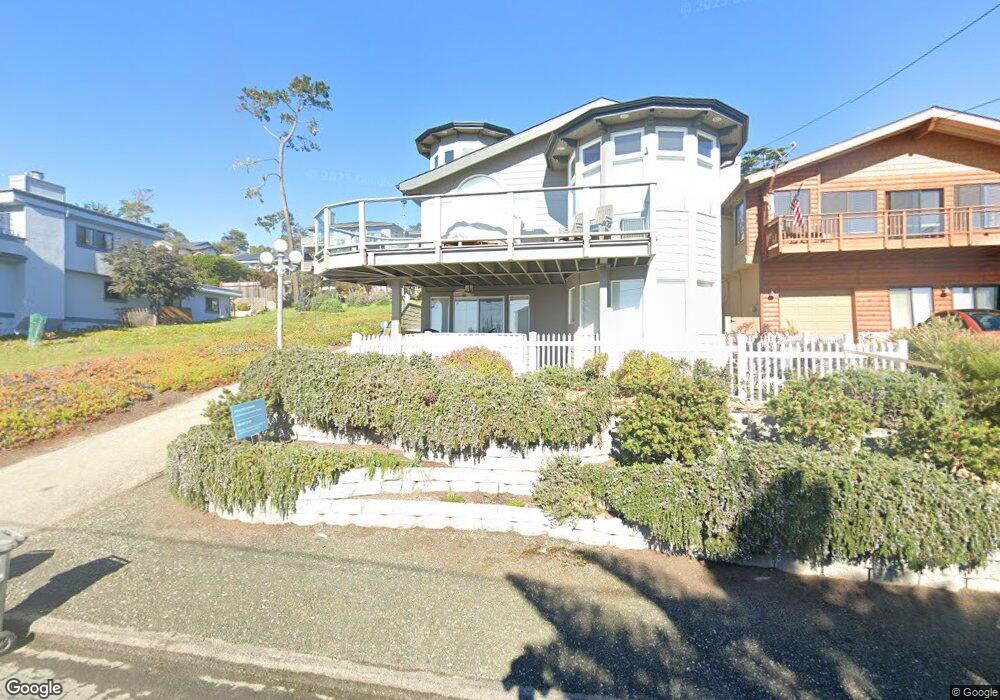
2040 Oxford Ave Cambria, CA 93428
Cambria NeighborhoodEstimated Value: $121,000 - $841,000
--
Bed
--
Bath
--
Sq Ft
5,250
Acres
About This Home
This home is located at 2040 Oxford Ave, Cambria, CA 93428 and is currently estimated at $565,328. 2040 Oxford Ave is a home located in San Luis Obispo County with nearby schools including Cambria Grammar, Santa Lucia Middle School, and Coast Union High School.
Ownership History
Date
Name
Owned For
Owner Type
Purchase Details
Closed on
Mar 31, 2023
Sold by
Colarian Jacob and Colarian Shoghig
Bought by
Jacob And Shoghig Colarian Family Trust
Current Estimated Value
Purchase Details
Closed on
Dec 1, 2004
Sold by
Manalio Ernest
Bought by
Colarian Jacob N and Colarian Shoghig
Home Financials for this Owner
Home Financials are based on the most recent Mortgage that was taken out on this home.
Original Mortgage
$205,000
Interest Rate
5.12%
Mortgage Type
Purchase Money Mortgage
Create a Home Valuation Report for This Property
The Home Valuation Report is an in-depth analysis detailing your home's value as well as a comparison with similar homes in the area
Home Values in the Area
Average Home Value in this Area
Purchase History
| Date | Buyer | Sale Price | Title Company |
|---|---|---|---|
| Jacob And Shoghig Colarian Family Trust | -- | None Listed On Document | |
| Colarian Jacob N | $369,000 | First American Title Company |
Source: Public Records
Mortgage History
| Date | Status | Borrower | Loan Amount |
|---|---|---|---|
| Previous Owner | Colarian Jacob N | $205,000 |
Source: Public Records
Tax History Compared to Growth
Tax History
| Year | Tax Paid | Tax Assessment Tax Assessment Total Assessment is a certain percentage of the fair market value that is determined by local assessors to be the total taxable value of land and additions on the property. | Land | Improvement |
|---|---|---|---|---|
| 2025 | $1,384 | $125,000 | $125,000 | -- |
| 2024 | $1,386 | $125,000 | $125,000 | -- |
| 2023 | $1,386 | $125,000 | $125,000 | $0 |
| 2022 | $1,384 | $125,000 | $125,000 | $0 |
| 2021 | $1,389 | $125,000 | $125,000 | $0 |
| 2020 | $1,384 | $125,000 | $125,000 | $0 |
| 2019 | $1,384 | $125,000 | $125,000 | $0 |
| 2018 | $1,382 | $125,000 | $125,000 | $0 |
| 2017 | $1,380 | $125,000 | $125,000 | $0 |
| 2016 | $1,379 | $125,000 | $125,000 | $0 |
| 2015 | $1,379 | $125,000 | $125,000 | $0 |
| 2014 | $1,356 | $125,000 | $125,000 | $0 |
Source: Public Records
Map
Nearby Homes
- 0 Oxford Ave
- 1970 Emmons Rd
- 379 Harvey St
- 740 Ardath Dr
- 395 Ivar St
- 605 Ardath Dr
- 2103 Benson Ave
- 305 Ivar St
- 798 Drake St
- 0 Madison Unit SC25216306
- 396 Castle St
- 1980 Sherwood Dr
- 1799 Saint Thomas Ave
- 0 Kenneth Dr Unit SC25087439
- 0 Kenneth Dr Unit SC24012358
- 2591 Windsor Blvd
- 2431 Sherwood Dr
- 1955 Avon Ave
- 0 Tully Place Unit SC25234309
- 0 Tully Place Unit SC22204783
- 1990 Oxford Ave
- 2098 Oxford Ave
- 1980 Oxford Ave
- 2091 Emmons Rd
- 2001 Emmons Rd
- 1976 Oxford Ave
- 2101 Emmons Rd
- 1985 Oxford Ave
- 2111 Emmons Rd
- 1983 Oxford Ave
- 2105 Oxford Ave
- 2120 Oxford Ave
- 1965 Emmons Rd
- 1964 Oxford Ave
- 1979 Oxford Ave
- 2117 Emmons Rd
- 2070 Marlborough Ln
- 2111 Oxford Ave
- 1998 Emmons Rd
- 2112 Marlborough Ln