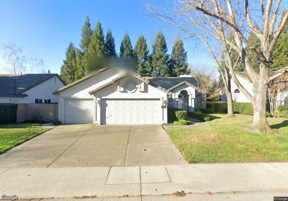
2042 Boulder Mine Way Gold River, CA 95670
Estimated Value: $674,959 - $773,000
3
Beds
2
Baths
1,885
Sq Ft
$385/Sq Ft
Est. Value
About This Home
This home is located at 2042 Boulder Mine Way, Gold River, CA 95670 and is currently estimated at $725,490, approximately $384 per square foot. 2042 Boulder Mine Way is a home located in Sacramento County with nearby schools including Gold River Discovery Center, Rio Americano High School, and Summit Christian School.
Ownership History
Date
Name
Owned For
Owner Type
Purchase Details
Closed on
Nov 29, 2010
Sold by
Hebert Richard and Hebert Dee Ann K
Bought by
Hebert Richard S and Hebert Dee Ann K
Current Estimated Value
Purchase Details
Closed on
Jul 14, 1999
Sold by
Walker Martin Bruce
Bought by
Hebert Richard and Hebert Dee Ann
Home Financials for this Owner
Home Financials are based on the most recent Mortgage that was taken out on this home.
Original Mortgage
$180,000
Interest Rate
7.51%
Purchase Details
Closed on
Nov 23, 1993
Sold by
U S Home Corp
Bought by
Walker Martin Bruce
Home Financials for this Owner
Home Financials are based on the most recent Mortgage that was taken out on this home.
Original Mortgage
$189,950
Interest Rate
3.25%
Create a Home Valuation Report for This Property
The Home Valuation Report is an in-depth analysis detailing your home's value as well as a comparison with similar homes in the area
Home Values in the Area
Average Home Value in this Area
Purchase History
| Date | Buyer | Sale Price | Title Company |
|---|---|---|---|
| Hebert Richard S | -- | None Available | |
| Hebert Richard | $225,000 | Financial Title Company | |
| Walker Martin Bruce | $200,000 | Stewart Title Of Sacramento |
Source: Public Records
Mortgage History
| Date | Status | Borrower | Loan Amount |
|---|---|---|---|
| Previous Owner | Hebert Richard | $180,000 | |
| Previous Owner | Walker Martin Bruce | $189,950 |
Source: Public Records
Tax History Compared to Growth
Tax History
| Year | Tax Paid | Tax Assessment Tax Assessment Total Assessment is a certain percentage of the fair market value that is determined by local assessors to be the total taxable value of land and additions on the property. | Land | Improvement |
|---|---|---|---|---|
| 2025 | $4,110 | $345,798 | $99,892 | $245,906 |
| 2024 | $4,110 | $339,019 | $97,934 | $241,085 |
| 2023 | $4,004 | $332,372 | $96,014 | $236,358 |
| 2022 | $3,978 | $325,856 | $94,132 | $231,724 |
| 2021 | $3,909 | $319,468 | $92,287 | $227,181 |
| 2020 | $3,835 | $316,193 | $91,341 | $224,852 |
| 2019 | $3,756 | $309,994 | $89,550 | $220,444 |
| 2018 | $3,709 | $303,917 | $87,795 | $216,122 |
| 2017 | $3,670 | $297,959 | $86,074 | $211,885 |
| 2016 | $3,381 | $292,118 | $84,387 | $207,731 |
| 2015 | $3,322 | $287,731 | $83,120 | $204,611 |
| 2014 | $3,252 | $282,095 | $81,492 | $200,603 |
Source: Public Records
Map
Nearby Homes
- 11917 Rising Sun Way
- 11925 Silver Cliff Way
- 2142 Stony Bar Way
- 12012 Gold Pointe Ln
- 11832 S Carson Way
- 12040 Gold Arbor Ln
- 12077 Gold Pointe Ln
- 11724 Gold Parke Ln
- 11701 Tenderfoot Dr
- 11657 New Albion Dr
- 8888 Bluff Ln
- 8927 Bluff Ln
- 8931 Bluff Ln
- 8911 Bluff Ln
- 11657 Gold Country Blvd
- 1957 Empire Oaks Ct
- 11600 Gold Country Blvd
- 11552 Big Four Way
- 2139 Dame Shirley Way
- 4117 Thistledown Dr
- 2038 Boulder Mine Way
- 2046 Boulder Mine Way
- 2067 Last Chance Ct
- 11879 Point Rock Way
- 2034 Boulder Mine Way
- 11901 Rising Sun Way
- 2063 Last Chance Ct
- 2045 Boulder Mine Way
- 2049 Boulder Mine Way
- 11886 Point Rock Way
- 11882 Point Rock Way
- 11905 Rising Sun Way
- 2059 Last Chance Ct
- 11844 Old Eureka Way
- 11873 Point Rock Way
- 11900 Old Eureka Way
- 11878 Point Rock Way
- 2053 Boulder Mine Way
- 11840 Old Eureka Way
- 2066 Last Chance Ct