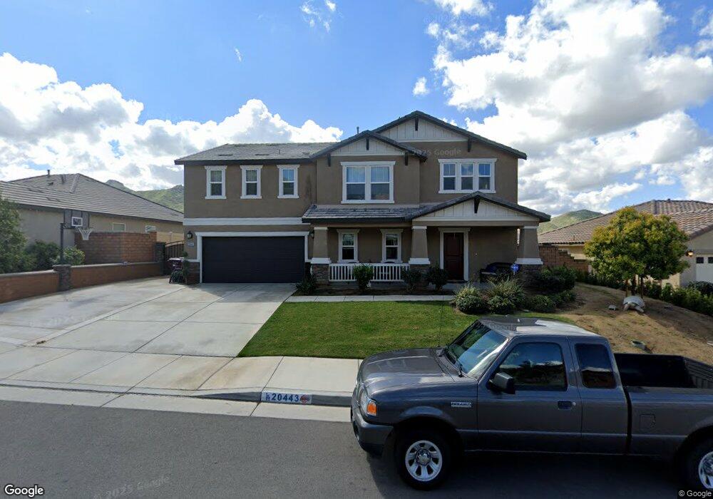
20443 Lyon Rd Riverside, CA 92507
Highgrove NeighborhoodEstimated Value: $734,896 - $839,000
5
Beds
3
Baths
2,923
Sq Ft
$271/Sq Ft
Est. Value
About This Home
This home is located at 20443 Lyon Rd, Riverside, CA 92507 and is currently estimated at $793,474, approximately $271 per square foot. 20443 Lyon Rd is a home with nearby schools including Highgrove Elementary School, University Heights Middle School, and John W. North High School.
Ownership History
Date
Name
Owned For
Owner Type
Purchase Details
Closed on
Feb 10, 2015
Sold by
Kb Home Coastal Inc
Bought by
Cornejo Tomas A and Cornejo Sonia
Current Estimated Value
Home Financials for this Owner
Home Financials are based on the most recent Mortgage that was taken out on this home.
Original Mortgage
$403,750
Interest Rate
3.64%
Mortgage Type
New Conventional
Create a Home Valuation Report for This Property
The Home Valuation Report is an in-depth analysis detailing your home's value as well as a comparison with similar homes in the area
Home Values in the Area
Average Home Value in this Area
Purchase History
| Date | Buyer | Sale Price | Title Company |
|---|---|---|---|
| Cornejo Tomas A | $425,000 | First American Title Company |
Source: Public Records
Mortgage History
| Date | Status | Borrower | Loan Amount |
|---|---|---|---|
| Previous Owner | Cornejo Tomas A | $403,750 |
Source: Public Records
Tax History
| Year | Tax Paid | Tax Assessment Tax Assessment Total Assessment is a certain percentage of the fair market value that is determined by local assessors to be the total taxable value of land and additions on the property. | Land | Improvement |
|---|---|---|---|---|
| 2025 | $8,458 | $510,778 | $144,217 | $366,561 |
| 2023 | $8,458 | $490,946 | $138,618 | $352,328 |
| 2022 | $8,131 | $481,320 | $135,900 | $345,420 |
| 2021 | $8,086 | $471,884 | $133,236 | $338,648 |
| 2020 | $7,984 | $467,046 | $131,870 | $335,176 |
| 2019 | $7,882 | $457,889 | $129,285 | $328,604 |
| 2018 | $7,726 | $448,911 | $126,751 | $322,160 |
| 2017 | $7,700 | $440,110 | $124,266 | $315,844 |
| 2016 | $7,331 | $431,481 | $121,830 | $309,651 |
| 2015 | $2,832 | $12,499 | $12,499 | $0 |
Source: Public Records
Map
Nearby Homes
- 20583 Spring St
- 20668 Pitchfork Dr
- 7387 Silverspot Rd
- 7672 Kuvera Bend St
- 20765 Barn Rd
- 20075 Sanquinella Cir
- 20346 Symphony Dr
- 20065 Curaco Ct
- 7608 Citrusmoon Ct
- 20046 Red Rock Ave
- 7222 Bliss St
- 7210 Bliss St
- 7221 Bliss St
- 7635 Sweet Ranch Cir
- 7145 Flourish St
- 7133 Flourish St
- 21047 Iron Rail Dr
- 7552 Honeybell Ct
- 19778 Limon Ct
- 22544 Main St
- 20431 Lyon Rd
- 20467 Lyon Rd
- 20444 Crooked Branch St
- 20479 Lyon Rd
- 20419 Lyon Rd
- 20432 Crooked Branch St
- 20446 Lyon Rd
- 20456 Crooked Branch St
- 20458 Lyon Rd
- 20434 Lyon Rd
- 20420 Crooked Branch St
- 20422 Lyon Rd
- 20491 Lyon Rd
- 20407 Lyon Rd
- 20468 Crooked Branch St
- 20470 Lyon Rd
- 20408 Crooked Branch St
- 20500 Pitchfork Dr
- 20410 Lyon Rd
- 20503 Lyon Rd
Your Personal Tour Guide
Ask me questions while you tour the home.