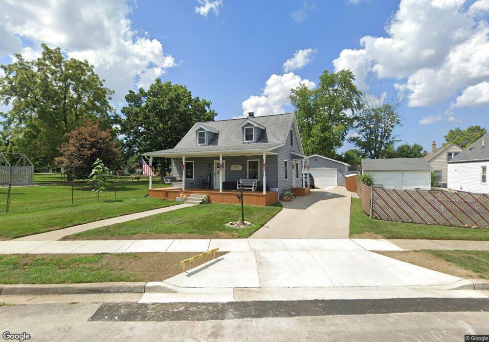
2045 Malcom Dr Dayton, OH 45420
Estimated Value: $179,000 - $191,892
3
Beds
1
Bath
1,008
Sq Ft
$184/Sq Ft
Est. Value
About This Home
This home is located at 2045 Malcom Dr, Dayton, OH 45420 and is currently estimated at $185,973, approximately $184 per square foot. 2045 Malcom Dr is a home located in Montgomery County with nearby schools including Greenmont Elementary School, Kettering Middle School, and Kettering Fairmont High School.
Ownership History
Date
Name
Owned For
Owner Type
Purchase Details
Closed on
Mar 15, 2002
Sold by
Vincent Lee
Bought by
Reliford Dale Lee and Reliford Kimberly Ann
Current Estimated Value
Home Financials for this Owner
Home Financials are based on the most recent Mortgage that was taken out on this home.
Original Mortgage
$90,480
Outstanding Balance
$36,770
Interest Rate
7.11%
Mortgage Type
FHA
Estimated Equity
$149,203
Purchase Details
Closed on
Apr 27, 1998
Sold by
Claiborne David W
Bought by
Lee Vincent
Home Financials for this Owner
Home Financials are based on the most recent Mortgage that was taken out on this home.
Original Mortgage
$89,095
Interest Rate
7.5%
Mortgage Type
VA
Create a Home Valuation Report for This Property
The Home Valuation Report is an in-depth analysis detailing your home's value as well as a comparison with similar homes in the area
Home Values in the Area
Average Home Value in this Area
Purchase History
| Date | Buyer | Sale Price | Title Company |
|---|---|---|---|
| Reliford Dale Lee | $91,900 | -- | |
| Lee Vincent | $86,500 | -- | |
| Lee Vincent | $86,500 | -- |
Source: Public Records
Mortgage History
| Date | Status | Borrower | Loan Amount |
|---|---|---|---|
| Open | Reliford Dale Lee | $90,480 | |
| Previous Owner | Lee Vincent | $89,095 |
Source: Public Records
Tax History
| Year | Tax Paid | Tax Assessment Tax Assessment Total Assessment is a certain percentage of the fair market value that is determined by local assessors to be the total taxable value of land and additions on the property. | Land | Improvement |
|---|---|---|---|---|
| 2025 | $4,012 | $62,350 | $11,010 | $51,340 |
| 2024 | $3,898 | $62,350 | $11,010 | $51,340 |
| 2023 | $3,898 | $62,350 | $11,010 | $51,340 |
| 2022 | $3,449 | $43,530 | $7,700 | $35,830 |
| 2021 | $3,192 | $43,530 | $7,700 | $35,830 |
| 2020 | $3,201 | $43,530 | $7,700 | $35,830 |
| 2019 | $3,097 | $37,220 | $7,700 | $29,520 |
| 2018 | $3,114 | $37,220 | $7,700 | $29,520 |
| 2017 | $2,871 | $37,220 | $7,700 | $29,520 |
| 2016 | $2,691 | $32,750 | $7,700 | $25,050 |
| 2015 | $2,573 | $32,750 | $7,700 | $25,050 |
| 2014 | $2,573 | $32,750 | $7,700 | $25,050 |
| 2012 | -- | $33,870 | $8,400 | $25,470 |
Source: Public Records
Map
Nearby Homes
- 2167 W Bataan Dr
- 2291 Patterson Rd
- 2216 Culver Ave
- 2040 Courtland Ave
- 1534 Horlacher Ave
- 2112 Patterson Rd
- 1513 Horlacher Ave
- 1421 Flesher Ave
- 2408 Homeland Ct
- 1529 Watervliet Ave
- 1618 Briedweng Ave Unit 1616
- 2817 Kennedy Ave
- 5123 Haverfield Rd
- 2904 Kingston Ave
- 2600 Ghent Ave
- 1525 Farrington Dr
- 1629 Beaver Creek Ln
- 4883 Rainier Dr
- 1409 Highview Ave
- 1436 Glenn Abbey Dr
- 2174 Adventure Dr
- 2170 Adventure Dr
- 2166 Adventure Dr
- 2046 Malcom Dr
- 2042 Malcom Dr
- 2050 Malcom Dr
- 2038 Malcom Dr
- 2162 Adventure Dr
- 2035 Malcom Dr
- 2034 Malcom Dr
- 2054 Malcom Dr
- 2167 Adventure Dr
- 2030 Malcom Dr
- 2158 Adventure Dr
- 2163 Adventure Dr
- 2037 Craig Dr
- 2033 Craig Dr
- 2026 Malcom Dr
- 2159 Adventure Dr
- 2029 Malcom Dr
Your Personal Tour Guide
Ask me questions while you tour the home.