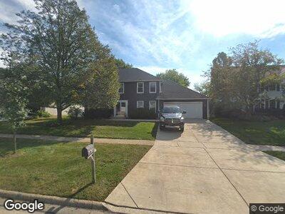
2049 Burnham Place Wheaton, IL 60189
Stonehedge NeighborhoodEstimated Value: $737,900 - $796,000
4
Beds
2
Baths
4,001
Sq Ft
$191/Sq Ft
Est. Value
About This Home
This home is located at 2049 Burnham Place, Wheaton, IL 60189 and is currently estimated at $763,225, approximately $190 per square foot. 2049 Burnham Place is a home located in DuPage County with nearby schools including Whittier Elementary School, Edison Middle School, and Wheaton Warrenville South High School.
Ownership History
Date
Name
Owned For
Owner Type
Purchase Details
Closed on
Oct 12, 2022
Sold by
Anderson David Lee
Bought by
Audriana And David Anderson Family Trust
Current Estimated Value
Purchase Details
Closed on
Dec 5, 2003
Sold by
Bagge Ronn R and Bagge Karen A
Bought by
Anderson David L and Anderson Audriana T
Home Financials for this Owner
Home Financials are based on the most recent Mortgage that was taken out on this home.
Original Mortgage
$322,700
Interest Rate
5.84%
Mortgage Type
Purchase Money Mortgage
Create a Home Valuation Report for This Property
The Home Valuation Report is an in-depth analysis detailing your home's value as well as a comparison with similar homes in the area
Home Values in the Area
Average Home Value in this Area
Purchase History
| Date | Buyer | Sale Price | Title Company |
|---|---|---|---|
| Audriana And David Anderson Family Trust | -- | -- | |
| Anderson David L | $415,000 | -- |
Source: Public Records
Mortgage History
| Date | Status | Borrower | Loan Amount |
|---|---|---|---|
| Previous Owner | Anderson David L | $444,000 | |
| Previous Owner | Anderson David L | $216,000 | |
| Previous Owner | Anderson David L | $368,000 | |
| Previous Owner | Anderson David L | $175,000 | |
| Previous Owner | Anderson David L | $124,000 | |
| Previous Owner | Anderson David L | $322,700 | |
| Previous Owner | Bagge Ronn R | $300,000 | |
| Previous Owner | Bagge Ronn R | $276,000 |
Source: Public Records
Tax History Compared to Growth
Tax History
| Year | Tax Paid | Tax Assessment Tax Assessment Total Assessment is a certain percentage of the fair market value that is determined by local assessors to be the total taxable value of land and additions on the property. | Land | Improvement |
|---|---|---|---|---|
| 2023 | $12,466 | $192,470 | $47,660 | $144,810 |
| 2022 | $12,182 | $181,900 | $45,040 | $136,860 |
| 2021 | $12,144 | $177,580 | $43,970 | $133,610 |
| 2020 | $12,107 | $175,930 | $43,560 | $132,370 |
| 2019 | $11,833 | $171,290 | $42,410 | $128,880 |
| 2018 | $12,747 | $181,990 | $39,960 | $142,030 |
| 2017 | $12,563 | $175,280 | $38,490 | $136,790 |
| 2016 | $12,404 | $168,280 | $36,950 | $131,330 |
| 2015 | $12,317 | $160,540 | $35,250 | $125,290 |
| 2014 | $10,902 | $140,460 | $34,740 | $105,720 |
| 2013 | $10,621 | $140,880 | $34,840 | $106,040 |
Source: Public Records
Map
Nearby Homes
- 2054 Dorset Dr
- 1932 Buckingham Dr
- 2041 Chatham Dr
- 659 Brighton Dr
- 2S723 Wendelin Ct
- 11 Somerset Cir
- 2S704 Cree Ln
- 466 Carrol Gate Rd
- 2508 Weatherbee Ln
- 26W051 Mohican Dr
- 26W241 Arrow Glen Ct
- 2S101 Apache Dr
- 1724 S Thompson Dr
- 25W451 Plamondon Rd
- 1938 Keim Dr
- 26W215 Tomahawk Dr
- 26W365 Blackhawk Dr
- 1635 Orth Dr
- 2130 Weatherbee Ln
- 1617 Orth Dr
- 2049 Burnham Place
- 2055 Burnham Place
- 2043 Burnham Place
- 2050 Greensboro Dr
- 2056 Greensboro Dr
- 2037 Burnham Place
- 2061 Burnham Place
- 2046 Burnham Place
- 929 Dorset Dr
- 2052 Burnham Place
- 2044 Greensboro Dr
- 2040 Burnham Place
- 2031 Burnham Place
- 2058 Burnham Place
- 2038 Greensboro Dr
- 2064 Burnham Place
- 2032 Burnham Place
- 2032 Greensboro Dr
- 2045 Richton Dr
- 2027 Burnham Place