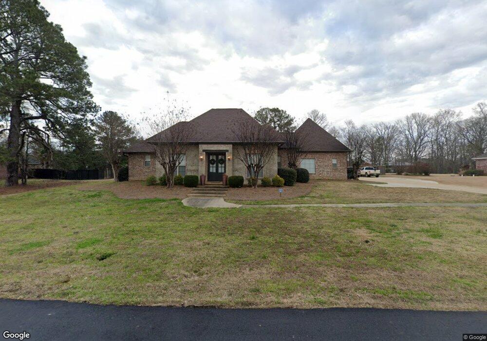
205 Allen Dr Brandon, MS 39047
Estimated Value: $566,000 - $651,133
4
Beds
5
Baths
3,821
Sq Ft
$158/Sq Ft
Est. Value
About This Home
This home is located at 205 Allen Dr, Brandon, MS 39047 and is currently estimated at $604,783, approximately $158 per square foot. 205 Allen Dr is a home located in Rankin County with nearby schools including Northshore Elementary School, Northwest Rankin Middle School, and Northwest Rankin High School.
Ownership History
Date
Name
Owned For
Owner Type
Purchase Details
Closed on
Feb 20, 2009
Sold by
David T David T and Dolson Karen J
Bought by
Sheppard Mitchelle and Sheppard Angela B
Current Estimated Value
Purchase Details
Closed on
Mar 15, 2007
Sold by
Donald Home Builders Llc
Bought by
Dolson David T and Dolson Karen J
Home Financials for this Owner
Home Financials are based on the most recent Mortgage that was taken out on this home.
Original Mortgage
$398,000
Interest Rate
6.27%
Mortgage Type
VA
Create a Home Valuation Report for This Property
The Home Valuation Report is an in-depth analysis detailing your home's value as well as a comparison with similar homes in the area
Purchase History
| Date | Buyer | Sale Price | Title Company |
|---|---|---|---|
| Sheppard Mitchelle | -- | -- | |
| Dolson David T | -- | Title & Escrow Services, Inc |
Source: Public Records
Mortgage History
| Date | Status | Borrower | Loan Amount |
|---|---|---|---|
| Previous Owner | Dolson David T | $398,000 |
Source: Public Records
Tax History
| Year | Tax Paid | Tax Assessment Tax Assessment Total Assessment is a certain percentage of the fair market value that is determined by local assessors to be the total taxable value of land and additions on the property. | Land | Improvement |
|---|---|---|---|---|
| 2024 | $4,380 | $43,450 | $0 | $0 |
| 2023 | $4,137 | $41,197 | $0 | $0 |
| 2022 | $4,075 | $41,197 | $0 | $0 |
| 2021 | $4,075 | $41,197 | $0 | $0 |
| 2020 | $4,075 | $41,197 | $0 | $0 |
| 2019 | $3,689 | $36,603 | $0 | $0 |
| 2018 | $1,888 | $36,603 | $0 | $0 |
| 2017 | $3,615 | $36,603 | $0 | $0 |
| 2016 | $3,363 | $35,922 | $0 | $0 |
| 2015 | $3,363 | $35,922 | $0 | $0 |
| 2014 | $3,110 | $34,151 | $0 | $0 |
| 2013 | -- | $34,151 | $0 | $0 |
Source: Public Records
Map
Nearby Homes
- 118 Bonne Vie Dr
- 202 Esplanade Dr
- 165 Church Rd
- 2713 Highway 471
- 102 Horseshoe Cir
- 720 Adair St
- 215 Wellington Way
- 213 Wellington Way
- 216 Meadowlands Dr
- 0 Fannin Landing Cir Unit 4078135
- 108 Holly Bush Rd
- 0 Stull Rd Unit 24042681
- 600 Bay Pointe Ln
- 117 Hollybush Place
- 118 Pine Ridge Cir
- 0 Fountains Cove Unit 4113281
- 113 Belle Chasse Dr
- 527 Ridge Cir
- 000 Holly Bush Rd
- 168 Blackstone Cir
- 203 Allen Dr
- 207 Allen Dr
- 206 Allen Dr
- 201 Allen Dr
- 37 Buckingham Place Unit 37
- 37 Buckingham Place
- 302 Warren Cove
- 210 Allen Dr
- 161 Fannin Landing Cir
- 211 Allen Dr
- 163 Fannin Landing Cir
- 212 Allen Dr
- 207 Arthurs Ct
- 303 Warren Cove
- 304 Warren Cove
- 195 Fannin Landing Cir
- 201 Arthurs Ct
- 213 Allen Dr
- 218 Arthurs Ct
- 306 Warren Cove
Your Personal Tour Guide
Ask me questions while you tour the home.