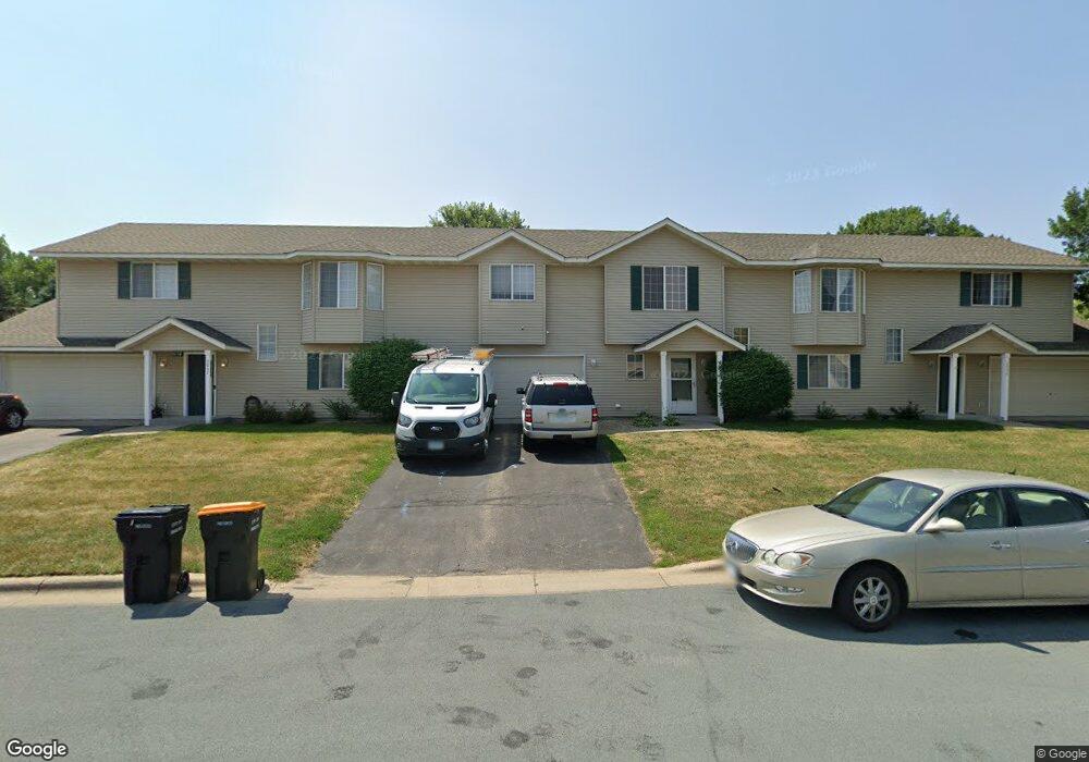
2050 Downing Ave Shakopee, MN 55379
Estimated Value: $246,000 - $258,000
3
Beds
2
Baths
1,256
Sq Ft
$200/Sq Ft
Est. Value
About This Home
This home is located at 2050 Downing Ave, Shakopee, MN 55379 and is currently estimated at $251,365, approximately $200 per square foot. 2050 Downing Ave is a home located in Scott County with nearby schools including Sun Path Elementary School, Shakopee West Middle School, and Shakopee Senior High School.
Ownership History
Date
Name
Owned For
Owner Type
Purchase Details
Closed on
May 21, 2007
Sold by
Bye Kristine M and Bye Peter
Bought by
Stoolman Andrew J and Stoolman Sara F
Current Estimated Value
Purchase Details
Closed on
Apr 12, 2000
Sold by
Mw Johnson Construction
Bought by
Moore Kristine M
Create a Home Valuation Report for This Property
The Home Valuation Report is an in-depth analysis detailing your home's value as well as a comparison with similar homes in the area
Home Values in the Area
Average Home Value in this Area
Purchase History
| Date | Buyer | Sale Price | Title Company |
|---|---|---|---|
| Stoolman Andrew J | $173,800 | -- | |
| Moore Kristine M | $120,000 | -- |
Source: Public Records
Tax History Compared to Growth
Tax History
| Year | Tax Paid | Tax Assessment Tax Assessment Total Assessment is a certain percentage of the fair market value that is determined by local assessors to be the total taxable value of land and additions on the property. | Land | Improvement |
|---|---|---|---|---|
| 2025 | $2,152 | $235,600 | $76,100 | $159,500 |
| 2024 | $2,232 | $225,000 | $72,400 | $152,600 |
| 2023 | $2,436 | $221,600 | $71,000 | $150,600 |
| 2022 | $2,384 | $223,300 | $72,700 | $150,600 |
| 2021 | $2,136 | $187,100 | $57,000 | $130,100 |
| 2020 | $2,248 | $183,300 | $52,500 | $130,800 |
| 2019 | $2,124 | $169,400 | $44,400 | $125,000 |
| 2018 | $2,118 | $0 | $0 | $0 |
| 2016 | $2,002 | $0 | $0 | $0 |
| 2014 | -- | $0 | $0 | $0 |
Source: Public Records
Map
Nearby Homes
- 1552 Dublin Ct
- 1844 Mockingbird Ave Unit 1102
- 1820 Mockingbird Ave
- 2471 Tyrone Dr
- 2447 Tyrone Dr
- 2399 Tyrone Dr
- 2263 Tyrone Dr
- 1511 England Way
- 2388 Vierling Dr E
- 2006 Tyrone Dr
- Lewis Plan at Summerland Place - Landmark Collection
- 2795 Downing Ave
- Vanderbilt Plan at Summerland Place - Landmark Collection
- Sinclair Plan at Summerland Place - Landmark Collection
- 1624 Philipp Way
- 2804 Trinity Dr
- Nokomis Plan at Summerland Place - The Tradition Collection
- Gregorian Plan at Summerland Place - The Tradition Collection
- 1542 Philipp Way
- Pryor Plan at Summerland Place - The Tradition Collection
- 2062 Downing Ave
- 2038 Downing Ave
- 2026 Downing Ave
- 2074 Downing Ave
- 1532 Hummingbird St
- 2047 Downing Ave
- 1516 Hummingbird St Unit 605
- 2035 Downing Ave
- 2059 Downing Ave
- 2014 Downing Ave
- 2086 Downing Ave
- 1536 Hummingbird St
- 2071 Downing Ave
- 1520 Hummingbird St
- 2023 Downing Ave
- 1540 Hummingbird St Unit 601
- 2098 Downing Ave
- 1524 Hummingbird St
- 1529 Hummingbird St
- 2002 Downing Ave