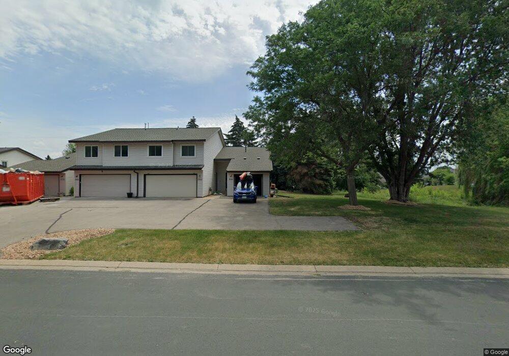
2064 13th Ave W Shakopee, MN 55379
Estimated Value: $218,000 - $252,000
2
Beds
1
Bath
1,070
Sq Ft
$223/Sq Ft
Est. Value
About This Home
This home is located at 2064 13th Ave W, Shakopee, MN 55379 and is currently estimated at $238,644, approximately $223 per square foot. 2064 13th Ave W is a home located in Scott County with nearby schools including Sweeney Elementary School, East Middle School, and Shakopee Senior High School.
Ownership History
Date
Name
Owned For
Owner Type
Purchase Details
Closed on
May 6, 2022
Sold by
Ctw Group Incorporated
Bought by
Thole Ryan Edward and Thole Jo Ann
Current Estimated Value
Home Financials for this Owner
Home Financials are based on the most recent Mortgage that was taken out on this home.
Original Mortgage
$202,730
Outstanding Balance
$192,624
Interest Rate
5.27%
Mortgage Type
New Conventional
Estimated Equity
$46,021
Purchase Details
Closed on
Feb 23, 2022
Sold by
Gayl Madigan
Bought by
Ctw Group Incorporated
Create a Home Valuation Report for This Property
The Home Valuation Report is an in-depth analysis detailing your home's value as well as a comparison with similar homes in the area
Home Values in the Area
Average Home Value in this Area
Purchase History
| Date | Buyer | Sale Price | Title Company |
|---|---|---|---|
| Thole Ryan Edward | $250,000 | None Listed On Document | |
| Ctw Group Incorporated | $150,000 | None Listed On Document |
Source: Public Records
Mortgage History
| Date | Status | Borrower | Loan Amount |
|---|---|---|---|
| Open | Thole Ryan Edward | $202,730 | |
| Closed | Thole Ryan Edward | $14,000 |
Source: Public Records
Tax History Compared to Growth
Tax History
| Year | Tax Paid | Tax Assessment Tax Assessment Total Assessment is a certain percentage of the fair market value that is determined by local assessors to be the total taxable value of land and additions on the property. | Land | Improvement |
|---|---|---|---|---|
| 2025 | $1,974 | $195,100 | $83,800 | $111,300 |
| 2024 | $1,764 | $186,100 | $79,800 | $106,300 |
| 2023 | $1,616 | $163,500 | $78,300 | $85,200 |
| 2022 | $1,356 | $165,900 | $80,100 | $85,800 |
| 2021 | $1,116 | $126,500 | $62,700 | $63,800 |
| 2020 | $1,074 | $119,300 | $55,100 | $64,200 |
| 2019 | $966 | $106,000 | $47,200 | $58,800 |
| 2018 | $1,268 | $0 | $0 | $0 |
| 2016 | $1,140 | $0 | $0 | $0 |
| 2014 | -- | $0 | $0 | $0 |
Source: Public Records
Map
Nearby Homes
- 2224 Quarry Ln
- 2075 13th Ave W
- 2123 Agate Curve
- 1279 Taylor St Unit 5
- 1259 Taylor St Unit 3
- 1226 Polk St S
- 1853 Stone Meadow Blvd
- 1538 12th Ave W
- 1187 Jackson St S
- 2007 10th Ave W Unit 12
- 1813 6th Ave W
- 1690 Windigo Ln
- The Ferguson Plan at Bluff View - Cottage Series
- The Edison Plan at Bluff View - Cottage Series
- The Tatum Plan at Bluff View - Cottage Series
- The Pattison Plan at Bluff View - Cottage Series
- The Harmony Plan at Bluff View - Freedom Series
- The Dover II Plan at Bluff View - Freedom Series
- The Clifton II Plan at Bluff View - Freedom Series
- The Cali Plan at Bluff View - Freedom Series
- 2062 13th Ave W
- 2060 13th Ave W
- 2058 13th Ave W
- 2056 13th Ave W
- 2054 13th Ave W
- 2157 Boulder Point
- 2157 Boulder Pointe
- 2117 Boulder Point
- 2117 Boulder Pointe
- 2161 Boulder Point
- 2052 13th Ave W
- 2113 Boulder Point
- 2165 Boulder Point
- 2050 13th Ave W
- 2109 Boulder Point
- 2169 Boulder Point
- 2105 Boulder Point Unit 402
- 2105 Boulder Point
- 2069 13th Ave W
- 2069 2069 13th-Avenue-w