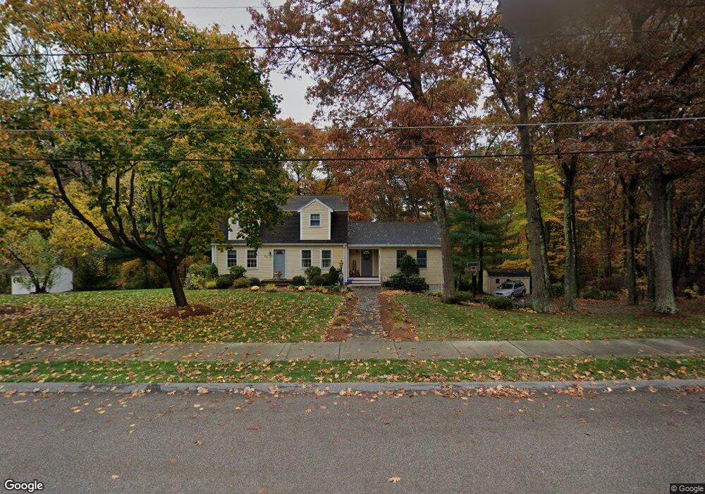
207 Irondequoit Rd Franklin, MA 02038
Estimated Value: $692,215 - $761,000
3
Beds
2
Baths
2,042
Sq Ft
$358/Sq Ft
Est. Value
About This Home
This home is located at 207 Irondequoit Rd, Franklin, MA 02038 and is currently estimated at $730,804, approximately $357 per square foot. 207 Irondequoit Rd is a home located in Norfolk County with nearby schools including Oak Street Elementary School, Horace Mann Middle School, and Franklin High School.
Ownership History
Date
Name
Owned For
Owner Type
Purchase Details
Closed on
Nov 16, 2019
Sold by
Fradkin Debra L and Fradkin Michael S
Bought by
Debra L & M S Fradkin Lt
Current Estimated Value
Purchase Details
Closed on
Feb 26, 1999
Sold by
Kale Carl A and Kale Rhonda L
Bought by
Fradkin Michael S and Fradkin Debra L
Home Financials for this Owner
Home Financials are based on the most recent Mortgage that was taken out on this home.
Original Mortgage
$152,400
Interest Rate
6.78%
Mortgage Type
Purchase Money Mortgage
Purchase Details
Closed on
Dec 27, 1991
Sold by
Knapp William J and Knapp Carol
Bought by
Kale Carl A and Kale Rhonda L
Create a Home Valuation Report for This Property
The Home Valuation Report is an in-depth analysis detailing your home's value as well as a comparison with similar homes in the area
Purchase History
| Date | Buyer | Sale Price | Title Company |
|---|---|---|---|
| Debra L & M S Fradkin Lt | -- | -- | |
| Fradkin Michael S | $190,500 | -- | |
| Kale Carl A | $145,000 | -- |
Source: Public Records
Mortgage History
| Date | Status | Borrower | Loan Amount |
|---|---|---|---|
| Previous Owner | Kale Carl A | $192,000 | |
| Previous Owner | Kale Carl A | $184,800 | |
| Previous Owner | Kale Carl A | $152,400 |
Source: Public Records
Tax History
| Year | Tax Paid | Tax Assessment Tax Assessment Total Assessment is a certain percentage of the fair market value that is determined by local assessors to be the total taxable value of land and additions on the property. | Land | Improvement |
|---|---|---|---|---|
| 2025 | $7,536 | $648,500 | $330,500 | $318,000 |
| 2024 | $7,305 | $619,600 | $330,500 | $289,100 |
| 2023 | $7,247 | $576,100 | $287,000 | $289,100 |
| 2022 | $6,275 | $446,600 | $217,400 | $229,200 |
| 2021 | $6,112 | $417,200 | $241,700 | $175,500 |
| 2020 | $5,691 | $392,200 | $225,700 | $166,500 |
| 2019 | $5,632 | $384,200 | $217,700 | $166,500 |
| 2018 | $5,308 | $362,300 | $213,700 | $148,600 |
| 2017 | $5,080 | $348,400 | $199,800 | $148,600 |
| 2016 | $4,782 | $329,800 | $202,400 | $127,400 |
| 2015 | $4,817 | $324,600 | $197,200 | $127,400 |
| 2014 | $4,341 | $300,400 | $173,000 | $127,400 |
Source: Public Records
Map
Nearby Homes
- 1801 Franklin Crossing Rd Unit 1801
- 134 Highwood Dr
- 201 Crossfield Rd
- 276 Pond St
- 25 Brookview Rd
- 8 Riverstone Way
- 41 Kimberlee Ave
- 70 Oak St
- 834-836 W Central St
- 214 Conlyn Ave
- 14 Pleasant St Unit B
- 12 Garden St
- 204 Lincoln St
- 5 Stone Ridge Rd
- 17 Longhill Rd
- 120 Union St Unit 1
- 43 Grey Wolf Dr Unit 13
- 90 E Central St Unit 103
- 90 E Central St Unit 106
- 90 E Central St Unit 304
- 201 Irondequoit Rd
- 213 Irondequoit Rd
- 7 Lucius St
- 7 Lucius St Unit 9999
- 5 Lucius St
- 216 Irondequoit Rd
- 191 Irondequoit Rd
- 200 Irondequoit Rd
- 219 Irondequoit Rd
- 392 Oak St
- 222 Irondequoit Rd
- 190 Irondequoit Rd
- 400 Oak St
- 3 Lucius St
- 181 Irondequoit Rd
- 192 Dailey Dr
- 402 Oak St
- 200 Dailey Dr
- 227 Irondequoit Rd
- 180 Dailey Dr
Your Personal Tour Guide
Ask me questions while you tour the home.