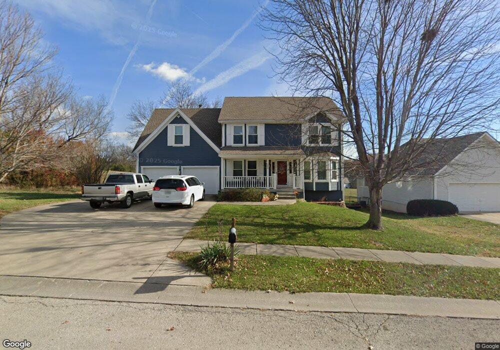
207 Maple Ln Smithville, MO 64089
Estimated Value: $348,000 - $472,000
4
Beds
4
Baths
2,324
Sq Ft
$185/Sq Ft
Est. Value
About This Home
This home is located at 207 Maple Ln, Smithville, MO 64089 and is currently estimated at $429,226, approximately $184 per square foot. 207 Maple Ln is a home located in Clay County with nearby schools including Maple Elementary School, Smithville Middle School, and Smithville High School.
Ownership History
Date
Name
Owned For
Owner Type
Purchase Details
Closed on
Jun 21, 2018
Sold by
Swanigan Michael and Swanigan Brady
Bought by
Larosh Kraig W and Larosh Shannon N
Current Estimated Value
Home Financials for this Owner
Home Financials are based on the most recent Mortgage that was taken out on this home.
Original Mortgage
$265,000
Outstanding Balance
$245,247
Interest Rate
4.6%
Mortgage Type
Commercial
Estimated Equity
$183,979
Purchase Details
Closed on
May 25, 2012
Sold by
Gordon Michael F and Gordon Mary Kathleen
Bought by
Swanigan Michael and Swanigan Brandy
Purchase Details
Closed on
Sep 9, 2003
Sold by
Gordon Michael F and Gordon Mary K
Bought by
Gordon Michael F and Gordon Mary Kathleen
Purchase Details
Closed on
Dec 2, 1999
Sold by
Villanueva Juan O
Bought by
Gordon Michael F and Gordon Mary K
Create a Home Valuation Report for This Property
The Home Valuation Report is an in-depth analysis detailing your home's value as well as a comparison with similar homes in the area
Home Values in the Area
Average Home Value in this Area
Purchase History
| Date | Buyer | Sale Price | Title Company |
|---|---|---|---|
| Larosh Kraig W | -- | Chesterfield Title Agency Ll | |
| Swanigan Michael | -- | Clinton County Land Title | |
| Gordon Michael F | -- | -- | |
| Gordon Michael F | -- | United Title Company |
Source: Public Records
Mortgage History
| Date | Status | Borrower | Loan Amount |
|---|---|---|---|
| Open | Larosh Kraig W | $265,000 |
Source: Public Records
Tax History
| Year | Tax Paid | Tax Assessment Tax Assessment Total Assessment is a certain percentage of the fair market value that is determined by local assessors to be the total taxable value of land and additions on the property. | Land | Improvement |
|---|---|---|---|---|
| 2025 | $3,800 | $65,440 | -- | -- |
| 2024 | $3,800 | $52,630 | -- | -- |
| 2023 | $3,634 | $52,630 | $0 | $0 |
| 2022 | $3,234 | $45,110 | $0 | $0 |
| 2021 | $3,257 | $45,106 | $3,420 | $41,686 |
| 2020 | $2,936 | $40,380 | $0 | $0 |
| 2019 | $2,957 | $40,380 | $0 | $0 |
Source: Public Records
Map
Nearby Homes
- 105 Highland Dr
- 1.77 Acres Highway 169
- 17205 Thomas Lane Rd
- 319 E Meadow St
- 106A N Smith St
- 0 Highway 169
- 503 Whitetail Ct
- 423 E Main St
- 508 Whitetail Ct
- 000 E Meadow St
- 407 Sixth St
- 300 Winner Ave
- 604 Blackhawke Dr
- 506 Blackhawke Dr
- 504 Blackhawke Dr
- 700 Blackhawke Dr
- 502 Blackhawke Dr
- 500 Blackhawke Dr
- 17409 Sparrowhawke Dr
- 600 Rock Bridge Ct
Your Personal Tour Guide
Ask me questions while you tour the home.