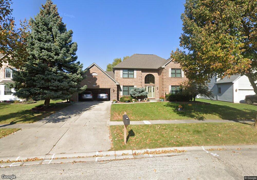
2070 Carlisle St Algonquin, IL 60102
Estimated Value: $491,000 - $539,000
4
Beds
3
Baths
2,811
Sq Ft
$180/Sq Ft
Est. Value
About This Home
This home is located at 2070 Carlisle St, Algonquin, IL 60102 and is currently estimated at $507,159, approximately $180 per square foot. 2070 Carlisle St is a home located in McHenry County with nearby schools including Westfield Community School, Kenneth E Neubert Elementary School, and United Junior High School.
Ownership History
Date
Name
Owned For
Owner Type
Purchase Details
Closed on
Sep 19, 2022
Sold by
Calabria Joseph C and Calabria Paulette L
Bought by
Paulette L Calabria Living Trust
Current Estimated Value
Purchase Details
Closed on
Mar 28, 1994
Sold by
Steel City National Bank Of Chicago
Bought by
Calabria Joseph and Calabria Paulette
Create a Home Valuation Report for This Property
The Home Valuation Report is an in-depth analysis detailing your home's value as well as a comparison with similar homes in the area
Home Values in the Area
Average Home Value in this Area
Purchase History
| Date | Buyer | Sale Price | Title Company |
|---|---|---|---|
| Paulette L Calabria Living Trust | -- | -- | |
| Calabria Joseph | $55,000 | -- |
Source: Public Records
Tax History Compared to Growth
Tax History
| Year | Tax Paid | Tax Assessment Tax Assessment Total Assessment is a certain percentage of the fair market value that is determined by local assessors to be the total taxable value of land and additions on the property. | Land | Improvement |
|---|---|---|---|---|
| 2024 | $12,622 | $169,347 | $35,906 | $133,441 |
| 2023 | $12,009 | $151,459 | $32,113 | $119,346 |
| 2022 | $11,026 | $134,565 | $38,555 | $96,010 |
| 2021 | $10,592 | $125,364 | $35,919 | $89,445 |
| 2020 | $10,320 | $120,926 | $34,647 | $86,279 |
| 2019 | $10,077 | $115,740 | $33,161 | $82,579 |
| 2018 | $9,619 | $106,919 | $30,634 | $76,285 |
| 2017 | $9,433 | $100,724 | $28,859 | $71,865 |
| 2016 | $8,969 | $94,470 | $27,067 | $67,403 |
| 2013 | -- | $93,165 | $25,250 | $67,915 |
Source: Public Records
Map
Nearby Homes
- 2161 Burnham Ct
- 000 County Line Rd
- 2043 Peach Tree Ln Unit 4122
- 2101 Peach Tree Ln Unit 4094
- 1971 Peach Tree Ln
- 30 Arbordale Ct Unit 4284
- 1900 Waverly Ln
- 741 Regal Ln
- 1820 Crofton Dr
- 2235 Dawson Ln
- 2248 Dawson Ln Unit 272
- 661 Majestic Dr
- 2060 Dorchester Ave
- 700 Fairfield Ln
- Marianne Plan at Algonquin Meadows - Traditional Townhomes
- Darcy Plan at Algonquin Meadows - Traditional Townhomes
- Charlotte Plan at Algonquin Meadows - Traditional Townhomes
- Adams Plan at Algonquin Meadows - Single Family
- Sequoia Plan at Algonquin Meadows - Single Family
- Bryce Plan at Algonquin Meadows - Single Family
- 2070 Carlisle St
- 2050 Carlisle St
- 2090 Carlisle St
- 2090 Carlisle St
- 2041 Tunbridge Trail
- 2041 Tunbridge Trail
- 2031 Tunbridge Trail
- 2051 Tunbridge Trail
- 2030 Carlisle St
- 2110 Carlisle St
- 2091 Carlisle St
- 2111 Carlisle St
- 2021 Tunbridge Trail
- 2071 Carlisle St
- 2061 Tunbridge Trail
- 2010 Carlisle St
- 2051 Carlisle St
- 1370 Carlisle St
- 2011 Tunbridge Trail
- 1425 Carlisle St