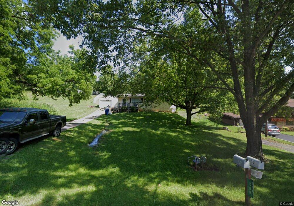
208 Hedge Dr Springfield, OH 45504
Cedar Hills/Broadview NeighborhoodEstimated Value: $155,000 - $231,000
3
Beds
2
Baths
1,092
Sq Ft
$172/Sq Ft
Est. Value
About This Home
This home is located at 208 Hedge Dr, Springfield, OH 45504 and is currently estimated at $188,151, approximately $172 per square foot. 208 Hedge Dr is a home located in Clark County with nearby schools including Possum Elementary School, Shawnee Middle School/High School, and Clark Preparatory Academy.
Ownership History
Date
Name
Owned For
Owner Type
Purchase Details
Closed on
Oct 27, 2021
Bought by
Brooks Michael Dean
Current Estimated Value
Purchase Details
Closed on
Jun 28, 2021
Sold by
Capers Jessica L and Legg Jessica L
Bought by
Brooks Michael
Home Financials for this Owner
Home Financials are based on the most recent Mortgage that was taken out on this home.
Original Mortgage
$97,010
Interest Rate
2.9%
Mortgage Type
FHA
Purchase Details
Closed on
Jan 8, 2016
Sold by
Mann Michael T
Bought by
Legg Jessica L and Mann Jessica L
Purchase Details
Closed on
Apr 16, 2003
Sold by
Huff Douglas S and Huff Shannon L
Bought by
Mann Michael T and Legg Jessica L
Home Financials for this Owner
Home Financials are based on the most recent Mortgage that was taken out on this home.
Original Mortgage
$93,532
Interest Rate
5.76%
Mortgage Type
FHA
Purchase Details
Closed on
Nov 29, 1993
Create a Home Valuation Report for This Property
The Home Valuation Report is an in-depth analysis detailing your home's value as well as a comparison with similar homes in the area
Home Values in the Area
Average Home Value in this Area
Purchase History
| Date | Buyer | Sale Price | Title Company |
|---|---|---|---|
| Brooks Michael Dean | -- | -- | |
| Brooks Michael | $98,800 | Ntc | |
| Legg Jessica L | -- | None Available | |
| Mann Michael T | $95,000 | -- | |
| -- | $74,000 | -- |
Source: Public Records
Mortgage History
| Date | Status | Borrower | Loan Amount |
|---|---|---|---|
| Previous Owner | Brooks Michael | $97,010 | |
| Previous Owner | Mann Michael T | $93,532 |
Source: Public Records
Tax History
| Year | Tax Paid | Tax Assessment Tax Assessment Total Assessment is a certain percentage of the fair market value that is determined by local assessors to be the total taxable value of land and additions on the property. | Land | Improvement |
|---|---|---|---|---|
| 2025 | $2,554 | $60,080 | $13,060 | $47,020 |
| 2024 | $2,545 | $49,870 | $9,630 | $40,240 |
| 2023 | $2,545 | $49,870 | $9,630 | $40,240 |
| 2022 | $2,469 | $49,870 | $9,630 | $40,240 |
| 2021 | $2,152 | $38,920 | $7,460 | $31,460 |
| 2020 | $2,170 | $38,920 | $7,460 | $31,460 |
| 2019 | $2,204 | $38,920 | $7,460 | $31,460 |
| 2018 | $1,888 | $32,850 | $6,430 | $26,420 |
| 2017 | $1,934 | $32,844 | $6,426 | $26,418 |
| 2016 | $1,706 | $32,844 | $6,426 | $26,418 |
| 2015 | $1,686 | $31,388 | $6,426 | $24,962 |
| 2014 | $1,691 | $31,388 | $6,426 | $24,962 |
| 2013 | $1,469 | $31,388 | $6,426 | $24,962 |
Source: Public Records
Map
Nearby Homes
- 190 Oakridge Dr
- 0 Upper Valley Pike
- 2805 Cottonwood Dr
- 2743 Ironwood Dr
- 624 Aberfelda Dr
- 925 Upper Valley Pike
- 917 White Oak Dr
- 124 Old Mill Rd
- 106 Walter St
- 110 Walter St
- 2705 Ash Dr
- 1906-1908 W High St
- 1866 Maiden Ln
- 1915 W Washington St
- 3267 Lower Valley Pike Unit Tract 2
- 1828 W Washington St
- 3891 New Carlisle Pike
- 1715 W North St
- 22 Seever St
- 202 Seever St
Your Personal Tour Guide
Ask me questions while you tour the home.