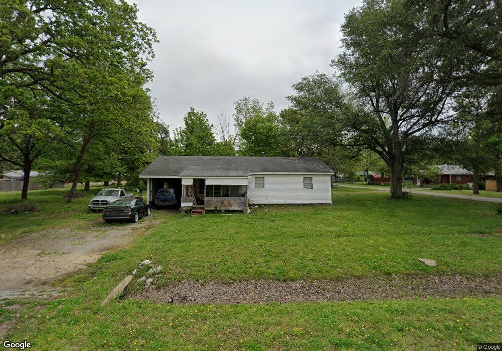
208 N State Highway 181 S Keiser, AR 72351
Estimated Value: $55,062 - $98,000
--
Bed
--
Bath
1,160
Sq Ft
$61/Sq Ft
Est. Value
About This Home
This home is located at 208 N State Highway 181 S, Keiser, AR 72351 and is currently estimated at $70,766, approximately $61 per square foot. 208 N State Highway 181 S is a home with nearby schools including Rivercrest Elementary School.
Ownership History
Date
Name
Owned For
Owner Type
Purchase Details
Closed on
Jan 2, 2002
Sold by
Radecki Margie Ann
Bought by
Albright Helen
Current Estimated Value
Purchase Details
Closed on
Jan 1, 2002
Sold by
Radecki Margie Ann
Bought by
Albright Helen
Purchase Details
Closed on
Jan 2, 2001
Sold by
Radecki Margie Ann
Bought by
Radecki Margie
Purchase Details
Closed on
Jan 1, 2001
Sold by
Radecki Margie Ann
Bought by
Radecki Margie
Purchase Details
Closed on
Jan 2, 1997
Sold by
Wilbanks Mccoy
Bought by
Raper Opal
Purchase Details
Closed on
Jan 1, 1997
Sold by
Wilbanks Mccoy
Bought by
Raper Opal
Purchase Details
Closed on
Jan 2, 1984
Sold by
Wilbanks Coy
Bought by
Wilbanks David A
Purchase Details
Closed on
Jan 1, 1984
Sold by
Wilbanks Coy
Bought by
Wilbanks David A
Purchase Details
Closed on
Jan 2, 1977
Bought by
Wilbanks Coy
Purchase Details
Closed on
Jan 1, 1977
Bought by
Wilbanks Coy
Create a Home Valuation Report for This Property
The Home Valuation Report is an in-depth analysis detailing your home's value as well as a comparison with similar homes in the area
Home Values in the Area
Average Home Value in this Area
Purchase History
| Date | Buyer | Sale Price | Title Company |
|---|---|---|---|
| Albright Helen | $48,000 | -- | |
| Radecki Margie Ann | -- | -- | |
| Albright Helen | $48,000 | -- | |
| Radecki Margie Ann | -- | -- | |
| Radecki Margie | -- | -- | |
| Radecki Margie | -- | -- | |
| Raper Opal | $37,000 | -- | |
| Wilbanks Mccoy | -- | -- | |
| Raper Opal | $37,000 | -- | |
| Wilbanks Mccoy | -- | -- | |
| Wilbanks David A | -- | -- | |
| Wilbanks David A | -- | -- | |
| Wilbanks Coy | -- | -- | |
| Wilbanks Coy | -- | -- |
Source: Public Records
Tax History Compared to Growth
Tax History
| Year | Tax Paid | Tax Assessment Tax Assessment Total Assessment is a certain percentage of the fair market value that is determined by local assessors to be the total taxable value of land and additions on the property. | Land | Improvement |
|---|---|---|---|---|
| 2024 | $508 | $9,828 | $1,000 | $8,828 |
| 2023 | $508 | $9,828 | $1,000 | $8,828 |
| 2022 | $508 | $9,828 | $1,000 | $8,828 |
| 2021 | $412 | $8,739 | $1,000 | $7,739 |
| 2020 | -- | $8,739 | $1,000 | $7,739 |
| 2019 | -- | -- | $1,000 | $7,739 |
| 2018 | -- | -- | $1,000 | $7,739 |
| 2017 | -- | -- | $1,000 | $9,066 |
| 2015 | -- | -- | $1,000 | $7,898 |
| 2013 | -- | -- | $1,000 | $7,898 |
Source: Public Records
Map
Nearby Homes
- 201 N Market St
- 303 Oak St
- 1 Cedar St
- 309 Senter Ave
- 0 E Johnson Ave
- 0 Shippen Ave Unit 22016399
- 1199 W Highway 119
- 1281 S Hwy 77
- 1281 S State Highway 77
- 123 Kristi Dr
- 132 Ken Dr
- 130 Diane Dr
- 110 Carriage Dr
- 101 Carriage Dr
- 106 W Cheryl St
- 109 Newport Dr
- 111 Colonial Rd
- 106 Hickory Cir
- 1169 S State Highway 119
- 116 Cherry Dr
- 104 E Adams St
- 302 Highway 181
- 106 E Adams St
- 103 E Adams St
- 101 E Mill St
- 108 E Adams St
- 103 E Mill St
- 109 E Adams St
- 105 E Mill St
- 110 E Adams St
- 306 Highway 181
- 104 E Mill St
- 111 E Adams St
- 108 E Madison St
- 107 E Mill St
- 112 E Adams St
- 113 E Adams St
- 114 E Madison St
- 109 E Mill St
- 302 S Poplar St