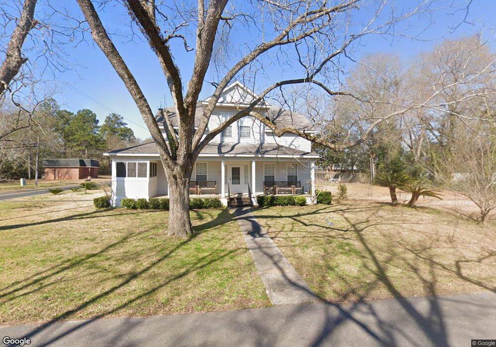
21 Warnock St Register, GA 30452
Estimated Value: $174,000 - $242,000
2
Beds
1
Bath
4,568
Sq Ft
$45/Sq Ft
Est. Value
About This Home
This home is located at 21 Warnock St, Register, GA 30452 and is currently estimated at $205,733, approximately $45 per square foot. 21 Warnock St is a home located in Bulloch County with nearby schools including Langston Chapel Elementary School, Statesboro High School, and Langston Chapel Middle School.
Ownership History
Date
Name
Owned For
Owner Type
Purchase Details
Closed on
Dec 8, 2011
Sold by
Underwood Richard T
Bought by
Xie Fang
Current Estimated Value
Purchase Details
Closed on
Oct 7, 2011
Sold by
Turner Spring Melanie
Bought by
Underwood Richard T
Purchase Details
Closed on
Mar 1, 2000
Bought by
Underwood Richard T and Underwood Melanie T
Purchase Details
Closed on
Aug 1, 1999
Bought by
Hodges Real Estate Partnership
Purchase Details
Closed on
Aug 1, 1988
Bought by
Wilson Daisy E
Create a Home Valuation Report for This Property
The Home Valuation Report is an in-depth analysis detailing your home's value as well as a comparison with similar homes in the area
Purchase History
| Date | Buyer | Sale Price | Title Company |
|---|---|---|---|
| Xie Fang | $87,000 | -- | |
| Underwood Richard T | -- | -- | |
| Underwood Richard T | -- | -- | |
| Hodges Real Estate Partnership | -- | -- | |
| Wilson Daisy E | -- | -- |
Source: Public Records
Tax History Compared to Growth
Tax History
| Year | Tax Paid | Tax Assessment Tax Assessment Total Assessment is a certain percentage of the fair market value that is determined by local assessors to be the total taxable value of land and additions on the property. | Land | Improvement |
|---|---|---|---|---|
| 2025 | $1,693 | $172,056 | $3,600 | $168,456 |
| 2024 | $1,693 | $61,056 | $3,600 | $57,456 |
| 2023 | $1,530 | $62,900 | $3,600 | $59,300 |
| 2022 | $1,162 | $53,818 | $3,600 | $50,218 |
| 2021 | $980 | $44,289 | $3,600 | $40,689 |
| 2020 | $945 | $41,570 | $3,600 | $37,970 |
| 2019 | $941 | $41,199 | $3,600 | $37,599 |
| 2018 | $989 | $43,010 | $3,600 | $39,410 |
| 2017 | $956 | $40,981 | $3,600 | $37,381 |
| 2016 | $940 | $39,273 | $3,600 | $35,673 |
| 2015 | $898 | $37,233 | $3,600 | $33,633 |
| 2014 | $829 | $37,233 | $3,600 | $33,633 |
Source: Public Records
Map
Nearby Homes
- 33 Main St
- 0 Highway 301 S Unit 25510428
- 19.13 ACRES Highway 301 N
- 0 Moore Rd Unit 10671805
- 0 Cypress Lake Rd Unit PARCEL D
- 0 Cypress Lake Rd Unit LOT E
- 129 Cypress Lake Dr
- 0 Twin Forks Rd Unit 25650888
- 0 Twin Forks Rd Unit 25650877
- 0 Twin Forks Rd Unit 25651132
- 0 Twin Forks Rd Unit 25641523
- 0 Twin Forks Rd Unit 25651129
- 1266 Old Register Way
- 251 Jm Royal Ln
- 805 Bay Tree Ln
- 195 Creekside Way
- 127 Turkey Trail
- 321 Royal Fern Ln
- 319 Royal Fern Ln
- 320 Royal Fern Ln