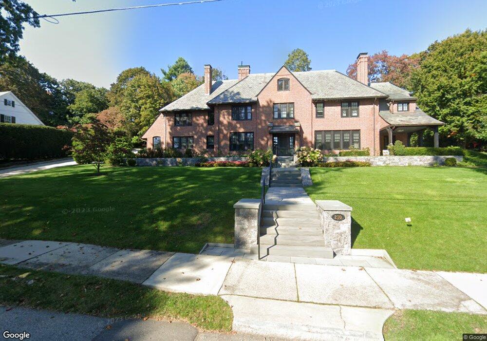
210 Kent Rd Waban, MA 02468
Waban NeighborhoodEstimated Value: $5,043,432 - $5,744,000
6
Beds
6
Baths
6,095
Sq Ft
$867/Sq Ft
Est. Value
About This Home
This home is located at 210 Kent Rd, Waban, MA 02468 and is currently estimated at $5,281,811, approximately $866 per square foot. 210 Kent Rd is a home located in Middlesex County with nearby schools including Angier Elementary School, Charles E Brown Middle School, and Newton South High School.
Ownership History
Date
Name
Owned For
Owner Type
Purchase Details
Closed on
Jul 29, 2021
Sold by
Sara Aronson T
Bought by
Leonard J Aronson T
Current Estimated Value
Purchase Details
Closed on
Aug 8, 2013
Sold by
Kent Road Nt and Stein Timothy D
Bought by
Sara Aronson T and Aronson Sara
Create a Home Valuation Report for This Property
The Home Valuation Report is an in-depth analysis detailing your home's value as well as a comparison with similar homes in the area
Home Values in the Area
Average Home Value in this Area
Purchase History
| Date | Buyer | Sale Price | Title Company |
|---|---|---|---|
| Leonard J Aronson T | -- | None Available | |
| Sara Aronson T | -- | -- |
Source: Public Records
Tax History
| Year | Tax Paid | Tax Assessment Tax Assessment Total Assessment is a certain percentage of the fair market value that is determined by local assessors to be the total taxable value of land and additions on the property. | Land | Improvement |
|---|---|---|---|---|
| 2025 | $49,954 | $5,097,300 | $1,943,000 | $3,154,300 |
| 2024 | $48,300 | $4,948,800 | $1,886,400 | $3,062,400 |
| 2023 | $46,891 | $4,606,200 | $1,516,400 | $3,089,800 |
| 2022 | $44,868 | $4,265,000 | $1,404,100 | $2,860,900 |
| 2021 | $43,294 | $4,023,600 | $1,324,600 | $2,699,000 |
| 2020 | $37,756 | $3,616,500 | $1,324,600 | $2,291,900 |
| 2019 | $30,497 | $2,918,400 | $1,286,000 | $1,632,400 |
| 2018 | $29,835 | $2,757,400 | $1,144,500 | $1,612,900 |
| 2017 | $28,926 | $2,601,300 | $1,079,700 | $1,521,600 |
| 2016 | $27,666 | $2,431,100 | $1,009,100 | $1,422,000 |
| 2015 | $26,379 | $2,272,100 | $943,100 | $1,329,000 |
Source: Public Records
Map
Nearby Homes
- 115 Windsor Rd
- 29 Montclair Rd
- 20 Kinmonth Rd Unit 203
- 20 Kinmonth Rd Unit 306
- 20 Kinmonth Rd Unit 4
- 110 Avalon Rd
- 0 Metacomet Rd
- 33 Metacomet Rd
- 19 Gordon Rd
- 34 Larchmont Ave
- 138 Waban Ave
- 55 Evelyn Rd
- 31 Wilde Rd
- 155 Paulson Rd
- 1754 Washington St
- 64 Varick Rd
- 1230 Commonwealth Ave
- 873 Chestnut St
- 40 Sewall St
- 177 Varick Rd
Your Personal Tour Guide
Ask me questions while you tour the home.