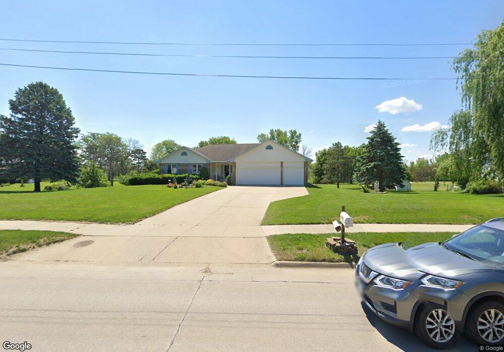
210 W Gilbert Dr Evansdale, IA 50707
Estimated Value: $319,000 - $363,000
3
Beds
3
Baths
1,724
Sq Ft
$201/Sq Ft
Est. Value
About This Home
This home is located at 210 W Gilbert Dr, Evansdale, IA 50707 and is currently estimated at $346,104, approximately $200 per square foot. 210 W Gilbert Dr is a home located in Black Hawk County with nearby schools including Poyner Elementary School, Bunger Middle School, and East High School.
Ownership History
Date
Name
Owned For
Owner Type
Purchase Details
Closed on
Oct 6, 2017
Sold by
Rubino Gerald E and Rubino Marilyn L
Bought by
Thomas Percy and Thomas Elisabeth
Current Estimated Value
Home Financials for this Owner
Home Financials are based on the most recent Mortgage that was taken out on this home.
Original Mortgage
$288,573
Outstanding Balance
$240,781
Interest Rate
3.78%
Mortgage Type
VA
Estimated Equity
$105,323
Create a Home Valuation Report for This Property
The Home Valuation Report is an in-depth analysis detailing your home's value as well as a comparison with similar homes in the area
Home Values in the Area
Average Home Value in this Area
Purchase History
| Date | Buyer | Sale Price | Title Company |
|---|---|---|---|
| Thomas Percy | -- | None Available |
Source: Public Records
Mortgage History
| Date | Status | Borrower | Loan Amount |
|---|---|---|---|
| Open | Thomas Percy | $288,573 |
Source: Public Records
Tax History Compared to Growth
Tax History
| Year | Tax Paid | Tax Assessment Tax Assessment Total Assessment is a certain percentage of the fair market value that is determined by local assessors to be the total taxable value of land and additions on the property. | Land | Improvement |
|---|---|---|---|---|
| 2024 | $4,386 | $308,400 | $30,940 | $277,460 |
| 2023 | $3,458 | $308,400 | $30,940 | $277,460 |
| 2022 | $3,432 | $234,770 | $28,880 | $205,890 |
| 2021 | $3,476 | $234,770 | $28,880 | $205,890 |
| 2020 | $3,448 | $221,040 | $25,990 | $195,050 |
| 2019 | $3,448 | $221,040 | $25,990 | $195,050 |
| 2018 | $3,636 | $221,040 | $25,990 | $195,050 |
| 2017 | $3,636 | $224,750 | $29,700 | $195,050 |
| 2016 | $3,564 | $221,440 | $29,700 | $191,740 |
| 2015 | $3,564 | $221,440 | $29,700 | $191,740 |
| 2014 | $3,402 | $210,790 | $29,700 | $181,090 |
Source: Public Records
Map
Nearby Homes
- 1018 Fox Ave
- 825 Jones Rd
- 755 Fox Ave
- 127 Doyle Ave
- 1007 Schons St
- Lot 9 Fran St
- Lot 29 Fran
- Lot 13 Fran
- 604 Ayers Ave
- 901 Brookside Ave
- 315 Belle St
- 244 Wema Ave
- 124 Ruby Dr
- 408 Crestridge Dr
- 306 Southcrest Dr
- 1107 Central Ave
- 730 Timber Oak Rd
- 860 Juniper Dr
- Lot 10 Timberline Dr
- Lot 7 Timberline Dr
- 206 W Gilbert Dr
- 316 Rae St
- 1042 Fox Ave
- 320 Rae St
- 198 W Gilbert Dr Unit U
- 198 W Gilbert Dr Unit V
- 198 W Gilbert Dr Unit Q
- 198 W Gilbert Dr Unit V
- 198 W Gilbert Dr Unit U
- 198 W Gilbert Dr Unit S
- 198 W Gilbert Dr Unit R
- 1101 Jones Rd
- 1036 Fox Ave
- 322 Rae St
- 1027 Jones Rd
- 1028 Fox Ave
- 324 Rae St
- 1116 Jones Rd
- 1031 Fox Ave
- 1025 Jones Rd