Estimated Value: $178,753 - $231,000
3
Beds
1
Bath
1,998
Sq Ft
$105/Sq Ft
Est. Value
About This Home
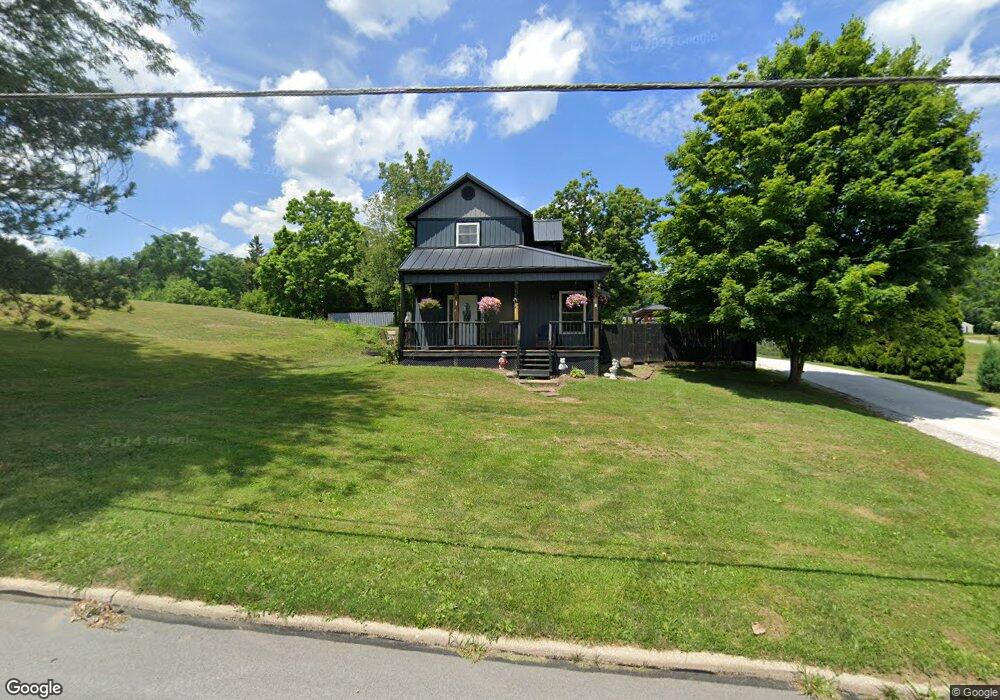
This home is located at 211 W Main St, Lucas, OH 44843 and is currently estimated at $210,188, approximately $105 per square foot. 211 W Main St is a home located in Richland County with nearby schools including Lucas Elementary School, Lucas Heritage Middle School, and Lucas High School.
Ownership History
Date
Name
Owned For
Owner Type
Purchase Details
Closed on
May 29, 2015
Sold by
Stacy Jennifer L
Bought by
Stacy Timothy H
Current Estimated Value
Home Financials for this Owner
Home Financials are based on the most recent Mortgage that was taken out on this home.
Original Mortgage
$71,400
Outstanding Balance
$55,063
Interest Rate
3.63%
Mortgage Type
New Conventional
Estimated Equity
$155,125
Purchase Details
Closed on
Jul 28, 1993
Sold by
Stacy Leslie C
Bought by
Stacy Timothy H
Create a Home Valuation Report for This Property
The Home Valuation Report is an in-depth analysis detailing your home's value as well as a comparison with similar homes in the area
Purchase History
| Date | Buyer | Sale Price | Title Company |
|---|---|---|---|
| Stacy Timothy H | -- | Southern Title | |
| Stacy Timothy H | $45,000 | -- |
Source: Public Records
Mortgage History
| Date | Status | Borrower | Loan Amount |
|---|---|---|---|
| Open | Stacy Timothy H | $71,400 |
Source: Public Records
Tax History
| Year | Tax Paid | Tax Assessment Tax Assessment Total Assessment is a certain percentage of the fair market value that is determined by local assessors to be the total taxable value of land and additions on the property. | Land | Improvement |
|---|---|---|---|---|
| 2024 | $1,698 | $42,080 | $10,090 | $31,990 |
| 2023 | $1,741 | $42,080 | $10,090 | $31,990 |
| 2022 | $1,661 | $35,950 | $10,700 | $25,250 |
| 2021 | $1,664 | $35,950 | $10,700 | $25,250 |
| 2020 | $1,692 | $35,950 | $10,700 | $25,250 |
| 2019 | $1,550 | $30,970 | $9,060 | $21,910 |
| 2018 | $1,596 | $30,970 | $9,060 | $21,910 |
| 2017 | $1,607 | $30,970 | $9,060 | $21,910 |
| 2016 | $1,507 | $29,330 | $7,740 | $21,590 |
| 2015 | $1,507 | $29,330 | $7,740 | $21,590 |
| 2014 | $1,483 | $28,760 | $7,170 | $21,590 |
| 2012 | $751 | $29,650 | $7,390 | $22,260 |
Source: Public Records
Map
Nearby Homes
- 2130 State Route 39
- 27 E Main St
- 2778 Lucas Perrysville Rd
- 1851 State Route 39
- 0 Mount Zion Rd Unit 9069748
- 2420 Mansfield Washington Rd
- 1661 State Route 603
- 0 State Route 39 & I-71 Northeast Quadrant
- 0 State Route 39 & I-71 Southeast Quadrant
- 1715 Mansfield Lucas Rd
- 3405 Hastings Newville Rd
- 0 Peterson Rd
- 2515 Peterson Rd
- 0 Woodville Rd Unit Lot 14952, 14953
- 0 Woodville Rd Unit Lot 14954, 14955
- 0 Woodville Rd Unit Lot 14956, 14957,
- 0 McBride Road Parcel # 1 Unit 9066028
- 1290 Bonnie Dr
- 0 Mcelroy Rd
- 400 Garver Rd
- 221 W Main St
- 191 W Main St
- 208 W Main St
- 198 W Main St
- 20 Bond St Unit 22
- 14 Brightwood Blvd
- 222 W Main St
- 233 W Main St
- 186 W Main St
- 0 W Main St
- 34 Brightwood Blvd
- 175 W Main St
- 42 Brightwood Blvd
- 167 W Main St
- 249 W Main St
- 25 Brightwood Blvd
- 16 Hanley Rd
- 24 Hanley Rd
- 164 W Main St
- 41 Brightwood Blvd
Your Personal Tour Guide
Ask me questions while you tour the home.