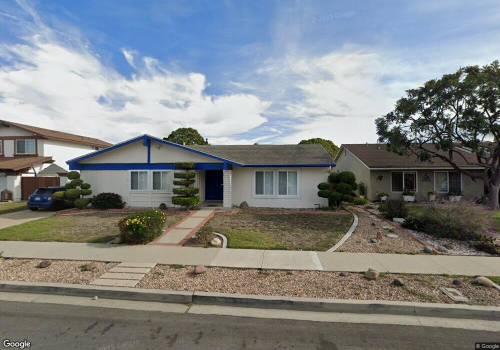
2110 Rhonda St Oxnard, CA 93036
Windsor North River Ridge NeighborhoodEstimated Value: $796,000 - $857,000
3
Beds
3
Baths
1,639
Sq Ft
$500/Sq Ft
Est. Value
About This Home
This home is located at 2110 Rhonda St, Oxnard, CA 93036 and is currently estimated at $819,151, approximately $499 per square foot. 2110 Rhonda St is a home located in Ventura County with nearby schools including Thurgood Marshall Elementary School, Oxnard High School, and Our Redeemer's Nursery School.
Ownership History
Date
Name
Owned For
Owner Type
Purchase Details
Closed on
Jul 21, 2023
Sold by
Whaley Leslee K
Bought by
Whaley Family Revocable Trust and Whaley
Current Estimated Value
Purchase Details
Closed on
Jun 27, 2022
Sold by
Harvey Whaley Paul
Bought by
Whaley Leslee K
Home Financials for this Owner
Home Financials are based on the most recent Mortgage that was taken out on this home.
Original Mortgage
$294,500
Interest Rate
4.43%
Mortgage Type
New Conventional
Purchase Details
Closed on
Jun 15, 2022
Sold by
Noonan Survivors Trust
Bought by
Whaley Leslee K
Home Financials for this Owner
Home Financials are based on the most recent Mortgage that was taken out on this home.
Original Mortgage
$294,500
Interest Rate
4.43%
Mortgage Type
New Conventional
Purchase Details
Closed on
Feb 4, 2020
Sold by
Noonan Pat L and Pat And Amber Noonan Trust
Bought by
Noonan Pat L and Noonan Survivor S Trust
Purchase Details
Closed on
May 1, 2003
Sold by
Noonan Pat L
Bought by
Noonan Pat L and Noonan Amber G
Purchase Details
Closed on
Mar 24, 2000
Sold by
Noonan Pat L and Larry Pat
Bought by
Noonan Pat L
Purchase Details
Closed on
Nov 23, 1993
Sold by
Noonan Pat L
Bought by
Noonan Pat L
Home Financials for this Owner
Home Financials are based on the most recent Mortgage that was taken out on this home.
Original Mortgage
$70,000
Interest Rate
6.85%
Create a Home Valuation Report for This Property
The Home Valuation Report is an in-depth analysis detailing your home's value as well as a comparison with similar homes in the area
Home Values in the Area
Average Home Value in this Area
Purchase History
| Date | Buyer | Sale Price | Title Company |
|---|---|---|---|
| Whaley Family Revocable Trust | -- | None Listed On Document | |
| Whaley Leslee K | -- | Fidelity National Title | |
| Whaley Leslee K | $310,000 | Fidelity National Title | |
| Noonan Pat L | -- | None Available | |
| Noonan Pat L | -- | -- | |
| Noonan Pat L | -- | -- | |
| Noonan Pat L | -- | Commonwealth Land Title Co |
Source: Public Records
Mortgage History
| Date | Status | Borrower | Loan Amount |
|---|---|---|---|
| Previous Owner | Whaley Leslee K | $294,500 | |
| Previous Owner | Noonan Pat L | $70,000 |
Source: Public Records
Tax History
| Year | Tax Paid | Tax Assessment Tax Assessment Total Assessment is a certain percentage of the fair market value that is determined by local assessors to be the total taxable value of land and additions on the property. | Land | Improvement |
|---|---|---|---|---|
| 2025 | $9,027 | $744,612 | $483,645 | $260,967 |
| 2024 | $9,027 | $730,012 | $474,162 | $255,850 |
| 2023 | $8,698 | $715,699 | $464,865 | $250,834 |
| 2022 | $1,199 | $95,841 | $19,576 | $76,265 |
| 2021 | $1,190 | $93,962 | $19,192 | $74,770 |
| 2020 | $1,124 | $93,001 | $18,997 | $74,004 |
| 2019 | $1,092 | $91,178 | $18,625 | $72,553 |
| 2018 | $1,075 | $89,391 | $18,260 | $71,131 |
| 2017 | $1,021 | $87,639 | $17,902 | $69,737 |
| 2016 | $985 | $85,921 | $17,551 | $68,370 |
| 2015 | $994 | $84,633 | $17,289 | $67,344 |
| 2014 | $982 | $82,977 | $16,951 | $66,026 |
Source: Public Records
Map
Nearby Homes
- 2134 Cold Stream Ct
- 2151 Olga St
- 2100 Norma St
- 1510 Holly Ave
- 1721 Joanne Way
- 1300 Bluebell St
- 1420 Joliet Place
- 1440 Ivywood Dr
- 1000 Camellia St
- 1131 Janetwood Dr
- 2310 Crown Point Ct
- 905 Kumquat Place
- 2056 Mission Hills Dr
- 1920 N H St Unit 235
- 1920 N H St Unit 251
- 3325 Eagle Bend Ln
- 643 Holly Ave
- 650 Bluebell Place
- 550 Holly Ave
- 1979 Newcastle Dr
- 2114 Rhonda St
- 2104 Rhonda St
- 2111 Patricia St
- 2115 Patricia St
- 2105 Patricia St
- 2120 Rhonda St
- 2100 Rhonda St
- 2101 Patricia St
- 2121 Patricia St
- 2124 Rhonda St
- 2111 Rhonda St
- 2105 Rhonda St
- 2115 Rhonda St
- 2125 Patricia St
- 2121 Rhonda St
- 2086 Rhonda St
- 2130 Rhonda St
- 2110 Patricia St
- 2104 Patricia St
- 2077 Patricia St
Your Personal Tour Guide
Ask me questions while you tour the home.