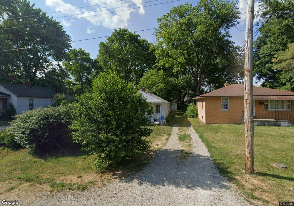
2117 E Enterprise St Unit 1 Springfield, IL 62702
Estimated Value: $56,000 - $121,000
2
Beds
1
Bath
710
Sq Ft
$120/Sq Ft
Est. Value
About This Home
This home is located at 2117 E Enterprise St Unit 1, Springfield, IL 62702 and is currently estimated at $84,851, approximately $119 per square foot. 2117 E Enterprise St Unit 1 is a home located in Sangamon County with nearby schools including Feitshans Elementary School, Washington Middle School, and Lanphier High School.
Ownership History
Date
Name
Owned For
Owner Type
Purchase Details
Closed on
Oct 15, 2018
Sold by
Sheriff Of Sangamon County
Bought by
Miller Brad Lee
Current Estimated Value
Purchase Details
Closed on
Jan 15, 2007
Purchase Details
Closed on
Nov 28, 2006
Purchase Details
Closed on
May 3, 2006
Purchase Details
Closed on
Sep 20, 2002
Purchase Details
Closed on
Feb 13, 1999
Purchase Details
Closed on
Jul 31, 1998
Create a Home Valuation Report for This Property
The Home Valuation Report is an in-depth analysis detailing your home's value as well as a comparison with similar homes in the area
Purchase History
| Date | Buyer | Sale Price | Title Company |
|---|---|---|---|
| Miller Brad Lee | $16,100 | Prairie Land Title | |
| -- | $15,000 | -- | |
| -- | -- | -- | |
| -- | -- | -- | |
| -- | $22,000 | -- | |
| -- | -- | -- | |
| -- | $12,500 | -- |
Source: Public Records
Tax History
| Year | Tax Paid | Tax Assessment Tax Assessment Total Assessment is a certain percentage of the fair market value that is determined by local assessors to be the total taxable value of land and additions on the property. | Land | Improvement |
|---|---|---|---|---|
| 2024 | $566 | $6,252 | $2,072 | $4,180 |
| 2023 | $544 | $5,664 | $1,877 | $3,787 |
| 2022 | $525 | $5,392 | $1,787 | $3,605 |
| 2021 | $487 | $4,945 | $1,639 | $3,306 |
| 2020 | $473 | $4,917 | $1,630 | $3,287 |
| 2019 | $463 | $4,899 | $1,624 | $3,275 |
| 2018 | $456 | $4,992 | $1,655 | $3,337 |
| 2017 | $0 | $4,840 | $1,605 | $3,235 |
| 2016 | $0 | $4,569 | $1,515 | $3,054 |
| 2015 | -- | $4,548 | $1,508 | $3,040 |
| 2014 | -- | $4,696 | $1,557 | $3,139 |
| 2013 | -- | $4,959 | $1,644 | $3,315 |
Source: Public Records
Map
Nearby Homes
- 1111 N Albany St Unit 1
- 2267 Cincinnati Ave
- 1050 N 19th St
- 1336 N Ohio St
- 2277 E Converse St Unit 1
- 1617 E Matheny Ave
- 1037 N Wesley St Unit 1
- 1617 E Cummins Ave
- 905 N Wesley St Unit 1
- 1717 E Keys Ave
- 2333 E Keys Ave Unit 1
- 1521 E Matheny Ave
- 2352 E Keys Ave Unit 1
- 2102 E Black Ave
- 1819 E Watch Ave
- 2373 E Keys Ave
- 2314 Ramsey Rd
- 2256 E Black Ave
- 300 Forrest Ave Unit 95
- 300 Forrest Ave Unit 52
- 2121 E Enterprise St
- 2109 E Enterprise St Unit 1
- 2129 E Enterprise St Unit 1
- 2133 E Enterprise St Unit 1
- 2118 Cincinnati Ave Unit 1
- 2135 E Enterprise St Unit 1
- 2128 Cincinnati Ave Unit 1
- 2112 Cincinnati Ave
- 2108 Cincinnati Ave Unit 1
- 2132 Cincinnati Ave Unit 1
- 2141 E Enterprise St
- 2136 Cincinnati Ave Unit 1
- 2146 Cincinnati Ave Unit 1
- 2145 E Enterprise St
- 2148 Cincinnati Ave Unit 1
- 2151 E Enterprise St
- 2152 Cincinnati Ave
- 2157 E Enterprise St
- 1031 N Wheeler Ave
- 1027 N Wheeler Ave
Your Personal Tour Guide
Ask me questions while you tour the home.