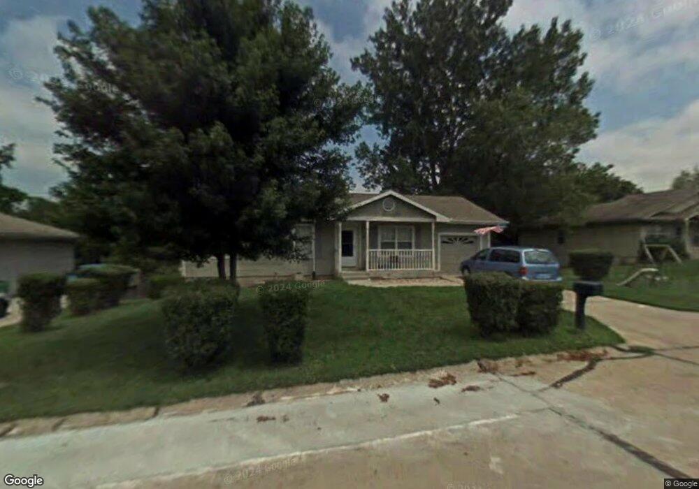
212 E 17th St Kearney, MO 64060
Estimated Value: $232,554 - $306,000
3
Beds
1
Bath
1,040
Sq Ft
$253/Sq Ft
Est. Value
About This Home
This home is located at 212 E 17th St, Kearney, MO 64060 and is currently estimated at $263,389, approximately $253 per square foot. 212 E 17th St is a home located in Clay County with nearby schools including Kearney Junior High School, Kearney High School, and Northern Hills Christian Academy.
Ownership History
Date
Name
Owned For
Owner Type
Purchase Details
Closed on
Feb 18, 2026
Sold by
Adams Shain K and Adams Tiffany
Bought by
Adams Shain K and Adams Tiffany
Current Estimated Value
Home Financials for this Owner
Home Financials are based on the most recent Mortgage that was taken out on this home.
Original Mortgage
$203,500
Outstanding Balance
$203,500
Interest Rate
6.06%
Mortgage Type
FHA
Estimated Equity
$59,889
Purchase Details
Closed on
Sep 14, 2022
Sold by
Adams Derrick R
Bought by
Adams Shain K
Home Financials for this Owner
Home Financials are based on the most recent Mortgage that was taken out on this home.
Original Mortgage
$161,616
Interest Rate
4.99%
Mortgage Type
New Conventional
Purchase Details
Closed on
Jan 23, 2021
Sold by
Adams Leanna D
Bought by
Adams Derrick R
Purchase Details
Closed on
Oct 24, 2001
Sold by
Raby Gary B and Raby Rebecca A
Bought by
Adams Leanna D
Create a Home Valuation Report for This Property
The Home Valuation Report is an in-depth analysis detailing your home's value as well as a comparison with similar homes in the area
Home Values in the Area
Average Home Value in this Area
Purchase History
| Date | Buyer | Sale Price | Title Company |
|---|---|---|---|
| Adams Shain K | -- | Old Republic Title | |
| Adams Shain K | -- | Thomson Affinity Title | |
| Adams Derrick R | -- | None Available | |
| Adams Leanna D | -- | First American Title Ins Co |
Source: Public Records
Mortgage History
| Date | Status | Borrower | Loan Amount |
|---|---|---|---|
| Open | Adams Shain K | $203,500 | |
| Previous Owner | Adams Shain K | $161,616 | |
| Closed | Adams Leanna D | $0 |
Source: Public Records
Tax History
| Year | Tax Paid | Tax Assessment Tax Assessment Total Assessment is a certain percentage of the fair market value that is determined by local assessors to be the total taxable value of land and additions on the property. | Land | Improvement |
|---|---|---|---|---|
| 2025 | $2,021 | $32,660 | -- | -- |
| 2024 | $2,021 | $29,490 | -- | -- |
| 2023 | $2,014 | $29,490 | $0 | $0 |
| 2022 | $1,834 | $25,970 | $0 | $0 |
| 2021 | $1,798 | $25,973 | $4,750 | $21,223 |
| 2020 | $1,790 | $23,520 | $0 | $0 |
| 2019 | $1,781 | $23,520 | $0 | $0 |
| 2018 | $1,612 | $20,560 | $0 | $0 |
| 2017 | $1,595 | $20,560 | $3,040 | $17,520 |
| 2016 | $1,595 | $20,560 | $3,040 | $17,520 |
| 2015 | $1,595 | $20,560 | $3,040 | $17,520 |
| 2014 | $1,534 | $19,680 | $3,040 | $16,640 |
Source: Public Records
Map
Nearby Homes
- 1404 Colony Dr
- 1304 S Jefferson St
- 1933 Meadowlane
- 1901 Meadowlane
- 1505 Emerald Cir
- 1300 Robin Cir
- 1845 Falcon Ct
- 200 E 20th Terrace
- 2001 Foxtail Point
- 1302 Regency Dr
- 2002 Foxtail Point
- 623 E 13th St
- 307 W 11th Terrace
- 200 E 10th St
- 1204 Noah's Ln
- 1209 Noah's Ln
- 1202 Noah Ln
- 1800 Patricia Dr
- 1104 Regency Dr
- 801 Southbrook Pkwy
Your Personal Tour Guide
Ask me questions while you tour the home.