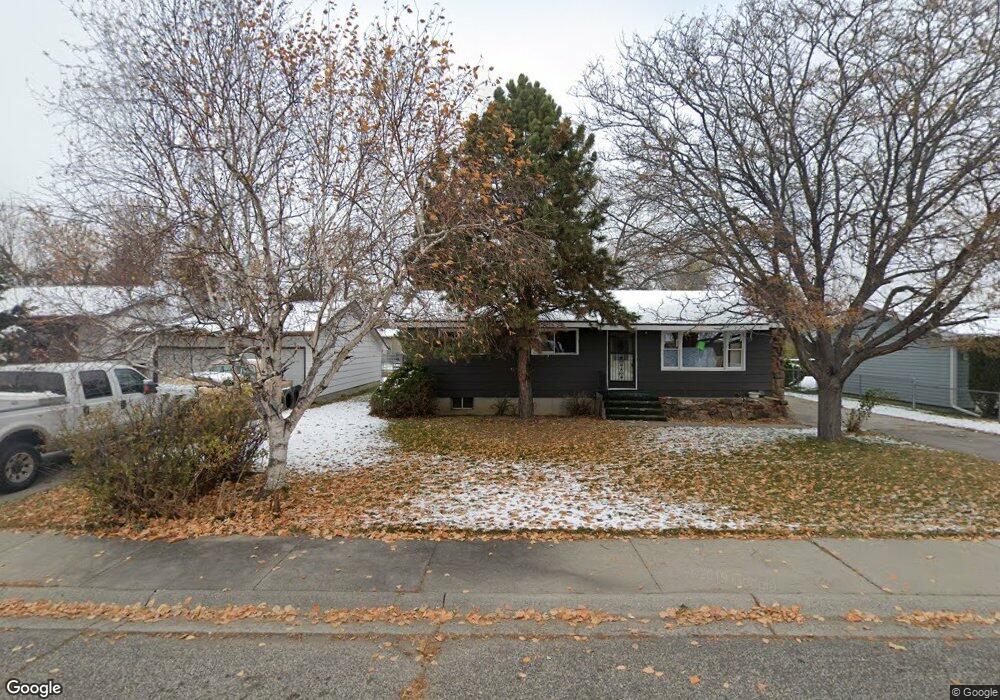
2121 George St Billings, MT 59102
West End NeighborhoodEstimated Value: $348,725 - $394,000
4
Beds
2
Baths
2,184
Sq Ft
$166/Sq Ft
Est. Value
About This Home
This home is located at 2121 George St, Billings, MT 59102 and is currently estimated at $363,431, approximately $166 per square foot. 2121 George St is a home located in Yellowstone County with nearby schools including Miles Avenue School, Will James Junior High School, and Billings West High School.
Ownership History
Date
Name
Owned For
Owner Type
Purchase Details
Closed on
Oct 26, 2020
Sold by
Zaz4 Llc
Bought by
Metzger Daniel D and Metzger Holley A
Current Estimated Value
Home Financials for this Owner
Home Financials are based on the most recent Mortgage that was taken out on this home.
Original Mortgage
$251,750
Outstanding Balance
$224,022
Interest Rate
2.8%
Mortgage Type
New Conventional
Estimated Equity
$139,409
Purchase Details
Closed on
Oct 19, 2009
Sold by
Ortiz Ramon G and Ortiz Darlene D
Bought by
Ortiz Ramon G
Home Financials for this Owner
Home Financials are based on the most recent Mortgage that was taken out on this home.
Original Mortgage
$268,500
Interest Rate
4.99%
Mortgage Type
Reverse Mortgage Home Equity Conversion Mortgage
Create a Home Valuation Report for This Property
The Home Valuation Report is an in-depth analysis detailing your home's value as well as a comparison with similar homes in the area
Home Values in the Area
Average Home Value in this Area
Purchase History
| Date | Buyer | Sale Price | Title Company |
|---|---|---|---|
| Metzger Daniel D | -- | First American Title Company | |
| Ortiz Ramon G | -- | None Available |
Source: Public Records
Mortgage History
| Date | Status | Borrower | Loan Amount |
|---|---|---|---|
| Open | Metzger Daniel D | $251,750 | |
| Previous Owner | Ortiz Ramon G | $268,500 |
Source: Public Records
Tax History
| Year | Tax Paid | Tax Assessment Tax Assessment Total Assessment is a certain percentage of the fair market value that is determined by local assessors to be the total taxable value of land and additions on the property. | Land | Improvement |
|---|---|---|---|---|
| 2025 | $3,045 | $364,000 | $50,538 | $313,462 |
| 2024 | $3,045 | $316,600 | $48,186 | $268,414 |
| 2023 | $3,045 | $316,600 | $48,186 | $268,414 |
| 2022 | $2,613 | $237,400 | $0 | $0 |
| 2021 | $2,488 | $237,400 | $0 | $0 |
| 2020 | $2,336 | $211,400 | $0 | $0 |
| 2019 | $2,230 | $211,400 | $0 | $0 |
| 2018 | $2,358 | $202,900 | $0 | $0 |
| 2017 | $2,117 | $202,900 | $0 | $0 |
| 2016 | $1,968 | $190,500 | $0 | $0 |
| 2015 | $1,924 | $190,500 | $0 | $0 |
| 2014 | $1,776 | $93,174 | $0 | $0 |
Source: Public Records
Map
Nearby Homes
- 2203 George St
- 2155 Pueblo Dr
- 2211 Dallas Dr
- 98 Cache Dr
- 15 S Crestwood Dr
- 16 19th St W
- 15 Mountain Side Cir
- 207 Boston Hill Rd
- 2206 Hewitt Dr
- 370 Delta Cir
- 430 Nelson Dr
- 3038 Canyon Dr
- 2521 Custer Ave
- 3039 Rosebud Dr
- 605 Nelson Dr
- 1736 Broadwater Ave
- 0 Wyatt Cir Unit 356590
- 3121 New Hope Dr
- 3121 New Hope Dr Unit 9
- 1824 Yellowstone Ave
Your Personal Tour Guide
Ask me questions while you tour the home.