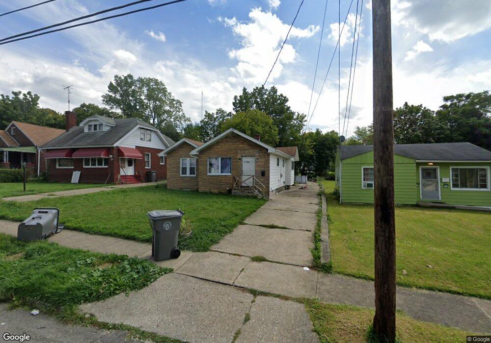
213 E Avondale Ave Youngstown, OH 44507
Cottage Grove NeighborhoodEstimated Value: $54,297 - $78,000
3
Beds
2
Baths
1,388
Sq Ft
$47/Sq Ft
Est. Value
About This Home
This home is located at 213 E Avondale Ave, Youngstown, OH 44507 and is currently estimated at $65,824, approximately $47 per square foot. 213 E Avondale Ave is a home located in Mahoning County with nearby schools including Taft Elementary School, Williamson Elementary School, and East High School.
Ownership History
Date
Name
Owned For
Owner Type
Purchase Details
Closed on
Mar 17, 2004
Sold by
Costello Kim and Dixon Graeme N
Bought by
Kcd Llc
Current Estimated Value
Purchase Details
Closed on
Mar 1, 2004
Sold by
Kendall Investments Inc
Bought by
Costello Kim and Dixon Graeme N
Purchase Details
Closed on
Feb 3, 2004
Sold by
Bankers Trust Of California Na
Bought by
Kendall Investments Inc
Purchase Details
Closed on
Dec 10, 2003
Sold by
Myles Anita P
Bought by
Bankers Trust Of California Na
Purchase Details
Closed on
Jul 30, 1999
Sold by
Kohowski Mary R
Bought by
Myles Anita P
Create a Home Valuation Report for This Property
The Home Valuation Report is an in-depth analysis detailing your home's value as well as a comparison with similar homes in the area
Home Values in the Area
Average Home Value in this Area
Purchase History
| Date | Buyer | Sale Price | Title Company |
|---|---|---|---|
| Kcd Llc | -- | -- | |
| Costello Kim | $30,000 | -- | |
| Kendall Investments Inc | $10,800 | Title Professionals | |
| Bankers Trust Of California Na | $22,400 | -- | |
| Myles Anita P | $35,000 | -- |
Source: Public Records
Tax History
| Year | Tax Paid | Tax Assessment Tax Assessment Total Assessment is a certain percentage of the fair market value that is determined by local assessors to be the total taxable value of land and additions on the property. | Land | Improvement |
|---|---|---|---|---|
| 2025 | $279 | $6,420 | $670 | $5,750 |
| 2024 | $316 | $6,420 | $670 | $5,750 |
| 2023 | $314 | $6,420 | $670 | $5,750 |
| 2022 | $170 | $2,660 | $740 | $1,920 |
| 2021 | $170 | $2,660 | $740 | $1,920 |
| 2020 | $171 | $2,660 | $740 | $1,920 |
| 2019 | $175 | $2,410 | $670 | $1,740 |
| 2018 | $177 | $2,410 | $670 | $1,740 |
| 2017 | $189 | $2,410 | $670 | $1,740 |
| 2016 | $203 | $3,030 | $670 | $2,360 |
| 2015 | $209 | $3,030 | $670 | $2,360 |
| 2014 | $198 | $3,030 | $670 | $2,360 |
| 2013 | $195 | $3,030 | $670 | $2,360 |
Source: Public Records
Map
Nearby Homes
- 221 E Avondale Ave
- 178 E Ravenwood Ave
- 320 E Auburndale Ave
- 328 Marmion Ave
- 32 E Avondale Ave
- 3031 Market St
- 353 Cornell Ave
- 28 W Philadelphia Ave
- 559 E Avondale Ave
- 124 E Midlothian Blvd
- 359 Potomac Ave
- 72 Labelle Ave
- 3919 Rush Blvd
- 173 Clarencedale Ave
- 582 Roxbury Ave
- 734 Cambridge Ave
- 192 Hollywood Ave
- 3419 Hillman St
- 544 Miller St
- 3114 Hillman St
- 209 E Avondale Ave
- 217 E Avondale Ave
- 203 E Avondale Ave
- 225 E Avondale Ave
- 212 E Lucius Ave
- 214 E Avondale Ave
- 229 E Avondale Ave
- 218 E Avondale Ave
- 204 E Lucius Ave
- 210 E Avondale Ave
- 208 E Lucius Ave
- 216 E Lucius Ave
- 169 E Avondale Ave
- 220 E Lucius Ave
- 233 E Avondale Ave
- 226 E Avondale Ave
- 222 E Avondale Ave
- 204 E Avondale Ave
- 226 E Lucius Ave
- 170 E Avondale Ave
Your Personal Tour Guide
Ask me questions while you tour the home.