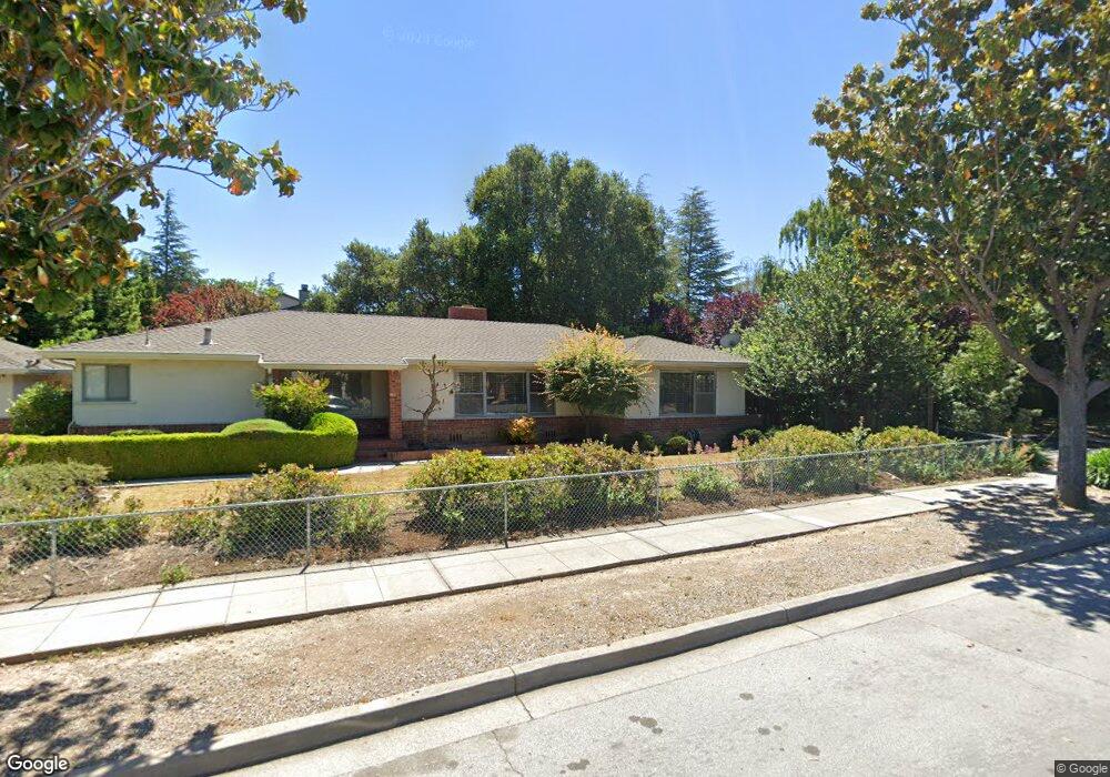
217 Ada Ave Unit 50 Mountain View, CA 94043
Whisman NeighborhoodEstimated Value: $1,332,000 - $1,593,647
3
Beds
3
Baths
2,009
Sq Ft
$739/Sq Ft
Est. Value
About This Home
This home is located at 217 Ada Ave Unit 50, Mountain View, CA 94043 and is currently estimated at $1,484,412, approximately $738 per square foot. 217 Ada Ave Unit 50 is a home located in Santa Clara County with nearby schools including Edith Landels Elementary School, Crittenden Middle School, and Mountain View High School.
Ownership History
Date
Name
Owned For
Owner Type
Purchase Details
Closed on
Feb 16, 2024
Sold by
Imai Bruce Brian
Bought by
Imai Family Revocable Trust and Imai
Current Estimated Value
Purchase Details
Closed on
Oct 21, 2015
Sold by
Imai Darren T
Bought by
Imai Bruce B
Purchase Details
Closed on
Apr 1, 1997
Sold by
Imai Robert N and Imai Amy
Bought by
Imai Robert N and Imai Amy
Create a Home Valuation Report for This Property
The Home Valuation Report is an in-depth analysis detailing your home's value as well as a comparison with similar homes in the area
Home Values in the Area
Average Home Value in this Area
Purchase History
| Date | Buyer | Sale Price | Title Company |
|---|---|---|---|
| Imai Family Revocable Trust | -- | None Listed On Document | |
| Imai Bruce B | -- | None Available | |
| Imai Robert N | -- | -- |
Source: Public Records
Tax History Compared to Growth
Tax History
| Year | Tax Paid | Tax Assessment Tax Assessment Total Assessment is a certain percentage of the fair market value that is determined by local assessors to be the total taxable value of land and additions on the property. | Land | Improvement |
|---|---|---|---|---|
| 2025 | $7,352 | $623,254 | $261,752 | $361,502 |
| 2024 | $7,352 | $611,034 | $256,620 | $354,414 |
| 2023 | $7,278 | $599,054 | $251,589 | $347,465 |
| 2022 | $7,258 | $587,308 | $246,656 | $340,652 |
| 2021 | $7,084 | $575,793 | $241,820 | $333,973 |
| 2020 | $7,094 | $569,890 | $239,341 | $330,549 |
| 2019 | $6,800 | $558,717 | $234,649 | $324,068 |
| 2018 | $6,736 | $547,763 | $230,049 | $317,714 |
| 2017 | $6,463 | $537,024 | $225,539 | $311,485 |
| 2016 | $3,736 | $307,821 | $92,505 | $215,316 |
| 2015 | $3,633 | $303,198 | $91,116 | $212,082 |
| 2014 | $3,603 | $297,260 | $89,332 | $207,928 |
Source: Public Records
Map
Nearby Homes
- 139 Flynn Ave
- 100 E Middlefield Rd Unit 6G
- 94 Flynn Ave Unit D
- 91 Tyrella Ct
- 505 Cypress Point Dr Unit 140
- 505 Cypress Point Dr Unit 137
- 505 Cypress Point Dr Unit 40
- 500 W Middlefield Rd Unit 18
- 234 Houghton St
- 325 Sylvan Ave
- 175 Evandale Ave Unit 2
- 440 Moffett Blvd Unit 84
- 440 Moffett Blvd Unit 86
- 440 Moffett Blvd
- 221 Hope St
- 231 Hope St
- 229 Hope St
- 433 Sylvan Ave Unit 84
- 433 Sylvan Ave Unit 113
- 433 Sylvan Ave Unit 134
- 217 Ada Ave Unit Ada Park
- 217 Ada Ave Unit 53
- 217 Ada Ave Unit 51
- 217 Ada Ave Unit 49
- 217 Ada Ave Unit 48
- 217 Ada Ave Unit 47
- 217 Ada Ave Unit 46
- 217 Ada Ave Unit 45
- 217 Ada Ave Unit 44
- 217 Ada Ave Unit 43
- 217 Ada Ave Unit 42
- 217 Ada Ave Unit 41
- 217 Ada Ave Unit 40
- 217 Ada Ave Unit 39
- 217 Ada Ave Unit 38
- 217 Ada Ave Unit 58
- 217 Ada Ave Unit 57
- 217 Ada Ave Unit 56
- 217 Ada Ave Unit 55
- 217 Ada Ave Unit 54